Punta Sant’Eliséo

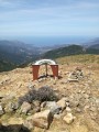
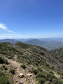
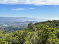
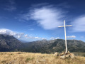
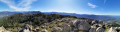
This summit offers a fantastic vantage point over the gulfs of Ajaccio and Sagone, as well as three of the island’s major mountains – a fabulous 360° view.

Please note: some sections require you to use your hands as well as your feet.

Details

625396
Creation:
Last update:
Last review:
  • Walking
    Activity: Walking
  • ↔
    Distance: 4.73 mi
  • ◔
    Average duration: 3h 55 
  • ▲
    Difficulty: Moderate

  • ⚐
    Back to start: Yes
  • ↗
    Ascent: + 1,978 ft
  • ↘
    Descent: - 1,965 ft

  • ▲
    Highest point: 4,157 ft
  • ▼
    Lowest point: 2,884 ft
  • ⚐ Country: France
  • ⚐ City: Salice (20121)
  • ⚑
    Start/End: N 42.074228° / E 8.905391°
  • ❏
    IGN map(s): Ref. 4151OT, 4252OT, 4252OTR
  • Hour-by-hour weather

Photos

Description of the walk

After passing through the village of Véro, head for the Col de Tartavellu and park by the radio masts.

(S/E) Cross the road; a huge cairn marks the start of the path. The walk begins beneath tall pine trees. Follow the path uphill, heading south-west.

(1) Pass close to Punta Peccuraghja and continue the climb.

(2) Reach Punta di Tacchione, where the path becomes more challenging. You must follow the cairns very carefully. In some places, you’ll need to climb using your hands.

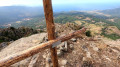
(3) You’ll reach Punta Sant’Eliséo; take a moment to admire the view.
The return journey follows the same route to the Col de Tartavellu (S/E).

Waypoints

  1. S/E : mi 0 - alt. 2,884 ft - Car park at the Col de Tartavellu
  2. 1 : mi 0.69 - alt. 3,074 ft - Punta Peccuraghja
  3. 2 : mi 1.68 - alt. 3,465 ft - Punta di Tacchione
  4. 3 : mi 2.33 - alt. 4,078 ft - Punta Sant’Eliséo
  5. S/E : mi 4.73 - alt. 2,884 ft - Car park at the Col de Tartavellu

Notes

Bring water, a cap and sun cream.

Reviews and comments

4.8 / 5
Based on 2 reviews

Reliability of the description
5 / 5
Ease of following the route
4.5 / 5
Route interest
5 / 5
Brunet Alain
Brunet Alain

Overall rating : 5 / 5

Date of your route : Sep 16, 2018
Reliability of the description : ★★★★★ Very good
Ease of following the route : ★★★★★ Very good
Route interest : ★★★★★ Very good

We stopped at Lake Créno – it was absolutely lovely

Machine-translated

jlcorsu
jlcorsu

Overall rating : 4.7 / 5

Date of your route : Nov 08, 2017
Reliability of the description : ★★★★★ Very good
Ease of following the route : ★★★★☆ Good
Route interest : ★★★★★ Very good

Hello,
following this hike: ‘Punta Sant’Eliséo’, which is a lovely walk with a steep start; afterwards, you’ll need to try to spot the small cairns, which can sometimes be hard to see along the path. On the section just before reaching the headland, you’ll be walking over rocks and loose ground, so you’ll need to be very careful. Once at the top, it’s pure bliss. Make sure you bring something to drink, a warm layer and a light snack.
Enjoy the walk!

Machine-translated

randonneur 20
randonneur 20

Hello,
Personally, I prefer to walk in my hiking boots, as part of the return journey is downhill. Remember to take plenty of water – it’s very hot – and be careful: unfortunately, there are a lot of wildfires at the moment!

There’s a lovely walk you can do even without hiking boots: the Capiaghja sheepfolds, heading towards Bocognano. It’s mostly in the shade, and after the sheepfolds, you’ll come to a river just past the bridge.
Here’s the link: https://www.visorando.com/randonnee-berge...

I hope this has been of some help.
Enjoy your hike.

Machine-translated

missagreen
missagreen

Hello!

I’m just passing through Ajaccio and would love to climb up to Punta Sant Eliseo.
I’m a novice walker – I’m actually a bit afraid of heights and am only wearing my running trainers… do you think it might still be doable? I’ve read that you can get round the sections where you have to climb?
If not, do you have any other suggestions for a similar hike in the area, with a stunning view?
We did the Anglais waterfalls from Vizzavona station on Tuesday.

Thanks in advance for your reply!!!

Machine-translated

Other walks in the area

For more walks, use our search engine .

The GPS track and description are the property of this route's author. Please do not copy them without permission.