


Refine your search for walks in Bainghen
Bainghen walks


 In the countryside around Hocquinghen
 Visorando Member
 11.99 mi
 +715 ft
 -702 ft
 6h 10
 Moderate
 Departure from Bainghen (Pas-de-Calais)
A lovely circular route of 19 km along the paths of the Boulonnais countryside. This route will take you along the local paths between the villages of Bainghen, Herbinghen, Hocquinghen and Nabringhen.
This route combines several hiking trails in the area. There are numerous paths allowing you to wander through cultivated fields or pastures, along the edges of woods and up and down hillsides.
There are a few navigation challenges – see the reviews
Trou du Charme Trail
6.93 mi
+449 ft
-423 ft
3h 35
 Easy
Departure from Bournonville (Pas-de-Calais)
Lovely family outing in the Desvroise countryside, on small paved country roads.Passes close to streams, forests, villages and farms.
The Desvres Hill
6.15 mi
+322 ft
-338 ft
3h 05
Easy
Departure from Vieil-Moutier (Pas-de-Calais)
A lovely walk alternating between footpaths and small country lanes in the Haut Pays d’Artois, offering rural scenery in an area dominated by livestock farming and pastures. The area has a rugged terrain and high altitudes.
The Bois d'Elloo
 Local authority9.57 mi
+597 ft
-597 ft
4h 55
 Difficult
Departure from Tournehem-sur-la-Hem (Pas-de-Calais)
During this route, walkers will pass through the Tournehem National Forest, which covers 988 hectares. They will see old windmills and the Hem valley.This is a signposted trail maintained by the Pays de Saint-Omer Urban Community.
The Saint-Louis Chapel from Tournehem-sur-la-Hem
 5.64 mi
+413 ft
-397 ft
2h 55
Easy
Departure from Tournehem-sur-la-Hem (Pas-de-Calais)
A lovely walk through woods and hedged farmland to the pretty Chapelle Saint-Louis. It's a signposted trail run by the Communauté d'Agglomération du Pays de Saint-Omer.
The Wismes Loop
13.08 mi
+909 ft
-902 ft
6h 50
Difficult
Departure from Nielles-lès-Bléquin (Pas-de-Calais)
Nothing spectacular, but a good day out in the fresh air. It’s best to go during dry spells, as some paths can become quite (or even very) difficult.
You could also consider starting from Wismes (car park by the church), which allows you to leave your picnic in the car and thus take some of the strain off your back.
Walk through the Artois Heights
 9.93 mi
+886 ft
-863 ft
5h 20
Moderate
Departure from Nielles-lès-Bléquin (Pas-de-Calais)
A winding route offering superb views of the Artois heights and the Bléquin valley.
From Landrethun-le-Nord to Caffiers via the Stinkal quarries
4.43 mi
+151 ft
-171 ft
2h 10
Easy
Departure from Landrethun-le-Nord (Pas-de-Calais)
A very nice walk, with no difficulties, through fields, a stretch of forest, the Bois de Beaulieu, where there used to be an abbey, and the discovery of the Stinkal quarry site: very careful during the week when there is a lot of lorry traffic. Unfortunately, you used to be able to take a small path along the railway line, which you took on the site of the quarries. Access to this path is now strictly forbidden, which means that you have to finish your walk on the tarmac from the quarries. This in no way detracts from the charm of the start of the walk.
From Moringhem to Quelmes
 11.18 mi
+449 ft
-436 ft
5h 30
Moderate
Departure from Moringhem (Pas-de-Calais)
A pleasant route, with the chance to enjoy a nice break at the lovely café in Quelmes.
Route amended in August 2026 to take Dominoe’s comments into account. I hope it will be better, but I haven’t been in the area for quite some time.
The Lady of the Wolves Trail
 Tourist office
 8.56 mi
+98 ft
-102 ft
4h 00
Moderate
Departure from Zutkerque (Pas-de-Calais)
South of Audruicq, discover the Brédenarde, a landscape of hedgerows, fruit trees and wooded countryside.Starting from Zutkerque or Polincove, take the ‘Dame aux Loups’ trail, named in honour of the Baronessde Draëck; you can admire her château, the first hills of Artois and follow the winding course of the Hem: the river of mills.
Marais Trail in Nortkerque
 5.74 mi
+26 ft
-26 ft
2h 40
Easy
Departure from Nortkerque (Pas-de-Calais)
This path takes you to one of the four villages of the Pays du Brédenarde, Nortkerque, which can be translated as ‘church of the North’. Geologically, the former Pays du Brédenarde consists of a layer of clay resting on chalk that overlooks the coastal plain. It is a landscape of hedgerows, fruit trees and livestock farming. In the past, the Brédenarde also included the municipalities of Audruicq, Zutkerque and Polincove.
(4) Please note: the footbridge no longer exists; access is impossible until further notice (see practical information).
From Wismes to the Bois d'Esquerdes via the Montagne d'Elnes
15.89 mi
+1,050 ft
-1,030 ft
8h 15
Difficult
Departure from Wismes (Pas-de-Calais)
A long route with very little tarmac and a superb climb.
There are also a few long straight stretches through the fields that will delight many!
Late July 2020:
- the section between points 6 and 7 is in excellent condition.
- at point 13, after the copse, you cross a maize field for about fifty metres (the path is clearly marked) before finding the track.
In the footsteps of Samer
 6.86 mi
+341 ft
-312 ft
3h 25
Moderate
Departure from Samer (Pas-de-Calais)
Enjoy varied landscapes in the heart of the Samer countryside, with nature, local heritage and a bucolic atmosphere.
Discover the heritage of Samer
 4.08 mi
+243 ft
-230 ft
2h 05
Easy
Departure from Samer (Pas-de-Calais)
A friendly walk to discover Samer's heritage: its iconic sites, typical landscapes and local treasures, combining nature and history. The route is easily accessible for people with pushchairs and/or pets.
Around the Meulestroom
 4.18 mi
+10 ft
-10 ft
1h 55
Easy
Departure from Polincove (Pas-de-Calais)
A glimpse into Polincove’s history, exploring its ancient water-related heritage. This route is designed as a walk punctuated by information panels about these iconic sites in our town: do take the time to read them. Ideal for families.
Around Muncq-Nieurlet
 7.40 mi
+505 ft
-476 ft
3h 50
Moderate
Departure from Muncq-Nieurlet (Pas-de-Calais)
This trail takes you through a wooded landscape at the edge of the Artois hills, interspersed with canals and watergangs. The varied relief offers a unique panorama, a superb walk with a breathtaking view.
Fiery hills in Val de Course
8.67 mi
+761 ft
-741 ft
4h 40
Moderate
Departure from Bezinghem (Pas-de-Calais)
A pleasant hike starting from Bezinghem and passing near Zoteux, Course and the centre of Doudeauville. Much of the route is on well-maintained paths. It alternates between countryside and small villages, as well as crossing Doudeauville on a road that runs pleasantly alongside the Course. The hills add a reasonable amount of elevation to this family hike.
The Holque trail from Audembert
5.72 mi
+449 ft
-453 ft
3h 00
Easy
Departure from Audembert (Pas-de-Calais)
The Holque trail, starting from Audembert, is an ideal way to enjoy a magnificent panorama of the Deux-Caps countryside.
Route des Écoliers in Merck-St-Liévin
4.76 mi
+282 ft
-302 ft
2h 25
Moderate
Departure from Merck-Saint-Liévin (Pas-de-Calais)
This route takes you through the Aa valley and across the heights of the artesian plateau known as the Haut-Pays. The start is opposite the church, where there is a chapel dedicated to Saint Liévin (patron saint of fishermen). Walkers will see the remains of old watermills and the former station on the Anvin–Calais railway line. This is a signposted trail managed by the Pays de Saint-Omer Urban Community.
Around Hennuin
 3.82 mi
+7 ft
-7 ft
1h 45
Easy
Departure from Audruicq (Pas-de-Calais)
This path, where land and water merge, is a walking trail that takes you alongside the watergangs (drainage structures designed to drain low-lying marshes and wetlands) and allows you to observe, with your family, the animal and plant species native to wetland habitats.
Circular route through the land of the wateringues
 1.78 mi
+3 ft
-3 ft
0h 50
Easy
Departure from Audruicq (Pas-de-Calais)
Here in Hennuin, you are at the heart of the Aa Delta – in the land of the wateringues, to be precise.
A five-stage interpretive trail is on offer to help you understand the importance of water management in this land reclaimed from the sea.
Pays de Langle Trail
 5.01 mi
+7 ft
-10 ft
2h 20
Easy
Departure from Audruicq (Pas-de-Calais)
From the Hennuin drawbridge, where the River Hem meets the Calais–Saint-Omer Canal – a key crossing point for boatmen – this trail will take you through the Pays de Langle, which owes its name to the shape formed by the Aa estuary in the Middle Ages. Here, perhaps more than anywhere else, the network of waterways shapes the landscape and serves as a reminder that you are in the coastal plain, in the land of canals and waterways.
An uphill battle
 15.98 mi
+1,371 ft
-1,365 ft
8h 35
Difficult
Departure from Fauquembergues (Pas-de-Calais)
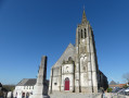
It's a route that will delight altitude enthusiasts (Carto exploreur and the Visorando app suggest it's as high as 500m). What's more, the views are stunning.
Route slightly modified in November 2019.
All trails are very good as of May 14, 2020 (even if some are very grassy).
 Vallée de la Course and the lost valleys
16.98 mi
+1,079 ft
-1,079 ft
3 hrs
Easy
Departure from Beussent (Pas-de-Calais)
A very pretty tour around the villages of Beussent, Montcavrel and Enquin-sur-Baillon. Very varied landscapes with small roads and farm tracks. An easy but challenging hike. You will have the chance to see different aspects of the Course valley, with its cress farms still in operation. Pleasant picnic stop in Enquin sur Baillon (shaded table) or Beussent, near the river. The departure point is Enquinehaut because the descent to the Course is splendid. You will see pretty lost valleys.
Renty Wood
10.46 mi
+492 ft
-479 ft
5h 15
Moderate
Departure from Renty (Pas-de-Calais)
This route, with very little tarmac, follows the Charles Quint trail, to which a short circular loop through unspoilt countryside with lovely views has been added.
Cap Blanc-Nez and the heights of Sangatte
 6.35 mi
+741 ft
-719 ft
3h 35
Moderate
Departure from Escalles (Pas-de-Calais)
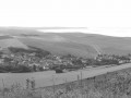
An invigorating seaside walk to the heights of Sangatte, via the cliffs of Cap Blanc-Nez. A walk combining nature and culture, in a place that has been awarded the Grand Site de France label since 2011. Numerous relics of the Second World War bear witness to the past, amid breathtaking scenery.
From Verchocq to the Vallon de Beaussart
 11.65 mi
+633 ft
-636 ft
5h 55
Moderate
Departure from Verchocq (Pas-de-Calais)
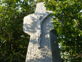
Exploring the Vallon de Beaussart and passing close to the Bois de Renty, always in the hope of spotting some wildlife: on 16 October, there were only a few pheasants, but they practically let you stroke them. A real treat for hunters!
There are practically no roads on this route.
From the heights of Escalles to Cap Blanc Nez via the Napoleon Well
4.28 mi
+420 ft
-417 ft
2h 20
Easy
Departure from Escalles (Pas-de-Calais)
A magnificent hike to admire the ballet of ferries and ships of all kinds in the Strait of Dover. In good weather, you can admire the English coastline... Don't forget to take a look at the remains of the first shaft dug for the Channel Tunnel, work on which began in 1875 under Napoleon III.
Access to the Mont d'Hubert car park, the starting point for this hike, is now prohibited, so you must start from the car park at the bottom of the Cap Blanc Nez obelisk.
Around Cap Blanc-Nez
 7.56 mi
+758 ft
-778 ft
4h 10
Moderate
Departure from Escalles (Pas-de-Calais)
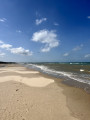
A very pleasant walk with magnificent views of Wissant beach, Cap Gris Nez, Cap Blanc Nez and the English coastline.
The peaks of Cap Blanc Nez
 4.91 mi
+479 ft
-456 ft
2h 40
Easy
Departure from Escalles (Pas-de-Calais)
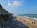
The cliffs of Cap Blanc Nez rise 130 m above the sea. From the Dover Patrol Monument erected at the top of the headland, there is a breathtaking view of Cap Gris Nez and Wissant Bay on one side, Calais on the other, with the English coast opposite.
From Sangatte to Wissant along the cliffs
5.79 mi
+472 ft
-476 ft
3h 05
Easy
Departure from Sangatte (Pas-de-Calais)
A lovely walk offering spectacular views; on a clear day, you can see as far as England. Follow the path (Route du Littoral) along the cliffs. At Cran d’Escalles, you can get closer to take some photos. Carry on breathing in the fresh sea air along the coast, passing through the Amont dunes before reaching the old harbour at Wissant. Children under the age of twelve must be supervised and accompanied on this walk.
To complete this walk, you’ll need to leave a car at the end of the route for the return journey.
Wissant via Cap Blanc-Nez from Sangatte
 12.42 mi
+1,020 ft
-994 ft
6h 35
Difficult
Departure from Sangatte (Pas-de-Calais)
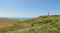
A walk that will take you to Cap Blanc-Nez, rising to 124 m, and the picturesque village of Wissant.
The first part of the walk offers magnificent views of Cap Blanc-Nez and its cliffs. Once you’ve climbed the cape, the village of Wissant will come into view.
A superb little walk allowing you to discover the treasures of the Opal Coast.
Keep an eye on the tide times!
Cap Blanc-Nez as seen from Sangatte
 5.87 mi
+689 ft
-659 ft
3h 20
Moderate
Departure from Sangatte (Pas-de-Calais)
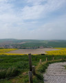
Ideal for exploring the coastline and Cap Blanc-Nez!
Moderator’s note Route impassable (7), see reviews and route description at (6)
From Turkey to Fond Breton (in less than 10 km!)
5.80 mi
+358 ft
-354 ft
3h 00
Moderate
Departure from Renty (Pas-de-Calais)
A short but fairly strenuous route with a steep hill and some very grassy paths.
On 12/08/2025: the start of the trail is once again very overgrown (brambles and nettles). It's passable but it's best to wear trousers or good gaiters and, of course, bring a walking stick or even a pair of secateurs.
The Artois Hills to Assonval
 8.11 mi
+335 ft
-318 ft
4h 00
Moderate
Departure from Renty (Pas-de-Calais)
Return to Assonval for a relatively easy walk (apart from the climb at the start) through the Artois hills.
Three-quarters of the walk takes place at an altitude of over 150 m (dizzying!) and follows good paths.