The Desvres Hill

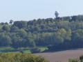
A lovely walk alternating between footpaths and small country lanes in the Haut Pays d’Artois, offering rural scenery in an area dominated by livestock farming and pastures. The area has a rugged terrain and high altitudes.

Details

8305838
Creation:
Last update:
Last review:
  • Walking
    Activity: Walking
  • ↔
    Distance: 6.15 mi
  • ◔
    Average duration: 3h 05 
  • ▲
    Difficulty: Easy

  • ⚐
    Back to start: Yes
  • ↗
    Ascent: + 322 ft
  • ↘
    Descent: - 338 ft

  • ▲
    Highest point: 669 ft
  • ▼
    Lowest point: 466 ft

Description of the walk

Park in the car park next to the Church of the Sacred Heart of Jesus in La Calique on the D202.

(S/E) Follow the D202 towards the hamlet of La Calique (east).

(1) Take the small dirt track on the left opposite number 18 on Rue Principale. This is theGRP® trail of the Haut Pays d’Artois.

(2) At the fork in the road, follow theGRP® to the left.

(3) At the edge of the forest, continue to the right along a forest track.

(4) Just before you leave the forest, leave theGRP® and take the path on the right, continuing straight on through the trees.

(5) At the junction, turn right to return to Rue Henri Vasseur via a hairpin bend. Join theGRP® again and turn right onto Rue Henri Vasseur to reach Rue de la Calique and Rue Principale.

(6) Leave theGRP® to cross Rue Principale and continue straight ahead along Rue de la Calique.

(7) Before reaching Chaussée de Brunehaut, take the path on the right, Chemin de Bécourt. Once past the first few houses, turn left at the junction.

(8) Immediately take the path on the right after the farmstead and follow it to the end.

(9) When you reach the cross-road, turn right and stay on this path to the right until you reach the Route de la Calique (Rue Principale).

(10) Turn right and follow the road straight on to the car park next to the church (S/E).

Waypoints

  1. S/E : mi 0 - alt. 659 ft - Car park at the Church of the Sacred Heart of Jesus
  2. 1 : mi 0.12 - alt. 663 ft - 18 Rue Principale
  3. 2 : mi 0.32 - alt. 633 ft - GRP Haut Pays d’Artois
  4. 3 : mi 0.6 - alt. 640 ft - Path on the right
  5. 4 : mi 0.79 - alt. 479 ft - Leave the GRP, turning right
  6. 5 : mi 1.38 - alt. 466 ft - Junction, turn right
  7. 6 : mi 2.36 - alt. 643 ft - Junction of Rue Principale and Rue Henri Vasseur
  8. 7 : mi 3.11 - alt. 545 ft - Chemin de Bécourt
  9. 8 : mi 3.84 - alt. 594 ft - Campagnette, path on the right
  10. 9 : mi 4.6 - alt. 636 ft - T-junction, turn right
  11. 10 : mi 5.07 - alt. 646 ft - D202
  12. S/E : mi 6.15 - alt. 659 ft - Car park at the Church of the Sacred Heart of Jesus

Reviews and comments

4.1 / 5
Based on 4 reviews

Reliability of the description
4 / 5
Ease of following the route
4 / 5
Route interest
4.3 / 5
bvalandrethun
bvalandrethun

Overall rating : 4.7 / 5

Date of your route : Aug 07, 2025
Reliability of the description : ★★★★☆ Good
Ease of following the route : ★★★★★ Very good
Route interest : ★★★★★ Very good
Very busy route : Yes

We did the Mount Pelé and Hulin circuit.
We plan to return at the end of April to discover the different orchids.

Machine-translated

B.Renard
B.Renard

Overall rating : 4 / 5

Date of your route : Apr 10, 2023
Reliability of the description : ★★★★☆ Good
Ease of following the route : ★★★★☆ Good
Route interest : ★★★★☆ Good
Very busy route : No

An interesting walk. Lovely views of the ‘Boutonnière du Boulonnais’. A peaceful setting.

Machine-translated

Premgun
Premgun

Overall rating : 3.7 / 5

Date of your route : Jul 09, 2022
Reliability of the description : ★★★★☆ Good
Ease of following the route : ★★★☆☆ Average
Route interest : ★★★★☆ Good
Very busy route : No

At point 4, heading towards point 5, the path is completely blocked by a barrier (private road). At the next junction, we took a parallel path which led us along an old disused railway line and then, via a sort of path through tall grass, we were able to reach the foot of La Calique hill and rejoin the route. There, we found that the end of the path (from point 4 to point 5 and beyond) is indeed private, blocked by a barrier.
The start of the route and the rest of the walk are very pleasant, with lovely paths and beautiful panoramic views.
Sections 4 to 5 need to be reviewed; in their current state, they cannot be recommended to walkers.

Machine-translated

Malyse56
Malyse56

Overall rating : 4 / 5

Date of your route : Jul 17, 2021
Reliability of the description : ★★★★☆ Good
Ease of following the route : ★★★★☆ Good
Route interest : ★★★★☆ Good
Very busy route : No

The path between points 4 and 5 is not maintained; the grass is very tall and the path is difficult to see. To avoid the road between the Vieil-Moutier junction and Les Génételles (2.5 km), I turned right at La Calique to reach Campagnette at point 8, then followed the route to point 10 before heading up through the Mont Graux woods onto the La Houlette PR. A lovely, leafy walk with a beautiful view.

Machine-translated

Other walks in the area

For more walks, use our search engine .

The GPS track and description are the property of this route's author. Please do not copy them without permission.