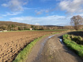
Around Hennuin

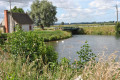
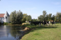
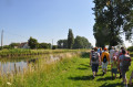
This path, where land and water merge, is a walking trail that takes you alongside the watergangs (drainage structures designed to drain low-lying marshes and wetlands) and allows you to observe, with your family, the animal and plant species native to wetland habitats.

Details

2796319
Creation:
Last update:
Last review:
  • Walking
    Activity: Walking
  • ↔
    Distance: 3.82 mi
  • ◔
    Average duration: 1h 45 
  • ▲
    Difficulty: Easy

  • ⚐
    Back to start: Yes
  • ↗
    Ascent: + 7 ft
  • ↘
    Descent: - 7 ft

  • ▲
    Highest point: 20 ft
  • ▼
    Lowest point: 7 ft
  • ⚐ Country: France
  • ⚐ City: Audruicq (62370)
  • ⚑
    Start/End: N 50.889693° / E 2.119617°
  • ❏
    IGN map(s): Ref. 2203E
  • Hour-by-hour weather

Photos

Description of the walk

Starting point: Hennuin bascule bridge.

(S/E) At the start sign, take the road on the right which runs alongside the canal. Then follow the RD218 on the hard shoulder for 25 metres. After the ‘end of built-up area’ sign, turn left and cross the bridge over the ‘Meulestroom’ river.

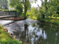
(1) Immediately after the bridge, turn right onto Rue de la Rivière (Polincove). You’ll be walking alongside the ‘Meulestroom’, which is the continuation of the canalised Hem.

(2) Before the level crossing, turn left onto Impasse d’Halluin, which runs alongside the railway line.

(3) At the junction, turn right and cross the watergang. You will once again be walking alongside the railway line.

(4) Turn left, leaving the railway line, towards the canal.

(5) Turn left and walk along the canal. You’ll pass the Grand Large and, further on, the pumping station. On your right is the River Robecq, flowing from Ruminghem, which runs alongside the Calais–Saint-Omer Canal.

(1) Then, once again, cross the bridge over the ‘Meulestroom’ and retrace your steps along the same route you took at the start to reach the Hennuin bascule bridge (S/E).

Waypoints

  1. S/E : mi 0 - alt. 13 ft - Hennuin bascule bridge
  2. 1 : mi 0.28 - alt. 13 ft - Meulestroom Bridge
  3. 2 : mi 1.42 - alt. 20 ft - Level crossing
  4. 3 : mi 1.82 - alt. 7 ft - Junction of dirt tracks
  5. 4 : mi 2.13 - alt. 10 ft - Turn left
  6. 5 : mi 2.32 - alt. 13 ft - The Open Sea - Canal de Calais
  7. S/E : mi 3.82 - alt. 13 ft - Hennuin bascule bridge

Notes

Worth a visit

‘Robecq’ means ‘wild’ (from ‘roh’) and ‘stream’ (from ‘becke’).

Between (5 and 1) A concrete opening connects the two waterways, known as the ‘trouée du Robecq’, which is very useful during heavy flooding to rebalance water levels.

The Hem rises in Surques and flows through Licques and Tournehem, amongst other places. From Fort Saint-Jean (in the hamlet of Polincove), it is channelled and becomes the ‘Meulestroom’. It ends its course in Hennuin before flowing into the Aa.

Hennuin Islet
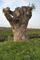
The Hennuin Islet is a conservation area at the confluence of the Hem and the Calais–Saint-Omer Canal. Owned by the Waterways Authority, the Hennuin Islet was used as a dumping ground for dredged sludge. After settling, this sludge left behind a sandy substrate very rich in nitrogen. It is on this unbalanced soil that a willow grove has grown. An interpretive trail helps visitors appreciate the importance of water management in this region.

Le Grand Large
At this point, the thirty-kilometre-long Calais–Saint-Omer Canal takes an impressive bend, known for its width as ‘Le Grand Large’.

Pumping station
Without the ingenious network of drainage boards, the area would be swallowed up by marshes. Fortunately, structures have been built by the drainage board sections, such as this pumping station, to facilitate the drainage of water from the watergangs into the canal.

Former Hennuin lock
The first lock was built at Hennuin in 1845; it is 42 metres long and 5.15 metres wide. It allowed the passage of 38-metre barges carrying 260 tonnes of cargo. It is a traditional, manually operated lock. In the late 1980s, as part of the construction of the Channel Tunnel, a new lock was built to allow larger barges to pass through and thus transport the
materials required for the tunnel’s construction.

Reviews and comments

4 / 5
Based on 3 reviews

Reliability of the description
4.3 / 5
Ease of following the route
4.3 / 5
Route interest
3.3 / 5
STaniel
STaniel

Overall rating : 4 / 5

Date of your route : Sep 26, 2023
Reliability of the description : ★★★★★ Very good
Ease of following the route : ★★★★★ Very good
Route interest : ★★☆☆☆ Disappointing
Very busy route : No

Half of the path is a road with heavy traffic.
The scenery isn’t anything special.
The only attraction is getting some fresh air...

Machine-translated

Cazeau
Cazeau

Overall rating : 4 / 5

Date of your route : Apr 03, 2022
Reliability of the description : ★★★★☆ Good
Ease of following the route : ★★★★☆ Good
Route interest : ★★★★☆ Good
Very busy route : No

The flat countryside, birds and even a kingfisher...

Machine-translated

dcasimir
dcasimir
• Edited:

Overall rating : 4 / 5

Date of your route : Oct 24, 2021
Reliability of the description : ★★★★☆ Good
Ease of following the route : ★★★★☆ Good
Route interest : ★★★★☆ Good
Very busy route : No

Hello,

We went on a lovely walk this week.
Just a quick note: when you park at the Hennuin bridge, take the road opposite the restaurant ‘Les Petites Casseroles’.
The road is a dead end and at first we didn’t dare venture down it.
Apart from that minor hiccup, nothing else to report, except that in wet weather, the path gets very muddy in places. Make sure you wear suitable footwear.
It’s a quiet path; we didn’t come across anyone.
Thank you for sharing this route.

Machine-translated

Other walks in the area

For more walks, use our search engine .

The GPS track and description are the property of this route's author. Please do not copy them without permission.