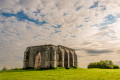
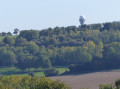
In the countryside around Hocquinghen

A lovely circular route of 19 km along the paths of the Boulonnais countryside. This route will take you along the local paths between the villages of Bainghen, Herbinghen, Hocquinghen and Nabringhen.
This route combines several hiking trails in the area. There are numerous paths allowing you to wander through cultivated fields or pastures, along the edges of woods and up and down hillsides.
There are a few navigation challenges – see the reviews

Details

n°7824659
Creation:
Last update:
Last review:
  • Walking
    Activity: Walking
  • ↔
    Distance: 11.99 mi
  • ◔
    Average duration: 6h 10 
  • ▲
    Difficulty: Moderate

  • ⚐
    Back to start: Yes
  • ↗
    Ascent: + 715 ft
  • ↘
    Descent: - 702 ft

  • ▲
    Highest point: 663 ft
  • ▼
    Lowest point: 243 ft
  • ⚐ Country: France
  • ⚐ City: Bainghen (62850)
  • ⚑
    Start/End: N 50.752949° / E 1.90623°
  • ❏
    IGN map(s): Ref. 2204E
  • Hour-by-hour weather

Description of the walk

Parking is available near the town hall and along the cemetery, for a start from the church.

(S/E) Head to the junction at the bottom of the bend where Rue de l’Église meets Rue de la Mairie. Turn left onto the D206E1 (Rue de Licques) and follow it for about 700 m.

(1) Turn left onto the Sentier des Mille Monts.

(2) At the junction with Rue du Coq, continue left for about 300 m.

(3) Take the path on the right, which continues as Rue de la Gare.

(4) At the junction, turn left into Rue des Potiers.

(5) After about 250 m, at the cross, take Impasse de l’Étaple on the right, then at the Fork in the road, follow thePR® Des Mille Monts on the left, which joins the D215.

(6) Once you reach Licques, turn right onto Rue Léonce Clipet, then immediately left and follow the path until you reach Rue des Alouettes.

(7) Turn right onto this street, then at the junction, turn left onto Rue de la Briqueterie until the next junction and carry on straight ahead to the last house.

(8) Turn onto the path on the right to cross the Champs de Licques, rejoin Rue Léonce Clipet and follow it to the left for about 150 metres (cross).

(9) Turn right onto the Sentier des Fontinettes, keeping to the left at all junctions.

(10) At Hocquinghen cemetery, continue straight on along Rue de l’Église, then turn left onto Route d’Herbinghen.

(11) Cross Rue Principale and continue straight ahead on the path opposite. Cross the Rivière Petite and come out onto the D215.

(12) Turn right onto this county road, pass through the hamlet of Le Moucroux; at the cross, continue along the D215 and carry on to the next junction.

(13) Turn right onto the Route de Bainghen (D206) for about 800 metres and pass the Rue de Baurietz on your right.

(14) Turn left at the start of the Sentier du Mont de Surques and follow it straight on, ignoring the paths branching off to the left. This path runs alongside the Mont de Surques on the right and the woods of Boctiau and Val on the left.

(15) At the end of the Bois du Val, turn right onto theGR® P Tour du Boulonnais, then follow the D206 to the right at the hamlet of Labiette for a few metres before turning left towards the hamlet of ‘Les Croisettes’ in the direction of Bainghen Town Hall.

(16) At the bend, leave Rue de la Mairie and turn left onto Impasse de la Biette; at the Fork in the road, keep left until you reach Rue de Boulogne.

(17) Turn right at the crossroads and then take the village track to the right until you reach the start of the Sentier des Mille Monts.

(18) Turn right onto the Sentier des Mille Monts, following the edge of the Bois de la Vallée des Vignes. The local track turns into a tarmac road. Continue along Rue de l’Église until you reach the starting point (S/E).

Waypoints

  1. S/E : mi 0 - alt. 413 ft - Église Saint-Martin (Bainghen)
  2. 1 : mi 0.51 - alt. 331 ft - PR des Mille Monts
  3. 2 : mi 0.95 - alt. 338 ft - Rue du Coq
  4. 3 : mi 1.11 - alt. 351 ft - Path on the right
  5. 4 : mi 1.38 - alt. 338 ft - Junction with Rue des Potiers
  6. 5 : mi 1.54 - alt. 282 ft - Impasse de l’Étaple
  7. 6 : mi 2.56 - alt. 249 ft - D215 road
  8. 7 : mi 2.83 - alt. 272 ft - Rue des Alouettes
  9. 8 : mi 3.13 - alt. 259 ft - Path on the right (Champs de Licques)
  10. 9 : mi 3.56 - alt. 253 ft - Sentier des Fontinettes
  11. 10 : mi 4.03 - alt. 285 ft - Cemetery - Église Saint-Omer (Hocquinghen)
  12. 11 : mi 4.28 - alt. 285 ft - Main Street
  13. 12 : mi 5.08 - alt. 302 ft - D215 road
  14. 13 : mi 5.71 - alt. 282 ft - D206 road
  15. 14 : mi 6.19 - alt. 361 ft - Mont de Surques Trail
  16. 15 : mi 7.9 - alt. 554 ft - GRP Tour du Boulonnais
  17. 16 : mi 8.76 - alt. 384 ft - Les Croisettes
  18. 17 : mi 9.87 - alt. 522 ft - Rue de Boulogne
  19. 18 : mi 10.41 - alt. 663 ft - PR des Mille Monts
  20. S/E : mi 11.99 - alt. 413 ft - Église Saint-Martin (Bainghen)

Worth a visit

(4) On your right at the end of the path is the old station on the railway line that linked Le Portel to Bonningues-les-Ardres. Opened in 1900, this line remained in operation until 1935.

GRP® Tour du Boulonnais: Walk around the Boulonnais Regional Park (Pas-de-Calais)
TheGR® 120, also known as the Sentier du Littoral, runs along the Opal Coast, from the Belgian border to Berck-sur-Mer.

Always be cautious and plan ahead when you're outdoors. Visorando and the author of this route cannot be held responsible for any accidents occurring on this route.

The GR® and PR® markings are the intellectual property of the Fédération Française de Randonnée Pédestre.

Reviews and comments

3.2 / 5
Based on 3 reviews

Reliability of the description
3 / 5
Ease of following the route
3.3 / 5
Route interest
3.3 / 5
tati59
tati59

Overall rating : 3 / 5

Date of your route : Sep 21, 2024
Reliability of the description : ★★★☆☆ Average
Ease of following the route : ★★★☆☆ Average
Route interest : ★★★☆☆ Average
Very busy route : No

As noted previously, it is impossible to reach points 14 and 15, as they are on private property with a barrier.
We went off-trail across the fields
Best avoided as a walk

Machine-translated

Jean- Francois 59
Jean- Francois 59

Overall rating : 3.3 / 5

Date of your route : Jun 20, 2023
Reliability of the description : ★★★☆☆ Average
Ease of following the route : ★★★☆☆ Average
Route interest : ★★★★☆ Good
Very busy route : No

There were a lot of inaccuracies in the route guidance, which led to us taking the wrong path. The section through the woods was impossible to find. So we ended up going off-piste…

Machine-translated

JVS
JVS

Overall rating : 3.3 / 5

Date of your route : Jan 23, 2023
Reliability of the description : ★★★☆☆ Average
Ease of following the route : ★★★★☆ Good
Route interest : ★★★☆☆ Average
Very busy route : No

It’s impossible to get from point 14 to 15 because the route goes through a fenced-off private woodland and there’s no way round it

Machine-translated

Other walks in the area

For more walks, use our search engine .

The GPS track and description are the property of this route's author. Please do not copy them without permission.