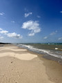
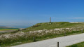
From Sangatte to Wissant along the cliffs

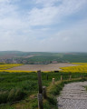
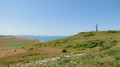
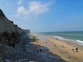
A lovely walk offering spectacular views; on a clear day, you can see as far as England. Follow the path (Route du Littoral) along the cliffs. At Cran d’Escalles, you can get closer to take some photos. Carry on breathing in the fresh sea air along the coast, passing through the Amont dunes before reaching the old harbour at Wissant. Children under the age of twelve must be supervised and accompanied on this walk.
To complete this walk, you’ll need to leave a car at the end of the route for the return journey.

Details

n°46014619
Creation:
Last update:
Last review:
  • Walking
    Activity: Walking
  • ↔
    Distance: 5.79 mi
  • ◔
    Average duration: 3h 05 
  • ▲
    Difficulty: Easy

  • ⚐
    Back to start: No
  • ↗
    Ascent: + 472 ft
  • ↘
    Descent: - 476 ft

  • ▲
    Highest point: 390 ft
  • ▼
    Lowest point: 10 ft

Description of the walk

Take the RD940, passing the Sangatte cemetery where a car park is available.
You can set off from the hotel in Sangatte and leave your vehicles at the finish point in Wissant.

(S) Set off facing the sea to reach the departmental road; follow it to the left for about a hundred metres, then cross over to join a path heading towards the sea. This path, known as the Route du Littoral, soon turns left and runs along the cliffs. Join the Chemin du Tour du Calaisis near a small car park.

(1) Cross the track leading to the Cap Blanc Nez monument and continue along the path opposite, which runs closer to the coast and leads to the Cran d’Escalles.

(2) Continue to follow the cliffs, taking care not to get too close due to the risk of rockfalls. Pass Petit Blanc Nez, then walk along the beach from the hamlet of Strouanne. You’ll reach Wissant beach.

(3) Turn left onto theGR®128(marked with red and white signs) and carry on until you reach the small square with the Hôtel de la Plage and the old harbour on your right (E).

Waypoints

  1. S : mi 0 - alt. 52 ft - Car park at Sangatte cemetery
  2. 1 : mi 1.87 - alt. 387 ft - Cap Blanc Nez
  3. 2 : mi 2.63 - alt. 82 ft - Cran d’Escalles
  4. 3 : mi 5.62 - alt. 23 ft - Wissant Beach
  5. E : mi 5.79 - alt. 46 ft - The old harbour at Wissant

Notes

You can get water at the starting point at Sangatte cemetery.
There are several restaurants in Wissant.
Bring a cap and sun cream in summer.

Worth a visit

Sangatte Cemetery.
Beautiful views of the cliffs at Cap Blanc Nez between (1) and (2).
The pretty village of Wissant.
Cap Blanc Nez monument

Always be cautious and plan ahead when you're outdoors. Visorando and the author of this route cannot be held responsible for any accidents occurring on this route.

The GR® and PR® markings are the intellectual property of the Fédération Française de Randonnée Pédestre.

Reviews and comments

5 / 5
Based on 1 review

Reliability of the description
5 / 5
Ease of following the route
5 / 5
Route interest
5 / 5
Yannick Barbeau
Yannick Barbeau

Overall rating : 5 / 5

Date of your route : Jun 07, 2026
Reliability of the description : ★★★★★ Very good
Ease of following the route : ★★★★★ Very good
Route interest : ★★★★★ Very good
Very busy route : Yes

A superb walk, between land and sea. I took a short detour to the summit of Cap Blanc Nez and then headed down to Cran d'Escalles. Otherwise, the route is very easy to follow – it’s a straight path, a bit of a workout with the wind constantly in your face, but the scenery is magnificent.

Machine-translated

Other walks in the area

For more walks, use our search engine .

The GPS track and description are the property of this route's author. Please do not copy them without permission.