Around the Meulestroom

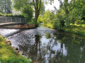
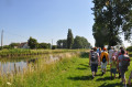
A glimpse into Polincove’s history, exploring its ancient water-related heritage. This route is designed as a walk punctuated by information panels about these iconic sites in our town: do take the time to read them. Ideal for families.

Details

105794066
Creation:
Last update:
Last review:
  • Walking
    Activity: Walking
  • ↔
    Distance: 4.18 mi
  • ◔
    Average duration: 1h 55 
  • ▲
    Difficulty: Easy

  • ⚐
    Back to start: Yes
  • ↗
    Ascent: + 10 ft
  • ↘
    Descent: - 10 ft

  • ▲
    Highest point: 20 ft
  • ▼
    Lowest point: 7 ft
  • ⚐ Country: France
  • ⚐ City: Polincove (62370)
  • ⚑
    Start/End: N 50.855511° / E 2.101835°
  • ❏
    IGN map(s): Ref. 2203E
  • Hour-by-hour weather

Description of the walk

Park in the car park at Polincove Town Hall (parking available).

Blue markings: paint and/or signposts.

(S/E) Take Impasse de l’École and carry on straight ahead.

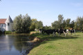
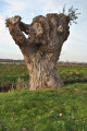
(1) Walk straight on, passing a riding school. Soon, the path runs alongside a river (pollarded trees). Carry on until you reach the first bridge (Pont du Fort Saint-Jean).

(2) Turn right onto the bridge. On the other side, turn right straight away. Take the second left, Rue du Trempal, and the EuroVelo route no. 5 (landscape at the start of the Aa Delta polder ).

(3) Turn right onto EV 5 and follow the waterway. At the next junction (marker 2), continue straight on. When the road bends to the right, carry on straight until you reach the D219.

(4) Follow the road to the left. After about a hundred metres, take the path on the right just before a bridge. Follow the Tiret on your left.

(5) Take the footbridge to cross the river. On the other side, turn right and follow the Tiret, now on your right, until you reach the confluence of the Hem and the Meulestroom.

(6) Take Impasse des Zeultuns on your right just before the footbridge and stay on the road until the next bridge.

(7) Cross the bridge over the river, then turn right and follow the river on your right-hand side.

(8) Cross Rue de la Mairie (D219) and continue along the river. At the next bridge, turn left to immediately reach a junction you passed at the start of the walk.

(1) Turn left and carry on straight ahead until you reach the car park where you started (S/E).

Waypoints

  1. S/E : mi 0 - alt. 16 ft - Town hall car park
  2. 1 : mi 0.19 - alt. 16 ft - Junction of the circular loop
  3. 2 : mi 0.78 - alt. 13 ft - Fort Saint-Jean Bridge
  4. 3 : mi 1.23 - alt. 7 ft - Intersection
  5. 4 : mi 2.04 - alt. 13 ft - D219 road
  6. 5 : mi 2.37 - alt. 16 ft - Footbridge over the - Hem ou Tiret (rivière)
  7. 6 : mi 3.02 - alt. 16 ft - The fork in the River Hem: the Meulestroom and the mill
  8. 7 : mi 3.47 - alt. 16 ft - Bridge over the Meulestroom
  9. 8 : mi 3.75 - alt. 16 ft - Crossing the D219
  10. S/E : mi 4.18 - alt. 16 ft - Town hall car park

Worth a visit

Numerous information panels, with QR codes providing details on the history and distinctive features of the area:
- Pollarded tree: who am I?
- Fort Saint-Jean, its origins and the ‘puchots’.
- Polder land and the wateringues.
- The Hem, the Meulestroom and the Tiret.
- The mills (flour and oil mills).
- The bridges, the drying shed and the basket-weaving workshop.

Other walks in the area

For more walks, use our search engine .

The GPS track and description are the property of this route's author. Please do not copy them without permission.