Wissant via Cap Blanc-Nez from Sangatte

A walk that will take you to Cap Blanc-Nez, rising to 124 m, and the picturesque village of Wissant.
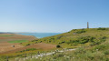
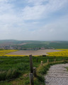
The first part of the walk offers magnificent views of Cap Blanc-Nez and its cliffs. Once you’ve climbed the cape, the village of Wissant will come into view.
A superb little walk allowing you to discover the treasures of the Opal Coast.

Keep an eye on the tide times!

Details

3903851
Creation:
Last update:
Last review:
  • Walking
    Activity: Walking
  • ↔
    Distance: 12.42 mi
  • ◔
    Average duration: 6h 35 
  • ▲
    Difficulty: Difficult

  • ⚐
    Back to start: Yes
  • ↗
    Ascent: + 1,020 ft
  • ↘
    Descent: - 994 ft

  • ▲
    Highest point: 476 ft
  • ▼
    Lowest point: 10 ft

Photos

Description of the walk

Start from the Hubert Latham car park in Sangatte.

(S/E) On leaving the car park, take the path heading towards the sea. Turn left and continue along the path that runs along the coast towards Cap Blanc-Nez. There’s only one path: it’s impossible to get lost – just keep going straight on until you reach a four-way junction near the Cap Blanc-Nez car park.

(1) Turn right and head for the viewpoint and the obelisk.

(2) Enjoy the lovely view of the English coast in fine weather, then return to the crossroads near the car park.

(1) Turn right and head down to the Cran d’Escalles car park.

(3) At Cran d’Escalles (you can head down to the beach if you wish), take the path opposite. Follow the coast. After a few kilometres, you’ll reach a path leading down to the beach near a farm in a place called “Strouane”.

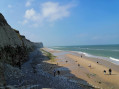
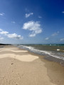
(4) Take the steps leading down onto the sand, and continue to the left towards Wissant. Watch out for the tide!
After 3 km on the sand, you’ll reach the Wissant sea wall.

(5) Turn back towards Strouane. Climb the steps and rejoin the path that runs along the coast.

(4) Turn left and head for the Cran d’Escalles car park. Enjoy the view of Cap Blanc-Nez.

(3) At Cran d’Escalles, continue up Cap Blanc-Nez via the same path you took down earlier.

(1) At the top, turn right and cross the car park. At the far end, cross the road carefully and head for the street opposite, then walk uphill towards the panoramic restaurant.

(6) When you’re almost at the top, do not head towards the restaurant, but take the path branching off to the left (signposted path).

(7) At the four-way junction, take the path straight ahead.
After a few metres, you’ll have two options: both paths lead to the same place and diverge for just a few metres. The only difference is that the path on the left offers a clearer view.

(8) About one kilometre past the crossroads, take the path on the left marked by a wooden post (this is the first path that really branches off to the left). Continue along this path, which curves to the left around a lake, then turns right and leads to the Hubert Latham car park (S/E).


Waypoints

  1. S/E : mi 0 - alt. 66 ft - Hubert Latham Car Park – Sangatte
  2. 1 : mi 1.72 - alt. 397 ft - Turn right at the fork
  3. 2 : mi 1.97 - alt. 430 ft - Cap Blanc-Nez
  4. 3 : mi 2.99 - alt. 82 ft - Cran d’Escalles
  5. 4 : mi 4.33 - alt. 33 ft - Strouane
  6. 5 : mi 6.01 - alt. 23 ft - Wissant
  7. 6 : mi 10.23 - alt. 476 ft - Panoramic restaurant
  8. 7 : mi 10.72 - alt. 436 ft - Crossroads
  9. 8 : mi 11.35 - alt. 377 ft - Return to Sangatte
  10. S/E : mi 12.42 - alt. 66 ft - Hubert Latham Car Park – Sangatte

Notes

Do not walk on the sand for the two hours before high tide, or the two hours after. It is therefore essential to check the high tide times before walking the 3 km between Strouane and Wissant.

An easy walk, apart from the distance. The path is straightforward to follow, as there are few junctions. Furthermore, the path to Wissant follows theGR®120. You simply need to follow the red and white markings.

Alternatives:

(5) You can walk along the sea wall (not included in the walk’s total distance. Allow an extra 600 m for the return trip along the sea wall).

(7) You can return to the starting point by turning left. It’s very straightforward; there’s just one path to follow.

Always be cautious and plan ahead when you're outdoors. Visorando and the author of this route cannot be held responsible for any accidents occurring on this route.

The GR® and PR® markings are the intellectual property of the Fédération Française de Randonnée Pédestre.

Reviews and comments

4.4 / 5
Based on 3 reviews

Reliability of the description
4.5 / 5
Ease of following the route
4.3 / 5
Route interest
4.3 / 5
manhatan
manhatan
• Edited:

Overall rating : 3.5 / 5

Date of your route : Feb 15, 2025
Reliability of the description : Not used / Not applicable
Ease of following the route : ★★★☆☆ Average
Route interest : ★★★★☆ Good
Very busy route : Yes

When I followed this route, the ground was very muddy; the clay makes it quite slippery, especially where the terrain gets steep.
You can see the cliffs clearly, but you need to watch out for the tides. Some sections may become impassable at high tide.
Please note that the final section of the route (from point 8), which leads back to Sangatte from Mont Fouret, is closed off by a barrier; I had to climb over the barrier to complete the walk. Without a GPS, it’s difficult to find your way back.

Machine-translated

JPaulo
JPaulo

Overall rating : 5 / 5

Date of your route : Aug 05, 2023
Reliability of the description : ★★★★★ Very good
Ease of following the route : ★★★★★ Very good
Route interest : ★★★★★ Very good
Very busy route : No

A superb walk starting from a brilliant car park 👌.
I extended the route a little by heading left as I left the car park and climbing – just a bit – up the cliff. Breathtaking views of the English coast, as the weather was bright and clear. It’s a good thing I didn’t go straight over the Blanc Nez as the wind was strong enough to knock the horns off a 🐂.
Perfect all the way to Wissant, apart from the short tarmac stretch. Lunch on the beach, then back to Blanc Nez via the beach at low tide, with the wind at my back.
Didn’t go to the Blanc Nez viewpoint – gusts of 70.

Machine-translated

randofamars
randofamars

Overall rating : 4.3 / 5

Date of your route : Sep 21, 2020
Reliability of the description : ★★★★☆ Good
Ease of following the route : ★★★★★ Very good
Route interest : ★★★★☆ Good
Very busy route : No

A route with magnificent views

Machine-translated

Other walks in the area

For more walks, use our search engine .

The GPS track and description are the property of this route's author. Please do not copy them without permission.