


Refine your search for walks in Aragon
Aragon walks


 Sierra de Guara - From Alquezar to Asque
 Visorando Member
 5.88 mi
 +1,201 ft
 -1,217 ft
 3h 45
3h 45
 Moderate
 Departure from Alquézar (Huesca)
Magical panoramas of rocky massifs, the clear, refreshing waters of the Rio del Vero and olive tree-lined paths to the picturesque villages of Alquézar and Asque. The perfect change of scenery!
La Faja de Pelay
 10.90 mi
+5,745 ft
-5,748 ft
10h 00
10.90 mi
+5,745 ft
-5,748 ft
10h 00
 Difficult
Departure from Torla-Ordesa (Huesca)
Difficult
Departure from Torla-Ordesa (Huesca)
An exceptional hike in the Ordesa Mont Perdu Natural Park. You must take the shuttle bus from Torla at the large car park at the entrance to the village.Please note: the elevation gain for this hike is incorrect. It should be 750m of elevation gain and loss, not 1758m as stated in the paragraph below.
Anisclo Canyon
 8.94 mi
+3,596 ft
-3,615 ft
7h 15
Moderate
Departure from Fanlo (Huesca)
8.94 mi
+3,596 ft
-3,615 ft
7h 15
Moderate
Departure from Fanlo (Huesca)
In the Ordesa y Monte Perdido National Park, walk through the famous Anisclo Canyon, created by the Rio Bellos.
The altitude difference shown is an overestimate - it's only 500m.
The watchtowers of Revilla
 2.64 mi
+1,339 ft
-1,362 ft
2h 25
2.64 mi
+1,339 ft
-1,362 ft
2h 25
 Easy
Departure from Tella-Sin (Huesca)
Easy
Departure from Tella-Sin (Huesca)
This hike, accessible to all, takes you to various viewpoints offering breathtaking views of the Escuain Gorge and Rio Yaga. Stop to see the Ermita de San Lorenzo, a rock covered with mysterious symbols and inscriptions. If you're lucky, you'll be able to spot the mythical bearded vulture and, more easily, vultures.
Mallos de Riglos circular
 Association / Club / Walk leader
 3.41 mi
+1,588 ft
-1,572 ft
2h 55
Moderate
Departure from Las Peñas de Riglos (Huesca)
3.41 mi
+1,588 ft
-1,572 ft
2h 55
Moderate
Departure from Las Peñas de Riglos (Huesca)
This well-marked trail leads from the village around the Mallos, impressive rock structures. There are two versions of the circular trail, this one being the shorter.
On sunny days, groups of climbers can be seen scaling these vertiginous walls, but this is obviously only for experienced, fully-equipped climbers.
Congost de Mont-Rebei and Montfalco Footbridges
 9.80 mi
+5,427 ft
-5,417 ft
9h 15
Difficult
Departure from Viacamp y Litera/Viacamp i Lliterà (Huesca)
9.80 mi
+5,427 ft
-5,417 ft
9h 15
Difficult
Departure from Viacamp y Litera/Viacamp i Lliterà (Huesca)
An unforgettable hike in the heart of an impressive gorge carved out by the Noguera Ribagoranza. Dizzying footbridges and breathtaking views await you.
Cirque de la Pineta by the Larri waterfall
 4.35 mi
+1,286 ft
-1,293 ft
3h 05
Moderate
Departure from Bielsa (Huesca)
4.35 mi
+1,286 ft
-1,293 ft
3h 05
Moderate
Departure from Bielsa (Huesca)
Accessible and very pleasant hike to the Pineta cirque with a beautiful view of Mont Perdu.
Loop around Mallos de Riglos
 5.37 mi
+2,119 ft
-2,116 ft
4h 20
Difficult
Departure from Las Peñas de Riglos (Huesca)
5.37 mi
+2,119 ft
-2,116 ft
4h 20
Difficult
Departure from Las Peñas de Riglos (Huesca)
A variant of the tour of the Mallos de Riglos, already described in Visorando, which offers beautiful views of the Pyrenees and a return via a spectacular balcony path, El camino de Solano.
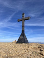
Peña de Oroel in a loop
 6.99 mi
+2,156 ft
-2,152 ft
5h 05
Moderate
Departure from Jaca (Huesca)
6.99 mi
+2,156 ft
-2,152 ft
5h 05
Moderate
Departure from Jaca (Huesca)
One of Jaca's great classics, the ascent to the Peña de Oroel cross can be enhanced by a beautiful ridge route and a wilder forest descent than the round trip via the normal route. Magnificent 360° views all along the ridge.
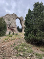
El Arco de Piedrafita or Sarronal Arch
 5.10 mi
+1,759 ft
-1,759 ft
3h 55
Moderate
Departure from Biescas (Huesca)
5.10 mi
+1,759 ft
-1,759 ft
3h 55
Moderate
Departure from Biescas (Huesca)
A beautiful loop starting from Piedrafita de Jaca with a visit to a geological curiosity, the Sarronal Arch.
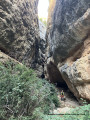
Gorges and Hermitage of San Julián de Andriá
 3.55 mi
+778 ft
-797 ft
2h 20
Easy
Departure from Nueno (Huesca)
3.55 mi
+778 ft
-797 ft
2h 20
Easy
Departure from Nueno (Huesca)
A short, easy and beautiful circular route near Huesca, where you will enter an amazing gorge, visit a hermitage and return to the starting point via a beautiful balcony trail.
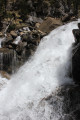
La Faja Racon
 4.83 mi
+3,875 ft
-3,852 ft
5h 35
Difficult
Departure from Torla-Ordesa (Huesca)
4.83 mi
+3,875 ft
-3,852 ft
5h 35
Difficult
Departure from Torla-Ordesa (Huesca)
On the right bank of the Rio Arazas, the Faja Racon trail is very similar to that on the left bank, the Faja de Pelay.
La Pena Falconera by Tamara Fountain
 7.67 mi
+1,325 ft
-1,329 ft
4h 40
Moderate
Departure from Bierge (Huesca)
7.67 mi
+1,325 ft
-1,329 ft
4h 40
Moderate
Departure from Bierge (Huesca)
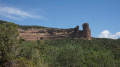
A hike along the Rió Alcanedre before passing through the Fuente de Tamara, a true paradise of emerald waters, and finally arriving at the Pena Falconera (or Huevo de Morrano) with its astonishing shapes.
Please note that part of the walk is also wheelchair accessible (see description).
Broto - Yosa - Tozal del Pueyo
 7.61 mi
+2,349 ft
-2,346 ft
5h 35
Moderate
Departure from Broto (Huesca)
7.61 mi
+2,349 ft
-2,346 ft
5h 35
Moderate
Departure from Broto (Huesca)
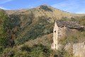
Superb loop to the abandoned village of Yosa, along the GR®-15. The return via the ridge offers sumptuous views of the surrounding area, particularly the Pyrenean peaks of Monte Perdido and its sisters.
In the Pineta Valley
 4.57 mi
+1,037 ft
-1,030 ft
3h 00
Moderate
Departure from Bielsa (Huesca)
4.57 mi
+1,037 ft
-1,030 ft
3h 00
Moderate
Departure from Bielsa (Huesca)
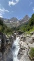
Short, easy hike in the heart of the Pineta Valley. Superb scenery.
From Ibon de Los Banos to Ibon Azul Superior in Panticosa
 8.14 mi
+3,153 ft
-3,150 ft
6h 30
Difficult
Departure from Panticosa (Huesca)
8.14 mi
+3,153 ft
-3,150 ft
6h 30
Difficult
Departure from Panticosa (Huesca)
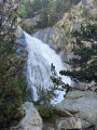
Start from Los Baños de Panticosa via the GR® 11, passing the Bachimana refuge, Ibon de Bachimana Bajo, Embalse de Bachimana Alto and Ibon Azul Superior. Return via the same route.
San Cristóbal del Barranco Hermitage in Aragon
 3.92 mi
+889 ft
-886 ft
2h 35
Moderate
Departure from La Sotonera (Huesca)
3.92 mi
+889 ft
-886 ft
2h 35
Moderate
Departure from La Sotonera (Huesca)
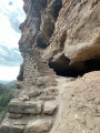
Make the most of your visit to Aragon and Loarre Castle to explore El Ermita de San Cristóbal del Barranco, a cave hermitage tucked away at the bottom of a ravine, accessible via a superb path. Please note: the approach to the hermitage is vertiginous.
La Fuente del Paco in Villanúa
 4.48 mi
+994 ft
-984 ft
2h 55
Easy
Departure from Villanúa (Huesca)
4.48 mi
+994 ft
-984 ft
2h 55
Easy
Departure from Villanúa (Huesca)
Version 2 updated on 30/04/2023
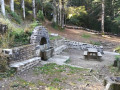
When the weather is bad in the Aspe Valley, it may be wise to go through the Somport tunnel and look for routes a little further south, where the sun may be shining. Here we present a fairly short, unpretentious but very accessible and frankly pretty (in our opinion) loop.El Paco is the cooler, wooded northern slope of a mountain, covered here with a protected pine forest, and La Fuente is a spring (fountain).
Barfaluy
 4.35 mi
+974 ft
-994 ft
2h 50
Moderate
Departure from Bárcabo (Huesca)
4.35 mi
+974 ft
-994 ft
2h 50
Moderate
Departure from Bárcabo (Huesca)
A loop passing through Lecina and its thousand-year-old oak tree, Abrigos de Barfaluy with its rock paintings and ancient beehives, Ermita de San Martín de Lecina.Enjoy a dip in the Rio Vero.
Red Canyon of Teruel
 5.04 mi
+551 ft
-561 ft
2h 50
Easy
Departure from Teruel
5.04 mi
+551 ft
-561 ft
2h 50
Easy
Departure from Teruel
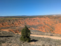
A leisurely walk right on Teruel’s doorstep, with spectacular scenery all along the way. The first half is straightforward, with the Red Canyon on your right as you head up the forest track: magical, like a scene from a Western. After the gentle path, you’ll find yourself on a plateau offering a sublime panorama. The return journey takes you along a dry stream bed, riding over silt and gravel, but with beautiful views throughout: hills, ravines, cliffs, and that ever-present red earth, creating a unique atmosphere. It is said that the Battle of Teruel took place here.
Hermitage of the Virgin of the Castle and the Mascun Springs
4.01 mi
+1,014 ft
-1,020 ft
2h 45
Moderate
Departure from Bierge (Huesca)
From Rodellar, the proposed hike takes you up to the Ermita de la Virgen del Castillo via the hamlet of Cheto. The return journey takes a detour to las Fuentes del Mascun, following the Mascun river.
On arrival, you can take a tour of the village of Rodellar.
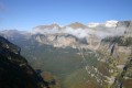
The Ordesa Viewpoints
 11.35 mi
+3,619 ft
-3,606 ft
8h 20
Moderate
Departure from Fanlo (Huesca)
11.35 mi
+3,619 ft
-3,606 ft
8h 20
Moderate
Departure from Fanlo (Huesca)
A magnificent hike along the edge of the Ordesa Canyon: extraordinary views of the canyon.
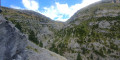
Anisclo Canyon circular loop via Col Arenas
 13.31 mi
+5,295 ft
-5,312 ft
8 hrs
13.31 mi
+5,295 ft
-5,312 ft
8 hrs
 Very difficult
Departure from Fanlo (Huesca)
Very difficult
Departure from Fanlo (Huesca)
Hike through the Anisclo Canyon, ascending via the Faja de la Pardina and Col Arenas.
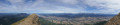
La Peña de Oroel
 4.06 mi
+1,847 ft
-1,844 ft
3h 30
Moderate
Departure from Jaca (Huesca)
4.06 mi
+1,847 ft
-1,844 ft
3h 30
Moderate
Departure from Jaca (Huesca)
Climb to the top of the Peña de Oroel, Jaca's rocky outcrop, a superb vantage point overlooking a large part of the Aragonese Pyrenees.
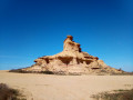
Monegros Desert
 5.83 mi
+338 ft
-312 ft
3h 00
Easy
Departure from Castejón de Monegros (Huesca)
5.83 mi
+338 ft
-312 ft
3h 00
Easy
Departure from Castejón de Monegros (Huesca)
Among Spain’s deserts, the Monegros Desert offers a guaranteed change of scenery thanks to the landscapes and geological formations you’ll discover along this easy walk.
Bagüeste, the abandoned village
 5.28 mi
+866 ft
-856 ft
3h 10
Easy
Departure from Aínsa-Sobrarbe/L´Aínsa-Sobrarbe (Huesca)
5.28 mi
+866 ft
-856 ft
3h 10
Easy
Departure from Aínsa-Sobrarbe/L´Aínsa-Sobrarbe (Huesca)
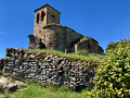
In the heart of the Sierra de Guara, this walk partly follows the historic Huesca trail. Along the way, you’ll discover the abandoned village of Bagüeste, with a church whose ruins are well worth seeing.
Circular walk around Los Mallos de Agüero from Murillo de Gallego
 8.55 mi
+1,312 ft
-1,316 ft
5h 05
Moderate
Departure from Murillo de Gállego/Morillo de Galligo (Zaragoza)
8.55 mi
+1,312 ft
-1,316 ft
5h 05
Moderate
Departure from Murillo de Gállego/Morillo de Galligo (Zaragoza)
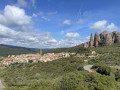
A circular route along beautiful paths and tracks to walk around the Mallos de Agüero from Murillo de Gallego.
The Mallos de Agüero may be smaller than those at Riglos but are much less crowded. You can walk around them from the village of Agüero; here I suggest a longer alternative with a unique and little-used return route from Murillo de Gallego, featuring a superb stretch at the foot of the Peña Rueba.
An easy hike with no particularly difficult sections; a good pair of walking shoes is all you need.
From Somport to Astún via the ridges – HIKE TO SEE AGAIN
 6.86 mi
+2,782 ft
-2,795 ft
5h 35
Difficult
Departure from Aísa (Huesca)
6.86 mi
+2,782 ft
-2,795 ft
5h 35
Difficult
Departure from Aísa (Huesca)
Hike to revisit
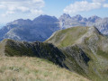
A little-used border hike offering views of the three valleys of Aspe, Canfranc and Ossau from above. Stunning views in all directions. Route for hikers: you will need to find your bearings at the start as there are no signposts. The end of the route can be avoided by hikers who suffer from vertigo.
 Circular route starting from Santa Maria de Buil
 12.81 mi
+1,893 ft
-1,867 ft
3 hrs
Difficult
Departure from Aínsa-Sobrarbe/L´Aínsa-Sobrarbe (Huesca)
12.81 mi
+1,893 ft
-1,867 ft
3 hrs
Difficult
Departure from Aínsa-Sobrarbe/L´Aínsa-Sobrarbe (Huesca)
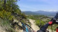
This route, starting from Santa Maria de Buil, will take you through forests, traditional villages, streams and steep terraces with breathtaking views of the mountains.
Four chapels of La Sotonera
 9.03 mi
+2,064 ft
-2,067 ft
5h 55
Difficult
Departure from La Sotonera (Huesca)
9.03 mi
+2,064 ft
-2,067 ft
5h 55
Difficult
Departure from La Sotonera (Huesca)
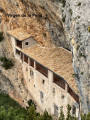
There are many ways to visit these hermitages; we chose to do a circular walk, starting from the village of Anies.
The first is El Ermita de la Virgen de la Pena de Anies, reminiscent of Greek meteors, which appears inaccessible; the next is El Ermita de San Cristobal del Barranco, a cave chapel lost at the bottom of a ravine. Next, we’ll visit two chapels – Santa Quiteria and Santa Barbara – which are of lesser interest but will bring the total to four!
Pico el Forato loop from Formigal
 4.29 mi
+1,801 ft
-1,785 ft
3h 35
Difficult
Departure from Sallent de Gállego (Huesca)
4.29 mi
+1,801 ft
-1,785 ft
3h 35
Difficult
Departure from Sallent de Gállego (Huesca)
Magnificent views of the French (Pic de Peyrelue, Soques, Balaïtous) and Spanish (Foratata, Sabocos, Pala de IP...) peaks of the Pyrenees on this moderately difficult loop trail, which goes around the El Forato massif, a group of several peaks very close to each other. Difficult if, like me, you choose to climb the peak from the landmark. Walking sticks are highly recommended for the descent. Lots of marmots along the route.
Pic El Pacino circular from Sallent de Gallego
6.63 mi
+2,136 ft
-2,129 ft
4h 55
Moderate
Departure from Sallent de Gállego (Huesca)
El Pacino offers a unique 360-degree panorama of the Aragonese and French peaks, including the Pic du Midi d'Ossau in Béarn, and a beautiful variety of vegetation, although it is sometimes too exuberant as it often invades the trails.
Finestras
8.98 mi
+1,841 ft
-1,841 ft
5h 45
Moderate
Departure from Viacamp y Litera/Viacamp i Lliterà (Huesca)
You will need to take an unpaved road to reach the starting point. Once you reach the starting point, you will begin your descent to the village of Finestras. From there, you will have a panoramic view of the Finestras wall. You will then descend to a small water source, which is beautiful and perfect for cooling off in summer. The return journey follows the same route as the outward journey.
The Chiniprés hut
 2.29 mi
+1,161 ft
-177 ft
2h 05
Moderate
Departure from Canfranc (Huesca)
2.29 mi
+1,161 ft
-177 ft
2h 05
Moderate
Departure from Canfranc (Huesca)
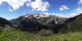
A relatively short route to one of the best viewpoints in the upper Canfranc Valley, offering views of both Canfranc-Gare international station and the Candanchú ski resort.
Collado del Bozo – Aisa Valley
 6.17 mi
+1,860 ft
-1,857 ft
4h 25
Moderate
Departure from Aísa (Huesca)
6.17 mi
+1,860 ft
-1,857 ft
4h 25
Moderate
Departure from Aísa (Huesca)
A very pleasant, easy walk in the Cirque d’Igüer (Sierra d’Aisa), with splendid views of the area’s main peaks: Pic de Mesola, Pic Lecherin, Pic d’Aspe and Pic de la Magdalena.
How not to walk the Pic du Midi d’Ossau circuit
 12.71 mi
+4,544 ft
-4,560 ft
2 days
Difficult
Departure from Jaca (Huesca)
12.71 mi
+4,544 ft
-4,560 ft
2 days
Difficult
Departure from Jaca (Huesca)
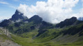
For a change from the usual ‘tours of…’, we suggest a round-trip crossing from the Col du Somport area to the Pombie Refuge, below the peak, taking different paths on the way there and back.
A two-day cross-border hike, deliberately avoiding the overcrowded areas such as the Col du Pourtalet, Ayous and Lac de Bious-Artigues, etc.
The first day offers stunning views: grassy ridges; the second even more so: flower-filled valleys. Magnificent views.
Calomarde Canyon
 3.94 mi
+486 ft
-469 ft
2h 15
Easy
Departure from Albarracín (Teruel)
3.94 mi
+486 ft
-469 ft
2h 15
Easy
Departure from Albarracín (Teruel)
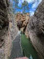
A beautiful hike along a superb canyon at the entrance to Calomarde. A fairly busy site in a very touristy area.Please note that when parking in the village of Colomarde, it is best to use the paid car park or find spaces in the village, although these are few and far between. If you do park in the village, please respect the area and its residents by parking correctly where possible.
Lake Anayet
6.80 mi
+2,087 ft
-2,113 ft
4h 55
Moderate
Departure from Sallent de Gállego (Huesca)
Hike from the car park at the Fomigal Zona Anayet resort towards Lake Anayet.
Follow the GR®11 trail. Pass through La Garganta and then continue at a leisurely pace to Lake Anayet. Once at the lake, the view of the Pic du Midi d'Ossau is magnificent, as are the surroundings, colours and reflections.
You can also hike to the Cuello de Anayet pass (2,414 m) and then Punta del Garmo (2,555 m), which are off the beaten track.
The Soaso Waterfalls
11.17 mi
+6,562 ft
-6,686 ft
10h 50
Moderate
Departure from Torla-Ordesa (Huesca)
Round trip to the Soaso waterfalls. A lovely walk following the trail to the Soaso waterfalls. This is the Faja de Pelay walk, but it doesn’t go via the top as that section is quite dangerous. There are four waterfalls, as well as a shelter in the middle of the plain. For children, it’s possible to walk as far as the waterfalls and stop there before turning back. This can be brilliant for little ones who already enjoy walking. Please stay on the paths and respect the mountain.
The Cinca and La Larri Waterfalls
5.69 mi
+1,211 ft
-1,227 ft
3h 40
Moderate
Departure from Bielsa (Huesca)
A lovely walk following the waterfalls, with magnificent scenery. This walk takes in the Cinca Waterfall, the Larri Waterfall, the Salto de la Larri Waterfall and a high vantage point overlooking the mountains. There are also numerous viewpoints, including several overlooking the Larri Waterfall. Please take care at a dangerous section where you have to cross a stream. There is also a lovely picnic spot with views of the mountains, right by the water. Please stay on the paths and respect the mountain
From Puerto Astun to Col des Moines
 3.79 mi
+1,552 ft
-1,572 ft
3h 05
Moderate
Departure from Jaca (Huesca)
3.79 mi
+1,552 ft
-1,572 ft
3h 05
Moderate
Departure from Jaca (Huesca)
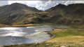
This hike climbs steeply over a short distance, but the path is passable. The hike takes you to Lake Escalar and the Col des Moines. It offers a variety of viewpoints.
La Casita de la Cueva in Canfranc
 4.96 mi
+1,654 ft
-1,657 ft
3h 45
Easy
Departure from Canfranc (Huesca)
4.96 mi
+1,654 ft
-1,657 ft
3h 45
Easy
Departure from Canfranc (Huesca)
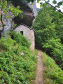
The immense forests that dominate the Canfranc resort hide many secrets: amazing hydraulic structures, comfortable paths to access them, unique vegetation and a little-known history. Hiking in this setting is all the more enjoyable, even if the gentle slope of the paths means you cover more ground than you might imagine.
San Blas Canyon
 3.71 mi
+620 ft
-617 ft
2h 15
Easy
Departure from Teruel
3.71 mi
+620 ft
-617 ft
2h 15
Easy
Departure from Teruel
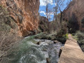
A beautiful family hike, not technical and well maintained. Located 15 minutes from Teruel on the outskirts of the village of San Blas. This hike allows you to enjoy the coolness of the Rio Guadialaviar, where you can refresh your feet in several places. Avoid the reeds, as I saw some snakes that were very happy to be there. Superb scenery all along the canyon, where you can navigate from one side of the river to the other thanks to a network of small bridges. Lots of coolness along the river, beautiful views.
Astún - Pombie
 5.96 mi
+1,706 ft
-2,070 ft
4h 15
Moderate
Departure from Jaca (Huesca)
5.96 mi
+1,706 ft
-2,070 ft
4h 15
Moderate
Departure from Jaca (Huesca)
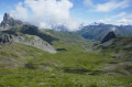
This is the first day of a cross-border hike that takes you to the Pic du Midi d'Ossau, starting from an unusual point, the Col du Somport, rather than the Col du Pourtalet.Overnight stay at the Refuge de Pombie is essential, so remember to book in advance.
Around Biscarrués - Romanesque tombs and witches in Aragon
 5.07 mi
+630 ft
-630 ft
2h 55
Easy
Departure from Biscarrués (Huesca)
5.07 mi
+630 ft
-630 ft
2h 55
Easy
Departure from Biscarrués (Huesca)
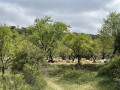
A short circular half-day tour starting from Biscarrués, alternating between tracks and paths, exploring Romanesque tombs, almond and cereal fields, passing through the village of Piedramorrera with its curious doorfronts.
Barrancos de San Martin
3.39 mi
+1,427 ft
-1,407 ft
2h 50
Moderate
Departure from Boltaña (Huesca)
A walk that will allow you to discover a canyon featuring magnificent pools with a final surprise: the Confesionnario waterfall, also known as Conoelmundo. This can be done by walking up the canyon (wear shoes that can get wet) or by taking the path that runs along the top of the canyon. The best time to visit is May–June. From the car park, it’s a 10-minute walk and, after crossing the river, you reach the first pool. After 150 m along the path from the first pool, you reach the river again. You’ll come across two signposts about 20 m apart, which will guide you to the waterfall via the canyon or the path. You can complete a circular walk as shown on the .gpx file
From the Col d’Astún to the Col des Moines
 3.43 mi
+883 ft
-912 ft
2h 20
Moderate
Departure from Jaca (Huesca)
3.43 mi
+883 ft
-912 ft
2h 20
Moderate
Departure from Jaca (Huesca)
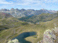
If you’re in the Col du Somport area and the weather is clear (and safe), this short circular route will delight you in no time. Thanks to the chairlift, you’ll reach the starting point quickly, and the ridge walk will allow you to admire the surroundings at your leisure in a unique way. The route is unmarked but clearly defined.
The Cinca waterfalls
6.45 mi
+1,864 ft
-1,864 ft
4h 35
Moderate
Departure from Bielsa (Huesca)
A trip to the Cinca waterfalls, then back via the sheep pasture before descending. A shorter version involves a return trip to the sheep pasture.
Circular route of Punta del Pacino via Reña Retourno
 5.90 mi
+1,860 ft
-1,847 ft
4h 20
Moderate
Departure from Sallent de Gállego (Huesca)
5.90 mi
+1,860 ft
-1,847 ft
4h 20
Moderate
Departure from Sallent de Gállego (Huesca)
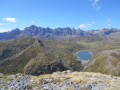
Punta Pacino is a magnificent 360° viewpoint from which you can admire a host of peaks, such as the Pics d’Enfer, Peña Roya, Pico de Anayet, Pic du Midi d’Ossau, Peña Forratata, Lake Lanuza, the village of Sallent de Gallego and many more. Forests and pastures blend together to form a splendid landscape. The route follows a track for a short stretch, but is mostly along paths and trails.
Circular route via the Coll de Ladrones and the Caseta de la Cueva (Caseta del Vasco)
7.76 mi
+3,094 ft
-3,097 ft
6h 15
Moderate
Departure from Canfranc (Huesca)
A pleasant circular walk, mostly through woodland, with a few sections of scree on the descent. Lovely views over the Canfranc Estación valley and the Candanchu cirque.
A hike of moderate difficulty due to the elevation gain. The path is narrow and you’d be well advised to be sure-footed.