The Chiniprés hut

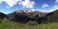
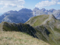
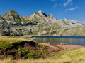
A relatively short route to one of the best viewpoints in the upper Canfranc Valley, offering views of both Canfranc-Gare international station and the Candanchú ski resort.

Fiche technique

33359921
Creation:
Last update:
Last review:
  • trace_mode_pedestrian
    Activité: trace_mode_pedestrian
  • ↔
    label_distance: 2.29 mi
  • ◔
    Durée calculée: 2h 05 
  • ▲
    Difficulte: Moyenne

  • ⚐
    Retour point de depart: Non
  • ↗
    label_elevation_gain: + 1,161 ft
  • ↘
    label_elevation_loss: - 177 ft

  • ▲
    label_highest_point: 5,538 ft
  • ▼
    label_lowest_point: 4,475 ft
  • ⚐ Pays: Spain
  • ⚐
    Area: Pyrenees
  • ⚐ Commune: Canfranc 
  • ⚑
    Départ: N 42.776036° / O 0.51257°
  • ⚑
    Arrivée: N 42.776628° / O 0.497472°
  • ❏
    Carte(s) IGN: Ref. 1547OT, 1547OTR
  • Météo détaillée heure par heure

Photos

Description of the walk

From Canfranc, take the road to the Somport Pass and, once you’ve left the town, pass above the Santa Cristina hotel and turn off the road at a wide left-hand bend, at a car park just before a bridge. The place is called Casa l’Anglasé.

(S) Start on the wide track (dirt track), which crosses the River Aragon via a bridge and turns right with almost no climb.

(1) A path branches off to the right, heading downhill: ignore this and follow the GR®11 markings; a sign clearly indicates Chinipres.

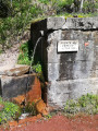
(2) This takes you to the “area recreativa de Canal Roya”, where facilities are provided for picnics, barbecues and, possibly, pitching a tent (to be checked). Drinking water available. Continue along the narrow path.

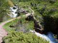
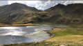
(3) You’ll come to a level dirt track; follow it to the right. This track runs almost level up the Canal Roya valley.

(4) Turn right onto a path leading to a bridge over the stream. Cross the bridge and head uphill on the other side.

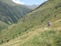
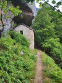
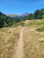
(5) At a junction, take a path climbing up the slope to the right, signposted for Chiniprés. This path climbs quite steeply at first, then less so. Once you reach the hut (in ruins), you have arrived.

(6) Return along the same route in the opposite direction to (S).
Optional: it is possible and fairly easy to climb a little way above the Chiniprés hut (off the path); the view stretches out even further!


Points de passages

  1. D : mi 0 - alt. 4,475 ft - Car park at the end of the road leading to the hotel
  2. 1 : mi 0.28 - alt. 4,518 ft - The path starts on the right
  3. 2 : mi 0.41 - alt. 4,557 ft - Picnic area and campsite
  4. 3 : mi 0.47 - alt. 4,570 ft - Junction – Dirt track
  5. 4 : mi 1.11 - alt. 4,829 ft - Junction
  6. 5 : mi 1.44 - alt. 4,882 ft - Path on the right
  7. A : mi 2.29 - alt. 5,459 ft - Chiniprés hut

Informations pratiques

Season: as soon as the snow has cleared (May-October, variable depending on the year). In winter, the Canal Roya valley is prone to avalanches.

Water points: a fountain in the first quarter of the path.

Picnic area and campsite.

A proximite

Reviews and comments

4.7 / 5
Based on 2 reviews

Fiabilité de la description
5 / 5
Facilité à suivre l'itinéraire
5 / 5
Intérêt du circuit de randonnée
4 / 5
bobca
bobca

Thank you, I’ve updated the description accordingly!

translation_auto

Gisèle 94
Gisèle 94

Note globale : 4 / 5

Date de la randonnée : Aug 06, 2026
Fiabilité de la description : Non utilise / Inapplicable
Facilité à suivre l'itinéraire : Non utilise / Inapplicable
Intérêt du circuit de randonnée : ★★★★☆ Bien
Circuit très fréquenté : Non

Alternative routes:

1. Instead of setting off from the Santa Christina hotel, you can park in a small car park further up the Somport road (Fondaria del Anglassée). You’ll join the GR11 straight away. It might be a bit longer, but it’s very flat and in the shade.
If you set off from the hotel, there’s a long stretch of tarmac road and the start of the path at the circular bend in the road is hard to spot (we had to search for it).

2. We didn’t go up to the caseta but walked as far as the Puente del Vado: a pleasant walk.
We saw loads of irises, but they’d finished flowering because of the heatwave.

The stream must be stunning, but this year it was terribly low on water!

translation_auto

bobca
bobca

Thank you, I will amend it accordingly.

translation_auto

alex 1964
alex 1964
• Modifié le :

Note globale : 4.7 / 5

Date de la randonnée : Jul 23, 2025
Fiabilité de la description : ★★★★★ Tres bien
Facilité à suivre l'itinéraire : ★★★★★ Tres bien
Intérêt du circuit de randonnée : ★★★★☆ Bien
Circuit très fréquenté : Oui

The first piece of advice is to park near the hotel because after that, the road is a dead end and the police will give you a ticket! The start of the hike in the forest is extraordinary, and the arrival in the valley with all the mountain ranges coming into view is superb. Be careful in case of rain; there is a sort of riverbed (under construction) that reveals the force of the water when it comes down from the mountain. After the bridge, the climb is surprising, but the landscape remains magnificent. Ideal for admiring the birds of prey that were present on the day!

translation_auto

Other walks in the area

For more walks, use our search engine .

Les descriptions et la trace GPS de ce circuit restent la propriété de leur auteur. Ne pas les copier sans son autorisation.