Country:
 City:
City:


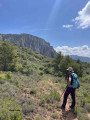
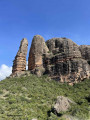
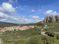
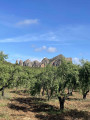
At the entrance to Murillo coming from the north (or from France), take the first street on the right at a car park with a playground; follow Calle Barella, which makes a hairpin bend; just after this bend, park in the car park below on the left, well before the traffic lights.
(S/E) From the car park, continue along the street you arrived on, which passes in front of the La Casona de la Reina Berta hotel, until you reach Murillo de Gallego’s main square, Plaza Ramón y Cajal. On your left is the Church of San Salvador; walk past the Murillo de Gallego Town Hall and cross the square to reach Calle Baja. Turn right onto this street; you have now joined the Camino Natural de la Hoya de Huesca, which we will follow as far as Agüero.
Carry straight on along Calle Morera, ignoring the streets to the right and left; at a Y-junction, turn right, then after 200 metres turn left, following the signposts.
The road turns into a wide track and, after passing a picnic area near a water source – the Fuente Veja – becomes a footpath.
(1) You have now left the village; continue along the signposted path which crosses the dry Baranco de Buera.
(2) The path leads onto a farm track; at the first junction after 300 metres, follow the signposting straight ahead; at the second junction after 300 metres, follow the signposting straight ahead downhill – the track makes a hairpin bend.
(3) At the end of the hairpin bend, turn right onto the signposted path. The path joins a track after 200m; at the first junction after 400m, follow the signposting to the right; at the second junction after 200m, follow the signposting straight ahead.
(4) Turn left onto a path which cuts across a bend in the track, passing close to some remarkable trees. After 200m, the path joins the track leading to Agüero.
(5) The track approaches the first houses in Agüero; take the tarmac road to the left, heading downhill towards the village, and at the hairpin bend, leave the road and take a path that goes downhill and then uphill towards the village, following the signposts.
(6) Once in the village, leave the signposted route and follow the street on your right, then turn right and immediately left onto Calle San Pedro; at the first junction, turn left and then immediately right onto Calle Esteban, which you’ll follow until it becomes a track and then a footpath. Follow this path, which leads to the foot of the Mallos.
(7) You will join the Mallos circuit route. Follow this path until you see a water intake, a recent building.
(8) Turn right onto a recently constructed track that climbs steeply, following the signposting for the Mallos circuit.
(9) The climb reaches a pass; stay on the track heading east, ignoring the rest of the Mallos circuit which drops straight south towards the village. Continue along this track until you reach a hairpin bend.
(10) Leave the track and take an unmarked path towards Murillo. Ignore a path on the right and continue level towards the east; the path reaches a flat area with a lovely view and turns into a track heading straight south.
(11) Leave the main downhill track for a less well-marked track on the left which runs along level ground; the track then bends to the right and descends due south.
(12) You’ll reach a Y-junction; turn left heading due north. This track descends gently, running almost parallel to the track you’ve just come down. After 800m, the track makes a wide hairpin bend and crosses the Baranco de Buera.
(13) 100 metres after the hairpin bend, you can take the path on the left or follow the track; the path joins the track 300 metres further on. If you take the path, ignore the paths on the left, which are the start of the standard route up to Pena Rueba and the access to a few caves. After rejoining the track, you’ll pass two reservoirs.
(14) 160 metres after the second reservoir, keep left onto the main track, which slopes gently downwards and takes you back to Murillo.
(15) On arriving in Murillo, turn right and then immediately left onto Calle Ermita de Liena; you’ll see the chapel on your right. Continue straight on, ignoring two streets on your right, then at the next Y-junction, turn right towards the Real Posada de Liena hotel. Walk past the hotel and you’ll arrive at Murillo’s main square, you simply need to follow the route back the way you came, passing the Casona de la Reina Berta, to reach the car park (S/E)


 A lovely walk in the glorious January sunshine, without coming across a single soul.
 Association / Club / Walk leader

 Visorando Member
 Difficult
 Easy
Easy