Country:

 City:
City:


Leave Vielha via the N-230 towards Lleida. Go through the tunnel until you can see the Embalse de Baserca dam. Cross the bridge over the Barranca des les Ixalanques and park immediately afterwards in a small lay-by on the right-hand side of the road: space for three to four cars.
GR®11 signposting: white and red – very frequent
(S) Take the path which immediately enters the woodland and leads to a metal footbridge which you must not cross: sign marking the entrance to the Posets-Maladeta Natural Park. Follow the wide path which runs some distance from the right bank of the stream known as Barranco de les Ixalenques. The route involves a long, steady climb through a magnificent woodland of beech and hazel trees. You will reach a junction with a signpost.
(1) Turn left, following the sign for “Estanys d’Anglios”. The path continues to run alongside the stream before veering off to the left to follow the path coming from the lakes (Barranco Riueño) and reaching the change in gradient which marks the start of the difficult section of the route.
(2) From this point, the path climbs very steeply and runs over difficult, stony terrain for a distance of about 500 m.
(3) Continue along the path, which turns westwards and leaves the woodland. The landscape becomes very rocky and the slope much less steep. You will reach a small lake.
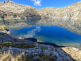
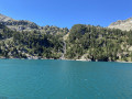
(4) Keep the lake on your right and continue towards a small rocky outcrop that encloses the basin of the Estany Gran de Anglios, eventually reaching the shores of this magnificent high-altitude lake.
(5) After a break, if you wish, continue to follow the path which runs as close as possible to the shore before veering off to the left to go round the rocky outcrop on which stands the small wooden hut grandly named Refugio Angliós. Easily cross two small streams using the stones provided, walk alongside a small pond that is drying up, and reach a signpost.
(6) Leave the hut on your right, head straight on, keeping to the marked GR® path, and walk for about 250 m.
(7) Take a short detour to the right to enjoy the view over the second pond (Estany del Mig), then retrace your steps to cross the GR®.
No signposting
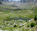
Head straight ahead and you’ll soon reach the banks of the Estany de l’Ubaga, overlooked by the reddish slopes of the northern face of the Pico dels Bous. Cross the outlet stream, then take a well-marked GR® cross-country path at an old, now-dry pond. Head straight ahead, eastwards, across grassy slopes dotted with boulders.
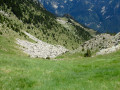
(8) Walk along the right-hand side of a tiny pond which, unfortunately, will soon be filled in too, but which currently serves as a very useful landmark on the ground. Take care to maintain the same direction, heading for a wide grassy notch at an elevation of 2276 m, and make your way to it: breathtaking views of the Estany Fe
(9) Head slightly to the right down the grassy slope, aiming for a scree slope without losing altitude. Stay very alert to spot the first cairns, which will help you navigate this section.
Marked by cairns
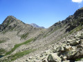
(10) Proceed carefully over rocks of all sizes, following the fairly dense line of cairns which prevent you from straying too far off course, before joining a clearer track a few dozen metres further on. This leads to the pass at 2,282 m, known as Colladeta de Riueño.
(11) Head straight up the grassy slope towards a large, easily identifiable scree slope to go round a rocky outcrop on the left. Reach the Estany del Cap Riueño, follow the bank and then head left when you reach the outlet.
(12) Turn right to cross it easily and continue the descent. The numerous herd tracks make it impossible to clearly identify any specific path: you must therefore stay on course by aiming for a multicoloured metal post which stands out clearly below and serves as a landmark.
(13) Follow a now clearer track which runs alongside a small tributary of the Barranco de Riueño and follows it at varying distances. Finding your way on this section is not straightforward as the cairns are often hard to spot and the stream serves as a guide.
No signposting
(14) Cross the Barranco de Riueño (via a wooden footbridge if the water is high) and rejoin a well-marked path that leads into the woodland.
(15) Begin a series of very tight and steep hairpin bends which really take it out of your legs towards the end of the walk: take care not to slip. You’ll emerge at the end of a track next to a sign marking the entrance to the Posets-Maladeta Natural Park and reach the small meeting point signposted at the side of the N-230: a few parking spaces are available (E).
 Visorando Member
 Moderate