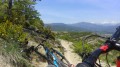
Circular route starting from Santa Maria de Buil

This route, starting from Santa Maria de Buil, will take you through forests, traditional villages, streams and steep terraces with breathtaking views of the mountains.

Details

605324
Creation:
Last update:
Last review:
  • Mountain biking
    Activity: Mountain biking
  • ↔
    Distance: 12.81 mi
  • ◔
    Duration according to the author: 3 hrs 
  • ▲
    Difficulty: Difficult

  • ⚐
    Back to start: Yes
  • ↗
    Ascent: + 1,893 ft
  • ↘
    Descent: - 1,867 ft

  • ▲
    Highest point: 2,969 ft
  • ▼
    Lowest point: 1,818 ft

Photos

Description of the route

Park near the village of Santa Maria de Buil in a field by the roadside at the Ermita de San Pedro.

(S/E) Walk down the road towards the village of Sarratillo. After passing through the village, when you reach the first three-way junction, turn right.
Then, at the side of the road, look for a dirt track.

(1) Turn left and follow this track uphill to the junction with the single track.

(2) Turn right towards the forest, then follow the single track; there are no junctions. Ride through the forest on a technical single track, taking care not to pick up too much speed.
You’ll come out onto a track.

(3) Follow it down, cross the forest and reach Cueva de las Esplucas.

(4) Follow this narrow track, which has no junctions, until you reach a wide track running alongside the Coacenas stream.

(5) Cross this track and head straight ahead, descending via the single track through the forest to join another track. You’ll reach a three-way junction.

(6) Head straight on, go down the path to reach another junction.

(7) Turn left, follow the single track and reach the Ermita de Santa Barbara.

(8) Stop off at the Santa Waldesca Chapel – where the village festivals are held – to have a bite to eat or take a break in the shade. There’s a stone table there. Carry on until you reach the junction with a road.

(9) Head down a single track with hairpin bends and stone steps. Technical but fun. Reach the river.

(10) Cross the river and follow the path back up to the junction leading to the village of Camporrotuno.

(11) Turn right and head towards the village. Make the most of the fountains to top up your water bottles or CamelBak, and also enjoy the lovely, shaded village square for a break.

(12) Continue along the same path back to the previous crossroads.

(11) Head up to the right towards the Ermita de San Lorenzo, go past it to reach another crossroads.

(13) Turn right, head up the path and enter the forest. Follow the single track, crossing the Barranco de la Fuente stream twice. Follow the single track towards Vinas de Aran. Pass a viewpoint with breathtaking views of the Pyrenees (in May, they were still snow-capped), before joining a new path

(14) Cross it, then follow the single track back to the starting village of Santa Maria de Buil (S/E)


Waypoints

  1. S/E : mi 0 - alt. 2,802 ft - Ermita de San Pedro
  2. 1 : mi 0.55 - alt. 2,867 ft - Dirt track to the left
  3. 2 : mi 0.81 - alt. 2,887 ft - Turn right towards the forest
  4. 3 : mi 1.13 - alt. 2,795 ft - Path
  5. 4 : mi 2.18 - alt. 2,618 ft - Cueva de las Esplucas
  6. 5 : mi 3.52 - alt. 2,146 ft - Cross the path
  7. 6 : mi 4.2 - alt. 2,005 ft - Opposite the three-way junction
  8. 7 : mi 4.5 - alt. 2,037 ft - To the left
  9. 8 : mi 5.35 - alt. 2,313 ft - Santa Waldesca Chapel
  10. 9 : mi 6.09 - alt. 2,303 ft - Head down the single track
  11. 10 : mi 6.7 - alt. 1,837 ft - Crossing the river
  12. 11 : mi 6.98 - alt. 1,896 ft - Crossroads towards Camporrotuno
  13. 12 : mi 7.13 - alt. 1,886 ft - Fountain
  14. 13 : mi 7.87 - alt. 2,018 ft - On the right
  15. 14 : mi 11.1 - alt. 2,966 ft - Crossing a path
  16. S/E : mi 12.81 - alt. 2,802 ft - Ermita de San Pedro

Notes

During this walk, you’ll pass a shelter where you can cool off. This chapel has a table where you can have a picnic or take a break; it’s the Santa Waldesca Chapel, where the romerias (village festivals) are held.

A water source halfway along the walk. A fountain in the village of Camporrotuno. A large tree in the square and a table where you can take a break in the shade.

In summer, bring at least 2 litres of water for the walk.

Worth a visit

See villages in ruins

Reviews and comments

5 / 5
Based on 2 reviews

Reliability of the description
5 / 5
Ease of following the route
5 / 5
Route interest
5 / 5
VF64
VF64

Overall rating : 5 / 5

Date of your route : Jan 21, 2019
Reliability of the description : Not used / Not applicable
Ease of following the route : ★★★★★ Very good
Route interest : ★★★★★ Very good

A lovely route I did on 31/12/18, starting in the village of Camporrotuno and using the GPX track from time to time (the route is signposted as mountain bike routes 14 and 19).
Thanks for the track!

Machine-translated

phijour
phijour

Overall rating : 5 / 5

Date of your route : Sep 17, 2017
Reliability of the description : ★★★★★ Very good
Ease of following the route : ★★★★★ Very good
Route interest : ★★★★★ Very good

A very easy route to follow thanks to the excellent signposting for mountain bike route no. 19.
Recommended for mountain bikes, it’s also very pleasant on foot.
Finally, you can also set off from Camporotuno, on the Ainsa–Barbastro road: head west out of the village and you’ll see the signs and the suggested route. The advantage is that you start with the climbs, and halfway through, it’s all downhill (more or less).

Machine-translated

For more walks, use our search engine .

The GPS track and description are the property of this route's author. Please do not copy them without permission.