


Refine your search for walks in Auberive (Haute-Marne)
Auberive (Haute-Marne) walks


 Auberive, its former abbey, forest and animal park on a circular route.
 Visorando Member
 6.88 mi
 +489 ft
 -518 ft
 3h 35
3h 35
 Moderate
 Departure from Auberive (Haute-Marne) (Haute-Marne)
Two-part hike: a beautiful forest loop ending at the animal park enclosures (fallow deer and wild boar), followed by a visit to the charming village of Auberive, with a tour of the former Cistercian abbey and a review of its rich history from its foundation in 1135 to its current status as a museum and exhibition venue.
The Amorey tufa formations from Auberive
 6.47 mi
+689 ft
-699 ft
3h 35
Moderate
Departure from Auberive (Haute-Marne) (Haute-Marne)
6.47 mi
+689 ft
-699 ft
3h 35
Moderate
Departure from Auberive (Haute-Marne) (Haute-Marne)
This route allows you to explore the village of Auberive and its abbey (open to visitors; check opening times and days). Most of the route is through forest and offers views of the tufa formations (information panel on site).
 Route d'Auberive via the Chalmessin Reserve
 15.91 mi
+1,608 ft
-1,608 ft
3 hrs
15.91 mi
+1,608 ft
-1,608 ft
3 hrs
 Difficult
Departure from Auberive (Haute-Marne) (Haute-Marne)
Difficult
Departure from Auberive (Haute-Marne) (Haute-Marne)
A fairly wild route, mainly through woodland, where it is not uncommon to spot roe deer from the Auberive Forest (future national park). Passes through the Chalmessin Nature Reserve via theGR®7, returning via the Bois de la Montagne and the Forêt des Charbonnières.Moderator’s note: Please note that reviews of this hike mention difficult, even impossible, sections
Farms and villages starting from Grancey-le-Château
 16.10 mi
+1,690 ft
-1,693 ft
7 hrs
16.10 mi
+1,690 ft
-1,693 ft
7 hrs
 Very difficult
Departure from Grancey-le-Château-Neuvelle (Côte-d'Or)
Very difficult
Departure from Grancey-le-Château-Neuvelle (Côte-d'Or)
A challenging hike classified as very difficult due to both its length and the difficult sections on certain parts of the route, requiring a good sense of direction and observation due to sections through woodland and meadows off the beaten track (between (9) and (10), near (12)), as well as a poorly maintained woodland path (between (12) and (13)). It is recommended that you follow the GPX track. In good weather, the scenery is pleasant and varied. There are charming rural villages.
Gurgy-le-Château and the former Carthusian monastery of Lugny
13.46 mi
+1,673 ft
-1,677 ft
7h 40
Difficult
Departure from Recey-sur-Ource (Côte-d'Or)
A circular route starting from Recey-sur-Ource that passes through woods and fields, via Gurgy-le-Château, the outskirts of Petit Saint-Broing, and also the former Chartreuse de Lugny. A hike requiring a good sense of direction as well as keen observation when you need to follow, for short stretches, a route not marked on the IGN map and when you need to cross six fords at the best possible spot, depending on the water level at the time of year.
Through the Auberive State Forest from Perrancey-les-Vieux-Moulins
18.45 mi
+1,083 ft
-1,184 ft
9h 25
Difficult
Departure from Perrancey-les-Vieux-Moulins (Haute-Marne)
This stage offers the chance to discover some of the springs of the Langres Plateau, whose waters feed into the English Channel. After skirting the marshes, you enter the Auberive State Forest, in the heart of the Forêts National Park. The abbey founded by Saint Bernard in 1132 reveals its secrets. But why Auberive, exactly?
Between Vernois-lès-Vesvres and Chalancey
 9.07 mi
+659 ft
-636 ft
4h 45
Moderate
Departure from Vernois-lès-Vesvres (Côte-d'Or)
9.07 mi
+659 ft
-636 ft
4h 45
Moderate
Departure from Vernois-lès-Vesvres (Côte-d'Or)
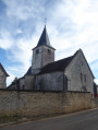
A walk between Vernois-lès-Vesvres and Chalancey, setting off via the Champberceau Forest and returning via the plateau, including a visit to Chalancey Castle.
From Vernois-lès-Vesvres to Cussey-les-Forges via the woods
 8.28 mi
+906 ft
-896 ft
4h 35
Moderate
Departure from Vernois-lès-Vesvres (Côte-d'Or)
8.28 mi
+906 ft
-896 ft
4h 35
Moderate
Departure from Vernois-lès-Vesvres (Côte-d'Or)
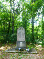
A circular route between the two villages, mainly through woodland. Unfortunately, on leaving Cussey-les-Forges, you have to take a section of the D120e as the Cussey Forest is completely fenced off.
Valley, cliffs and Lake La Mouche from Perrancey-les-Vieux-Moulins
 13.88 mi
+784 ft
-778 ft
7h 05
Difficult
Departure from Saint-Ciergues (Haute-Marne)
13.88 mi
+784 ft
-778 ft
7h 05
Difficult
Departure from Saint-Ciergues (Haute-Marne)
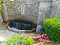
The walk is mainly through woodland, but with a few passages through farmland or pastures to vary the landscape. It visits four pleasant villages with churches and refreshing fountains, as well as several picnic areas. It offers views of Lac de la Mouche and winds its way along the foot of cliffs, some of which are jagged, such as along the "ecological trail" (from (15) to (16)).If you find the walk a little long, you can shorten it to about 15 km by cutting from (8) to (17).
Avot circular route to Courlon
11.27 mi
+1,352 ft
-1,207 ft
6h 20
Moderate
Departure from Avot (Côte-d'Or)
Hike starting from towns north-west of Is-sur-Tille. You will hike through forests and plains, passing through two towns with a rich heritage: Courlon Castle, an old mill, a foundry and beautiful buildings.
Circular route between Avot and Salives
 14.06 mi
+1,404 ft
-1,398 ft
7h 40
Difficult
Departure from Avot (Côte-d'Or)
14.06 mi
+1,404 ft
-1,398 ft
7h 40
Difficult
Departure from Avot (Côte-d'Or)
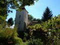
A lovely walk around one of the four sources of the River Tille, taking in significant medieval remains in the villages of Le Meix, Salives and Barjon.
The Maquis Trail in Avot
 Local authority
 8.14 mi
+1,093 ft
-1,079 ft
4h 40
Moderate
Departure from Avot (Côte-d'Or)
8.14 mi
+1,093 ft
-1,079 ft
4h 40
Moderate
Departure from Avot (Côte-d'Or)
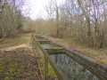
Starting from Avot, this walk takes you in the footsteps of the Maquis Lucius and the local Resistance during the Second World War. Taking in forest tracks, a section of the GR®7, rural heritage and rolling countryside, the route passes several sites linked to the history of the Maquis: a former command post, an equipment depot and a parachute drop zone known as ‘Sacristie’. The route also passes through Avelanges before returning to Avot, offering a beautiful view of the village at the end of the walk.
Path from En Nachot to Avot
 5.88 mi
+692 ft
-709 ft
3h 20
5.88 mi
+692 ft
-709 ft
3h 20
 Easy
Departure from Avot (Côte-d'Or)
Easy
Departure from Avot (Côte-d'Or)
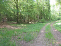
Starting from the central square of the village of Avot, where the statue of Diana the Huntress (1837) stands, the En Nachot footpath takes you through part of the village. Here you can admire examples of architectural heritage (a house and its leat on the River Tille) and industrial heritage (the chimney of the old sawmill) before winding your way along the northern slope of the Nachot woodland. This forest, situated on the hill overlooking the village, offers the chance to discover some remains of the old game reserve and to find a few mushrooms in season.
Crossing the Mont de l'Échelle and Bonière State Forests
9.74 mi
+912 ft
-1,188 ft
5h 15
Moderate
Departure from Avot (Côte-d'Or)
This is the first of eight stages in the Côte d’Or valleys on the Mediterranean side of the Atlantic/Mediterranean watershed. We set off from the entrance to the Forêts National Park and then cross the Mont de l’Échelle and Bonière State Forests. We then emerge onto a path jutting out above the Ignon valley. The heritage sites include wash houses, hemp retting pits, wells and a communal oven converted into a shelter.
Foncegrive and Selongey as seen from Boussenois
 10.98 mi
+869 ft
-866 ft
5h 50
Moderate
Departure from Boussenois (Côte-d'Or)
10.98 mi
+869 ft
-866 ft
5h 50
Moderate
Departure from Boussenois (Côte-d'Or)
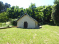
From Boussenois, head towards Foncegrive, partly through the woods; pass through Foncegrive and continue to Selongey, also via a small woodland path; pass through Selongey and head back up via the Sainte-Anne Chapel to return to Boussenois.
Between Boussenois and Rivière-les-Fosses
 9.41 mi
+787 ft
-758 ft
5h 00
Difficult
Departure from Boussenois (Côte-d'Or)
9.41 mi
+787 ft
-758 ft
5h 00
Difficult
Departure from Boussenois (Côte-d'Or)
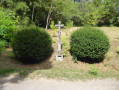
A walk between Boussenois and Rivière-les-Fosses via La Montagne and the woods of Grand Maisonnais
From Boussenois to Vernois-lès-Vesvres in the Chamberceau Forest
 10.09 mi
+787 ft
-791 ft
5h 20
Moderate
Departure from Boussenois (Côte-d'Or)
10.09 mi
+787 ft
-791 ft
5h 20
Moderate
Departure from Boussenois (Côte-d'Or)
A circular walk starting from Boussenois and heading to Vernois through the woods.
The Prauthoy Massif
 3.59 mi
+315 ft
-246 ft
1h 55
Easy
Departure from Vaux-sous-Aubigny (Haute-Marne)
3.59 mi
+315 ft
-246 ft
1h 55
Easy
Departure from Vaux-sous-Aubigny (Haute-Marne)
The walk starts not far from Aubigny Church and takes you on a lovely, easy circular route entirely through the Prauthoy Forest. Ideal for hot days. At the start or finish, enjoy the view from Aubigny Church of Mont Poupet and Mont Blanc, weather permitting.
Salives, medieval town
 7.39 mi
+840 ft
-853 ft
4h 10
Moderate
Departure from Salives (Côte-d'Or)
7.39 mi
+840 ft
-853 ft
4h 10
Moderate
Departure from Salives (Côte-d'Or)
Salives, a must-see medieval village in Côte d'Or: its ramparts, its keep, the heraldic route recounting the medieval life of the village, and its wash house with the main source of the Tille river under the church. This route also takes in Barjon Castle and Saint-Frodulphe Chapel. A little further on, there is a mill with a water wheel that is still in working order. Also worth seeing in Le Meix are the wash house beneath the town hall and the château.
A walk in the Montsaugeonnais at the crossroads of three provinces
 11.02 mi
+804 ft
-814 ft
5h 45
Moderate
Departure from Vaux-sous-Aubigny (Haute-Marne)
11.02 mi
+804 ft
-814 ft
5h 45
Moderate
Departure from Vaux-sous-Aubigny (Haute-Marne)
On the borders of Champagne, Burgundy and Franche-Comté, the Domaine du Muid Montsaugeonnais covers 13 hectares, spread across the territories of four communes: Chatoillenot, Montsaugeon, Rivière-les-Fosses and Vaux-sous-Aubigny.
Abandoned since the outbreak of phylloxera in the late 19th century, the vineyard was revived in 1988 thanks to the Chevaliers du Montsaugeonnais.
The short circular loop of the Grandes Charmes
4.30 mi
+535 ft
-528 ft
2h 25
Moderate
Departure from Vaux-sous-Aubigny (Haute-Marne)
A lovely walk offering superb panoramic views, leafy arches and, depending on the season, birdsong.
A circular walk around the Tufière de Rolampont and the Gallo-Roman mausoleum at Faverolles
 10.95 mi
+974 ft
-978 ft
5h 55
Moderate
Departure from Rolampont (Haute-Marne)
10.95 mi
+974 ft
-978 ft
5h 55
Moderate
Departure from Rolampont (Haute-Marne)
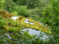
This walk, three-quarters of which is through woodland, allows you to enjoy two exceptional sites: the active tufa formation at Rolampont, and the Gallo-Roman archaeological site of the Faverolles Mausoleum.
More walks in Auberive (Haute-Marne)
Select a point of interest below: