Between Vernois-lès-Vesvres and Chalancey

A walk between Vernois-lès-Vesvres and Chalancey, setting off via the Champberceau Forest and returning via the plateau, including a visit to Chalancey Castle.

Details

14488960
Creation:
Last update:
Last review:
  • Walking
    Activity: Walking
  • ↔
    Distance: 9.07 mi
  • ◔
    Average duration: 4h 45 
  • ▲
    Difficulty: Moderate

  • ⚐
    Back to start: Yes
  • ↗
    Ascent: + 659 ft
  • ↘
    Descent: - 636 ft

  • ▲
    Highest point: 1,555 ft
  • ▼
    Lowest point: 1,086 ft

Photos

Description of the walk

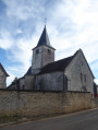
Start from the church in Vernois-lès-Vesvres; parking is available next to the church.

(S/E) Facing the church, turn left then immediately right onto the road towards Boussenois.

(1) Take the first track on the left and continue straight on through the Champberceau Forest until you reach a white track at elevation 432.

(2) Turn left and carry on until you reach a 90° bend in the white track.

(3) Carry on straight ahead along a grass track; at the Y-junction, turn right and, at the small clearing, turn left. At the three-way junction in the Combe aux Loups, veer right to join the D140.

(4) Turn left and carry on straight ahead towards Chalancey.

(5) After the bend, take a path on the left, then turn immediately right and go through a gate. At the second gate, turn right, join the D140 and follow it to the left as far as Chalancey.

(6) At the entrance to the village, turn right, go through the gate and continue along Rue de l’Aiguillon.

(7) Turn into the first street on the left, Rue des Fées, and, after the town hall, turn right onto Rue du Château. Join the Grande Rue and follow it to the left.

(8) At the church, turn left, head down to the castle and return to the church. Turn left towards Selongey and leave the village.

(9) At the junction, turn right and immediately turn left onto a small, straight road, which you follow to the end.

(10) At the end of the road, turn right and, at the next junction, turn left.

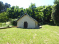
(11) At the T-junction, turn left. On the descent, at elevation 416, the track turns into a small road. Continue straight on, passing the water tank and the cemetery, to return to the starting point (S/E).

Waypoints

  1. S/E : mi 0 - alt. 1,086 ft - Église Saint-Gengoult (Vernois-lès-Vesvres)
  2. 1 : mi 0.12 - alt. 1,093 ft - Junction
  3. 2 : mi 1.37 - alt. 1,427 ft - White trail at La Borne Percée
  4. 3 : mi 2.1 - alt. 1,401 ft - Junction onto a grass track
  5. 4 : mi 3.43 - alt. 1,217 ft - D140 road - Venelle (rivière) - Affluent de la Tille
  6. 5 : mi 3.72 - alt. 1,273 ft - Junction on the path
  7. 6 : mi 4.49 - alt. 1,496 ft - Rue de l’Aiguillon
  8. 7 : mi 4.65 - alt. 1,555 ft - Rue des Fées
  9. 8 : mi 4.78 - alt. 1,545 ft - Église Sainte-Madeleine (Chalençay)
  10. 9 : mi 5.06 - alt. 1,539 ft - Leaving the village
  11. 10 : mi 6.59 - alt. 1,539 ft - The Mountain
  12. 11 : mi 7.33 - alt. 1,526 ft - Champ Perdron
  13. S/E : mi 9.07 - alt. 1,086 ft - Église Saint-Gengoult (Vernois-lès-Vesvres)

Worth a visit

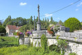
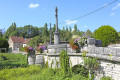
The village of Vernois-lès-Vesvres and Saint-Gengoult Church.
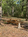
The Champberceau Forest.
The village of Chalancey with its church and castle.
The cultivated plateau between the two villages on the way back.

Reviews and comments

4.5 / 5
Based on 2 reviews

Reliability of the description
5 / 5
Ease of following the route
5 / 5
Route interest
3.5 / 5
User 25802189

Overall rating : 5 / 5

Date of your route : May 29, 2025
Reliability of the description : ★★★★★ Very good
Ease of following the route : ★★★★★ Very good
Route interest : ★★★★★ Very good
Very busy route : No

Thanks so much

Machine-translated

Chabanis
Chabanis

Overall rating : 4 / 5

Date of your route : Jun 05, 2023
Reliability of the description : ★★★★★ Very good
Ease of following the route : ★★★★★ Very good
Route interest : ★★☆☆☆ Disappointing
Very busy route : No

The first part through the forest is very pleasant, but the rest of the route, which follows field paths with endless, monotonous straights in full sun, spoils the enjoyment of this walk.

Machine-translated

Other walks in the area

For more walks, use our search engine .

The GPS track and description are the property of this route's author. Please do not copy them without permission.