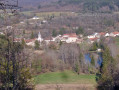
Foncegrive and Selongey as seen from Boussenois

From Boussenois, head towards Foncegrive, partly through the woods; pass through Foncegrive and continue to Selongey, also via a small woodland path; pass through Selongey and head back up via the Sainte-Anne Chapel to return to Boussenois.

Details

4059905
Creation:
Last update:
Last review:
  • Walking
    Activity: Walking
  • ↔
    Distance: 10.98 mi
  • ◔
    Average duration: 5h 50 
  • ▲
    Difficulty: Moderate

  • ⚐
    Back to start: Yes
  • ↗
    Ascent: + 869 ft
  • ↘
    Descent: - 866 ft

  • ▲
    Highest point: 1,411 ft
  • ▼
    Lowest point: 971 ft
  • ⚐ Country: France
  • ⚐ City: Boussenois (21260)
  • ⚑
    Start/End: N 47.629681° / E 5.210091°
  • ❏
    IGN map(s): Ref. 3121SB
  • Hour-by-hour weather

Photos

Description of the walk

Park near Boussenois Town Hall; there is a car park 50 metres away in the direction of the church.

(S/E) Facing the town hall, turn right onto the Grande Rue towards Selongey and continue straight on to leave the village.

(1) Once you’ve left the village, take the first track on the right and, at the next junction, turn left to join the D103. At the road, turn right.

(2) At the bend, take the small road on the right and carry on straight ahead. The road turns into a track.

(3) At a Y-junction after a small clearing, turn left, go under the motorway bridge and turn right.

(4) At the bend running parallel to the motorway, turn left onto a forest track and carry on straight ahead. The track turns into a small road, then a street, and you’ll enter the village of Foncegrive.

(5) At the end of the street, turn left onto Chemin de Boussenois, continue straight on along Rue du Pont de la Venelle and cross over the river.

(6) At the junction after the bridge, take the second street on the left, pass the church and carry on straight ahead along Rue du Mont.

(7) At the water tower, take the path on the left. At the Y-junction after a sharp bend, follow the path to the right.

(8) At the next crossroads (X-junction), carry on straight ahead along Chemin des Ruelles.

(9) At the end of the path, turn right onto Chemin de Grancey, then left onto Rue de Marey, then turn left and cross over the Venelle.

(10) After the bridge, turn right onto Rue de Meville, then take the second street on the left and turn left again to go up Rue de la Côte.

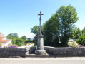
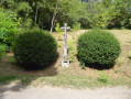
(11) At the junction with a wayside cross, turn left onto Chemin de Sainte-Anne and continue straight on, passing in front of the chapel. At the Saint-Anne chapel, leave the track and turn left to go round the right-hand side of the chapel; join a small path and enter the woods. At a T-junction, turn left then right along the fence, go round the S-bend and continue along the path.

(12) Join a track and follow it straight on to the right. Take the first path on the left and enter the woods; please note that the IGN map does not accurately show the existing paths in the Bois de Gency. There are two T-junctions; continue straight on.

(13) At a Y-junction, turn left; then at the second Y-junction, turn right; and at the third Y-junction, turn right and carry on straight ahead. At an X-junction, take the path leading uphill to the right; at a T-junction, turn left; at a Y-junction, turn right; and at a T-junction, turn right.

(14) Join a track and turn right. At an X-junction, take the small path on the left to reach a fork you passed on the way out.

(4) Turn right, go under the motorway and follow the path in the opposite direction to the outward journey until you reach Boussenois Town Hall (S/E).

Waypoints

  1. S/E : mi 0 - alt. 1,184 ft - Boussenois Town Hall
  2. 1 : mi 0.32 - alt. 1,198 ft - T-junction
  3. 2 : mi 0.55 - alt. 1,148 ft - The fork in the road at the sweeping bend
  4. 3 : mi 1.5 - alt. 1,381 ft - T-junction
  5. 4 : mi 1.97 - alt. 1,385 ft - Crossroads at the circular loop
  6. 5 : mi 3.2 - alt. 1,060 ft - The Boussenois path. Towards the - Venelle (rivière) - Affluent de la Tille
  7. 6 : mi 3.4 - alt. 1,024 ft - Rue du Mont, near the - Ru de la Groge
  8. 7 : mi 3.67 - alt. 1,093 ft - Water tower
  9. 8 : mi 4.36 - alt. 1,125 ft - Chemin des Ruelles
  10. 9 : mi 5.34 - alt. 1,007 ft - Grancey Path
  11. 10 : mi 5.68 - alt. 974 ft - Rue de Meville
  12. 11 : mi 6.1 - alt. 1,079 ft - Saint Anne’s Path
  13. 12 : mi 6.74 - alt. 1,207 ft - Trail junction
  14. 13 : mi 7.36 - alt. 1,286 ft - Gency Woods
  15. 14 : mi 8.4 - alt. 1,348 ft - Les Longs Champs
  16. S/E : mi 10.98 - alt. 1,184 ft - Back to the Town Hall

Worth a visit

The woods of Boussenois and Foncegrive.
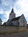
The village of Foncegrive and its church.
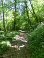
The woods between Foncegrive and Selongey.
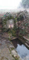
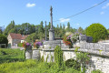
The flower-adorned bridge over the Venelle.
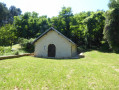
St Anne’s Chapel.

Reviews and comments

4.2 / 5
Based on 4 reviews

Reliability of the description
4.5 / 5
Ease of following the route
4.5 / 5
Route interest
3.5 / 5
Chabanis
Chabanis

Overall rating : 4 / 5

Date of your route : Jul 07, 2026
Reliability of the description : ★★★★☆ Good
Ease of following the route : ★★★★☆ Good
Route interest : ★★★★☆ Good
Very busy route : No

We did this walk again, following the new route at the end which avoids walking alongside the motorway. Unfortunately, due to the thunderstorms, numerous trees had fallen across the path and we had to turn back, ending up walking alongside the motorway…

Machine-translated

LAURENT FRANCOIS
LAURENT FRANCOIS

Hello
Following Chabanis’s visit, the route has been altered between points 11 and 12 near Saint Anne’s Chapel. You must now leave the track, go round the right-hand side of the chapel and follow a new path through the woods which rejoins the track at point 12.
A new path has been created in the woods (with new survey markers) to avoid walking through the centre of private property. Thank you to everyone who made the creation of this new path possible.
FRANCOIS LAURENT

Machine-translated

Chabanis
Chabanis

Overall rating : 4 / 5

Date of your route : Jun 11, 2024
Reliability of the description : ★★★★☆ Good
Ease of following the route : ★★★★☆ Good
Route interest : ★★★★☆ Good
Very busy route : No

We’ve done this walk again.
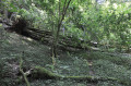
Please note ⚠️: after St Anne’s Chapel (between 11 and 12), the path leads onto private property where you can no longer pass, so you must take a path before that, which climbs up behind the chapel. Towards the end of the walk, the route no longer runs alongside the motorway but cuts through the woods, which is less monotonous; however, the paths through the woods are difficult to navigate – with tall grass, undergrowth and brambles – and you’ll need the app’s GPS to find your way.

Machine-translated

Chabanis
Chabanis

Thank you very much!

Machine-translated

LAURENT FRANCOIS
LAURENT FRANCOIS

Hello
The walk was amended on 1 August 2023; the section running alongside the motorway has been removed and replaced with a route along small paths in the Bois de Gency.
The author

Machine-translated

cuzcodom
cuzcodom
• Edited:

Overall rating : 4 / 5

Date of your route : Mar 12, 2023
Reliability of the description : ★★★★★ Very good
Ease of following the route : ★★★★★ Very good
Route interest : ★★☆☆☆ Disappointing
Very busy route : No

A pleasant walk, but nothing more.
I don’t understand the decision to take the motorway on the way back, when all you need to do is follow the yellow path to the left as you come out of the Bois de Gency (before the point (13)): it’s clearly signposted (sign for ‘la vallée’); then, when it tells you to turn left, you turn right (it’s a very well-used path, so you can’t get lost) and this takes you to a long, straight forest lane on the right. And finally, almost at the motorway, there’s a path branching off to the left (still very well marked) which leads directly to the tunnel under the motorway.
Well, that’s if you don’t mind the motorway.

Machine-translated

Chabanis
Chabanis

Overall rating : 4.7 / 5

Date of your route : Jul 18, 2022
Reliability of the description : ★★★★★ Very good
Ease of following the route : ★★★★★ Very good
Route interest : ★★★★☆ Good
Very busy route : No

An easy and very pleasant walk (apart from the stretch along the motorway…) on good paths.
Thanks to the author!😀

Machine-translated

Other walks in the area

For more walks, use our search engine .

The GPS track and description are the property of this route's author. Please do not copy them without permission.