Country:
 City:
City:


Park in the (unobtrusive) car park on the left, just before the Porte de Bourgogne.
(S/E) Pass under the gate and continue to the castle gate, from where you can see the interesting architecture of its outbuildings and the collegiate church.
(1) Walk back to the crossroads and head downhill to the right. You’ll come to a bridge.
(2) Before the bridge, take the road on the right (towards Église St-Germain) until you reach the Church of Saint-Germain.
(3) Walk past the church on the left and, at the corner of the cemetery, take the path on the left, which very quickly becomes a downhill track.
(4) Where it meets a track, turn left. You’ll come to the D 959; cross it, turn right onto it, then, after 50 m, follow the road to the left. At the next junction, turn right onto a track.
(5) At the fork, turn right, and then right again after 100 metres, to reach an orientation table offering a beautiful panoramic view of Grancey-le-Château and the surrounding countryside.
(6) Continue along this very good path, which climbs towards the forest and then, after a long descent, reaches a large hunters’ rest area (a small lean-to could serve as shelter to weather a heavy downpour).
(7) Continue down the path, which is now tarmac. At the crossroads, turn left to cross the bridge and reach the centre of Cussey-les-Forges. Behind the town hall, in the Espace Molveau: several picnic tables and shelter available under a canopy. There is also shelter available in the beautifully restored wash house, to the right of the town hall.
(8) Turn left then right to cross the D120a. Walk past the church on the left, turn left once, then turn left into thesecond street, and rejoin the D120a, which you follow to the right, heading north.
(9) At the fork in the road, take the D120b to the left (towards Villemervry). Pass the first path on the right, then take the second one, which starts off steeply before veering right to climb up into the Combe aux Geais. Continue climbing, staying on the main path, for about 2 km. You’ll reach a crossroads at the edge of the forest.
(10) Take the path on the left, signposted “Sur la piste des premiers paysans”. Continue along this path, which is lined with information boards detailing local history. You’ll reach the bottom of the Combe du Ru.
(11) At the crossroads, turn sharply left to return to the other side of the Combe. After about 1 km, note the information panel on the left, illustrated with a bronze breastplate dating from 800 BC.
(12) 50 m further on, head down a path on the left which is gently sloping at first, then becomes very steep (marked yellow-green). You’ll reach a field; continue along the path which turns right, on the edge between the cultivated land and the woodland.
(13) After about 1 km along this stony track, just before you come to another good stony track coming from the right, take a grassy, downhill path on the left. You’ll arrive at the church in Villemervry. Head down into the village and visit the beautiful wash house to the right of the road, on the banks of La Tille. Return to the main street and, at the crossroads, follow signpost C3 towards “Grancey le C.” Ignore the first path on the left and take the second one, further up, as you come out of the bend to the right.
(14) Follow this path uphill to a crossroads at a pass, amongst the fields. Take a path on the left, then, after 150 m, continue along the main path which turns right. You’ll reach a large farm.
(15) Continue down the path, which is now tarmac. 200 m further down, at the first junction, turn right onto the stony path. Pass to the north of a large, newly built farm, and continue to a junction of tarmac roads. Take the one leading downhill opposite. Cross the D959 and the bridge to reach the Ruisseau des Tilles.
(2) Head back up the opposite way to how you came, towards the Grancey-le-Château car park (S/E).
 Visorando Member
 Very difficult
 Moderate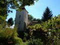
 Local authority
 Easy
Easy