Path from En Nachot to Avot

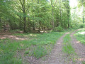
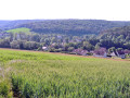
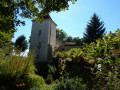
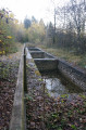
Starting from the central square of the village of Avot, where the statue of Diana the Huntress (1837) stands, the En Nachot footpath takes you through part of the village. Here you can admire examples of architectural heritage (a house and its leat on the River Tille) and industrial heritage (the chimney of the old sawmill) before winding your way along the northern slope of the Nachot woodland. This forest, situated on the hill overlooking the village, offers the chance to discover some remains of the old game reserve and to find a few mushrooms in season.

Details

38627349
Creation:
Last update:
Last review:
  • Walking
    Activity: Walking
  • ↔
    Distance: 5.88 mi
  • ◔
    Average duration: 3h 20 
  • ▲
    Difficulty: Easy

  • ⚐
    Back to start: Yes
  • ↗
    Ascent: + 692 ft
  • ↘
    Descent: - 709 ft

  • ▲
    Highest point: 1,640 ft
  • ▼
    Lowest point: 1,047 ft
  • ⚐ Country: France
  • ⚐ City: Avot (21580)
  • ⚑
    Start/End: N 47.61858° / E 5.01384°
  • ❏
    IGN map(s): Ref. 3021SB
  • Hour-by-hour weather

Photos

Description of the walk

Park in the central square, in the heart of the village, between the church and the town hall.

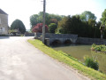
(S/E) With the church behind you, take Rue de Travot towards Grancey-le-Château-Neuvelle. Walk past the town hall and cross the bridge over the River Tille.

(1) Turn left towards Vesvrotte and you’ll soon reach a three-way junction.

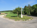
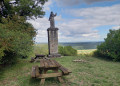
(2) Turn left past the wayside cross, then take the white track immediately on the right. Head up towards the woods, follow the edge of the woodland and arrive at a timber storage area.

(3) Continue along the path on the left until you reach a crossroads.

(4) Take the path on the right to reach the junction with a cross-path.

(5) Continue straight on, passing Combe Forêt, until you reach another junction.

(6) Follow the path opposite to reach a forest track.

(7) Turn left onto this track and walk past the sand pit.

(8) Leave the path on your left and continue uphill to the right. You will reach a junction (elevation 467).

(9) Take the path known as ‘Minot’ on the left. The return route follows the ‘Autour de Conge’ trail. You’ll reach the junction you passed on the way out, between the two trails ‘En Nachot’ and ‘Autour de Conge’.

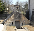
(4) Go straight on, then follow the route back in the opposite direction to the one taken on the way out, as far as the wayside shrine.

(2) Continue to the right, then, at the chimney of the old sawmill, turn right, cross the bridge over La Tille and return to the village square (S/E).

Waypoints

  1. S/E : mi 0 - alt. 1,063 ft - Avot’s main square
  2. 1 : mi 0.13 - alt. 1,053 ft - Bridge over the - Tille (rivière)
  3. 2 : mi 0.3 - alt. 1,053 ft - Calvary, 1866 - Tille (rivière)
  4. 3 : mi 1.1 - alt. 1,329 ft - Timber storage area
  5. 4 : mi 1.27 - alt. 1,385 ft - Junction of the circular loop
  6. 5 : mi 1.46 - alt. 1,434 ft - Crossroads
  7. 6 : mi 2.14 - alt. 1,385 ft - Crossroads
  8. 7 : mi 2.22 - alt. 1,339 ft - Fork in the road. Forest track
  9. 8 : mi 2.85 - alt. 1,371 ft - T-junction
  10. 9 : mi 3.46 - alt. 1,532 ft - Crossroads (elevation 467)
  11. S/E : mi 5.88 - alt. 1,063 ft - Avot’s main square

Notes

Facilities: car park, picnic area, relaxation area, restaurant.

Worth a visit

(S/E) Heritage: 16th-century church, renovated in the 17th century, statue of Diana dating from 1837.

(1) Town house and bridge over the River Tille.

Calvary, 1866.

Chimney of the old sawmill.

Other walks in the area

For more walks, use our search engine .

The GPS track and description are the property of this route's author. Please do not copy them without permission.