Rivière-les-Fosses and Chatoillenot circular walk

A circular walk through the woods and countryside to visit the villages of Rivière-les-Fosses, Chatoillenot and Esnoms-au-Val.

Details

n°4059593
Creation:
Last update:
Last review:
  • Walking
    Activity: Walking
  • ↔
    Distance: 11.16 mi
  • ◔
    Average duration: 5h 50 
  • ▲
    Difficulty: Moderate

  • ⚐
    Back to start: Yes
  • ↗
    Ascent: + 784 ft
  • ↘
    Descent: - 797 ft

  • ▲
    Highest point: 1,411 ft
  • ▼
    Lowest point: 997 ft

Photos

Description of the walk

Park in the car park at the church in Rivière-les-Fosses.

(S/E) Take Rue Des Roches, which slopes down to the right of the church; at the end of the street, turn left onto Rue De Cheville and take the first street on the right. Cross over La Coulange and turn left.

(1) At the Y-junction, take the road on the right and carry on straight ahead along the road, which turns into a track. Keep going straight on.

(2) At the crossroads (X-junction) at elevation 397, by the signpost, turn onto the track on the right towards Vaux-sous-Aubigny.

(3) At the end of the woodland, at the T-junction where two tracks meet, at No. 57, turn left and, at the next Y-junction, turn right.

(4) At the X-junction opposite the apiary, turn onto the track on the left towards Chatoillenot and carry on straight ahead.

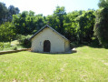
(5) Before the wayside cross, take a small path leading down into the woods on the right, join another path and turn left. Walk past the wash house and join the D140. Continue straight on towards the village.

(6) Turn into the first street on the right between the castle walls, go under the stone bridge and take the first street on the left, then left again onto Rue Joseph Cressot.

(7) You’ll come out onto the square with the fountain; turn right onto Rue du Pont de Vau, walk past the church and leave the village.

(8) Before crossing the Ruisseau du Badin, take the road on the left which turns into a track and joins the D140.

(9) At the D140, turn right, pass the school and, at the next junction, turn left onto Rue Badot. At the wayside shrine, carry on straight ahead and take the second street on the left to pass the church

(10) At the church, turn right onto Rue d’Auvigny, then left and leave the village via the D140.

(11) At the wayside cross, turn left onto the field track, rejoin the D140 and turn right, then take the first road on the left.

(12) At the Y-junction, turn left; then, at the X-junction, carry on straight ahead and walk past the Maison Bélier farm.

(13) Before entering the woods, take a field path on the left and walk between the woods and the field, then enter the Bois du Petit Maisonnais and continue straight on along the forest track.

(14) At the end of the track, turn left onto a white track, walk past the farm buildings and continue straight on until you reach the D140a.

(15) Turn right to enter the village via Rue de Princey.

(16) At the wayside cross, turn right onto a small uphill path; at the end of the path, turn left and return to the starting point (S/E).

Waypoints

  1. S/E : mi 0 - alt. 1,079 ft - Église Saint-Mammes (Rivière-les-Fosses)
  2. 1 : mi 0.25 - alt. 1,070 ft - Rue Village
  3. 2 : mi 0.77 - alt. 1,306 ft - Elevation 397
  4. 3 : mi 1.92 - alt. 1,266 ft - Volnay
  5. 4 : mi 2.69 - alt. 1,106 ft - Elevation 337
  6. 5 : mi 4.08 - alt. 1,053 ft - Calvary
  7. 6 : mi 4.29 - alt. 1,020 ft - D140 road
  8. 7 : mi 4.51 - alt. 1,076 ft - The fountain
  9. 8 : mi 4.75 - alt. 1,024 ft - Le Badin
  10. 9 : mi 5.84 - alt. 1,076 ft - Les Lannes
  11. 10 : mi 6.64 - alt. 1,115 ft - Rue d’Auvigny
  12. 11 : mi 7.05 - alt. 1,119 ft - Calvary on the D140a
  13. 12 : mi 7.67 - alt. 1,309 ft - Certenaille Woods
  14. 13 : mi 8.84 - alt. 1,342 ft - Maison Bèlier
  15. 14 : mi 10.02 - alt. 1,280 ft - Gand Maisonnais woods
  16. 15 : mi 10.74 - alt. 1,076 ft - Source de la Coulange
  17. 16 : mi 11.08 - alt. 1,024 ft - Calvary on Rue de Princey
  18. S/E : mi 11.16 - alt. 1,079 ft - Église Saint-Mammes (Rivière-les-Fosses)

Worth a visit

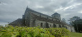
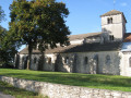
Starting from the church at Rivière-les-Fosses.
The view in the distance of the hills above Rivière-les-Fosses.
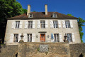
The village of Chatoillenot with its wash house, central fountain, church and narrow streets leading up to the castle.
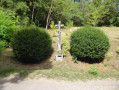
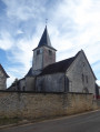
The village of Esnoms au Val with its church and wayside crosses.
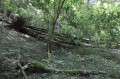
On the way back, a walk through the woods.

Reviews and comments

5 / 5
Based on 1 review

Reliability of the description
5 / 5
Ease of following the route
5 / 5
Route interest
5 / 5
philjacque
philjacque

Overall rating : 5 / 5

Date of your route : Feb 15, 2023
Reliability of the description : ★★★★★ Very good
Ease of following the route : ★★★★★ Very good
Route interest : ★★★★★ Very good
Very busy route : No

Hello.
A lovely walk with plenty of points of interest. It might be worth mentioning that there is a shelter with picnic tables near the school just before Esnoms au Val.
As for churches: the one in Esnoms was open (which is rare...) and we were able to enjoy a guided tour of the church in Rivière (which was open for the occasion).

Machine-translated

Other walks in the area

For more walks, use our search engine .

The GPS track and description are the property of this route's author. Please do not copy them without permission.