The Maquis Trail in Avot

Starting from Avot, this walk takes you in the footsteps of the Maquis Lucius and the local Resistance during the Second World War. Taking in forest tracks, a section of the GR®7, rural heritage and rolling countryside, the route passes several sites linked to the history of the Maquis: a former command post, an equipment depot and a parachute drop zone known as ‘Sacristie’. The route also passes through Avelanges before returning to Avot, offering a beautiful view of the village at the end of the walk.

Details

41374863
Creation:
Last update:
Last review:
  • Walking
    Activity: Walking
  • ↔
    Distance: 8.14 mi
  • ◔
    Average duration: 4h 40 
  • ▲
    Difficulty: Moderate

  • ⚐
    Back to start: Yes
  • ↗
    Ascent: + 1,093 ft
  • ↘
    Descent: - 1,079 ft

  • ▲
    Highest point: 1,532 ft
  • ▼
    Lowest point: 1,050 ft
  • ⚐ Country: France
  • ⚐ City: Avot (21580)
  • ⚑
    Start/End: N 47.61861° / E 5.01379°
  • ❏
    IGN map(s): Ref. 3021SB, 3121SB
  • Hour-by-hour weather

Photos

Description of the walk

The route starts from the village’s central square, near the fountain topped by the statue of Diana the Huntress.

(S/E) Take Rue de Travot towards Salives.

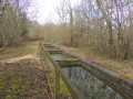
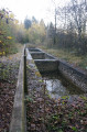
(1) Pass first the washhouse, then along Rue du Ruisselot, past two sites linked to the Maquis Lucius: the former operational command post at No. 8 and the former equipment store at No. 10.

(2) As you leave the village, at the last house, leave the road and take the path on the left. Follow this section, which is shared with the GR®7.

(3) At the junction, after about 750 metres, carry on straight ahead.

(4) At the junction, take the path to the left

(5) At the next junction, after about 480 m, take the path on the right. Keep to the right again, then turn left twice. Continue along the GR®7 towards the Fontaine de Champignolle.

(6) Walk past the fountain, a former site linked to water-based activities, particularly the retting of hemp. A shelter and a picnic area provide a place to stop for a break.

(7) Cross the D112 with care and continue along the GR®7.

(8) After 700 m, turn left at the junction towards the Source de Vaubois.

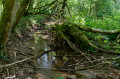
(9) Continue along the path which winds through the Combe Vaubois.

(10) Leave the GR®7 by taking the path on the left.

(11) After leaving the woods and passing the Trou d’Avelanges, turn left towards the Croix du Chaignot.

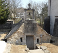
(12) Take the path on the right-hand side of the road leading to Avelanges. Walk through the village, past the town hall and the wash house, where you can take shelter for a break. Join the D120 and follow it in the same direction.

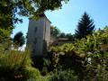
(13) At the junction by Saint-Denis Church, cross over and walk along the left-hand side of the church. Leave the village and rejoin the D120.

(14) Take the path on the left and you’ll come to the old ‘Sacristie’ airdrop zone on your left. Return to the D120.

(15) This time, cross carefully to enter the Bois de la Montagne. Continue for 3.5 km.

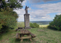
(16) At the viewpoint overlooking Avot, head downhill to the right towards the centre of the village to reach Rue du Roitu, which leads to the D19 (Rue de Chevie).

(18) Turn left to return directly to the starting point (S/E).

Waypoints

  1. S/E : mi 0 - alt. 1,060 ft - Avot village square - Fontaine centrale et Diane Chasseresse
  2. 1 : mi 0.25 - alt. 1,063 ft - Lavoir
  3. 2 : mi 0.38 - alt. 1,096 ft - Avot exit – GR®7 - PC opérationnel du maquis
  4. 3 : mi 0.87 - alt. 1,355 ft - First junction in the forest
  5. 4 : mi 1.16 - alt. 1,421 ft - Second junction in the forest
  6. 5 : mi 1.53 - alt. 1,463 ft - Chambremont junction
  7. 6 : mi 2.32 - alt. 1,371 ft - Fontaine de Champignolles
  8. 7 : mi 2.48 - alt. 1,483 ft - Crossing the D112
  9. 8 : mi 2.91 - alt. 1,394 ft - Junction towards the Vaubois spring
  10. 9 : mi 3.01 - alt. 1,368 ft - Vaubois Spring
  11. 10 : mi 3.58 - alt. 1,289 ft - Exit from the GR®7
  12. 11 : mi 4.09 - alt. 1,460 ft - Trou d’Avelanges
  13. 12 : mi 4.24 - alt. 1,437 ft - Croix du Chaignot
  14. 13 : mi 4.67 - alt. 1,273 ft - Avelanges wash house (covered picnic table)
  15. 14 : mi 4.73 - alt. 1,250 ft - Junction by the Church of Saint Denis in Avelanges
  16. 15 : mi 5.96 - alt. 1,519 ft - “Sacristie” drop-off point
  17. 16 : mi 6.29 - alt. 1,519 ft - Junction and entrance to the Bois de la Montagne
  18. 17 : mi 7.64 - alt. 1,188 ft - Viewpoint over Avot
  19. 18 : mi 7.97 - alt. 1,053 ft - Rue de Chevie
  20. S/E : mi 8.14 - alt. 1,060 ft - Avot village square - Fontaine centrale et Diane Chasseresse

Notes

The route starts from the main square in Avot. A few parking spaces are available in the square and near the town hall.

The route follows country lanes and forest tracks, as well as a section of the GR®7. Hiking boots are recommended.

Several road crossings require caution, particularly on the D112.

The route passes through woodland and hunting areas. From October to the end of February, check local conditions and observe any temporary signage that may be in place.

Please respect private property and agricultural and forestry activities, and stay on the marked paths.

Hunting: the route passes through wooded areas where hunting may be taking place. During the hunting season, check before setting off and observe any temporary signage in place on the ground. Information on current hunting activities can be found on ChasseInfo.

Worth a visit

(1) Avot washhouse.

Maquis operational headquarters.

Maquis equipment store.

(6) Champignolles Fountain.

(9) Vaubois Spring.

(11) Avelanges Cave.

(13) Avelanges wash house/fountain.

(14) Saint-Denis Church, Avelanges.

(15) ‘Sacristie’ parachute drop zone.

(18) Avot washhouse.

Always be cautious and plan ahead when you're outdoors. Visorando and the author of this route cannot be held responsible for any accidents occurring on this route.

The GR® and PR® markings are the intellectual property of the Fédération Française de Randonnée Pédestre.

Other walks in the area

For more walks, use our search engine .

The GPS track and description are the property of this route's author. Please do not copy them without permission.