Country:
 City:


Park in the car park opposite Auberive Town Hall.
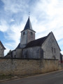
(S/E) With the town hall on your left, turn right onto Rue de la Poste and head towards Sainte-Anne Church.
(1) Continue to the right along Rue des Fermiers, passing a cultural information board detailing the history of Auberive, and head towards the junction, where there is a fountain and a picnic table on the right.
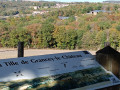
(2) Take the first left onto Rue de l’École des Filles. At the two junctions, leave Ruelle des Passerelles on your right and keep left. At the end, you’ll come to Rue du Moulin; follow it to the right. Cross the Ruisseau du Val Clavin and turn left at the end of the path.Take care as you walk up the road: it is narrow. Then turn right onto the Chemin du Sinaï towards the cemetery. Reach the cemetery and its wayside cross and enjoy the lovely view over the village.
(3) Return to Rue du Moulin via the same path and continue straight ahead. Then leave the Promenade entre Deux Eaux on your right and continue straight ahead to the Grille Jean Lamour, which leads to Auberive Abbey.
(4) Turn back and turn left onto the Promenade Entre Deux Eaux, which passes by a few benches and a wash house. At the end, turn left to cross the River Aube and reach the entrance to the abbey.
(5) Turn back and leave the promenade on your right to head straight ahead. Walk past the bust of André Theuriet and a château as you climb the Côte de l’Abbaye. You’ll come to the junction with the fountain.
(2) Turn left and head back to the car park (S/E).
 Visorando Member
 Moderate

 Very difficult
 Difficult