From Boussenois to Vernois-lès-Vesvres in the Chamberceau Forest

A circular walk starting from Boussenois and heading to Vernois through the woods.

Details

4056528
Creation:
Last update:
Last review:
  • Walking
    Activity: Walking
  • ↔
    Distance: 10.09 mi
  • ◔
    Average duration: 5h 20 
  • ▲
    Difficulty: Moderate

  • ⚐
    Back to start: Yes
  • ↗
    Ascent: + 787 ft
  • ↘
    Descent: - 791 ft

  • ▲
    Highest point: 1,535 ft
  • ▼
    Lowest point: 1,079 ft
  • ⚐ Country: France
  • ⚐ City: Boussenois (21260)
  • ⚑
    Start/End: N 47.629558° / E 5.209984°
  • ❏
    IGN map(s): Ref. 3121SB
  • Hour-by-hour weather

Photos

Description of the walk

Park near the town hall on Grande Rue in Boussenois; there is a small car park 50 m away.

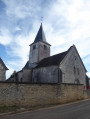
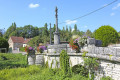
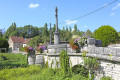
(S/E) Set off along the Grande Rue towards the church, walk past it and follow the castle’s boundary wall. At the end of the boundary wall, take the first path on the right.

(1) At the junction before the pond, look for a path leading uphill to the left (the start is quite difficult to spot); follow it until you reach another path. Turn right to cross a small bridge and continue uphill, turning left. Join another path on the right, then one on the left, and carry on straight ahead. You’ll come to a T-junction.

(2) Head right and carry on straight on until you reach Dessus de la Greuze.

(3) At the T-junction at the 458 mark, turn right and carry on straight ahead.

(4) At elevation 456, join a white track and turn left. Continue straight on, ignoring all paths and tracks you cross along the way. Go under the motorway, make a left/right turn and join a white track at elevation 436.

(5) Carry on straight ahead. At the next multi-way junction, veer left at a 45° angle and carry on straight ahead until you reach the junction with the D27k

(6) Cut left to pass in front of the Étang des Vernes and go past a property.

(7) At the bend in the road, turn right, then left, to take an uphill track known as the “Chemin du Facteur”. At the two Y-junctions, carry straight on.

(8) Cut across the wide track and carry on straight ahead. At the junction with another track, turn right, then left, make a 90° turn and carry on straight ahead until you reach the motorway.

(9) Facing the motorway, take the white track on the right and follow it to the T-junction.

(10) Turn left to go under the motorway. After the bridge, carry on straight ahead to reach a small road.

(11) Head right until you reach the D103. Follow it to the left for 100 m until you reach the track at the end of the bend.

(12) Turn left, then rejoin the D103.

(13) Follow the D103 to the left, enter the village and carry on straight ahead to reach the starting point, near the town hall (S/E).


Waypoints

  1. S/E : mi 0 - alt. 1,184 ft - Boussenois Town Hall
  2. 1 : mi 0.6 - alt. 1,220 ft - Junction before the pond
  3. 2 : mi 1.05 - alt. 1,444 ft - Combe Gorin
  4. 3 : mi 1.91 - alt. 1,512 ft - Le Dessus de la Greuze
  5. 4 : mi 2.44 - alt. 1,493 ft - Junction with the white trail
  6. 5 : mi 3.63 - alt. 1,434 ft - La Borne Percée
  7. 6 : mi 5.23 - alt. 1,096 ft - Junction with the D27k, near the - Venelle (rivière) - Affluent de la Tille
  8. 7 : mi 5.86 - alt. 1,109 ft - Junction on the track
  9. 8 : mi 6.37 - alt. 1,329 ft - Junction with a track
  10. 9 : mi 7.43 - alt. 1,460 ft - Opposite the motorway
  11. 10 : mi 8.15 - alt. 1,385 ft - Passing under the motorway
  12. 11 : mi 8.64 - alt. 1,381 ft - Junction
  13. 12 : mi 9.62 - alt. 1,155 ft - Junction on the path
  14. 13 : mi 9.79 - alt. 1,198 ft - The D103
  15. S/E : mi 10.09 - alt. 1,184 ft - Boussenois Town Hall

Worth a visit

A walk through the woods above the villages of Boussenois and Vernois.

Reviews and comments

3.8 / 5
Based on 3 reviews

Reliability of the description
4 / 5
Ease of following the route
3.3 / 5
Route interest
4 / 5
philjacque
philjacque

Overall rating : 4 / 5

Date of your route : Apr 10, 2023
Reliability of the description : ★★★★☆ Good
Ease of following the route : ★★★★☆ Good
Route interest : ★★★★☆ Good
Very busy route : No

Hello.
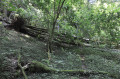
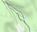
A lovely walk in this quiet part of the Côte d’Or. There are plenty of woods, so there are lots of trees and branches on the paths, particularly on the path after point 1, which is now completely impassable. Solution: at point 1, turn right, walk past the small pond and take the path that climbs up the other side of the valley. At the top of the valley, it rejoins the original GPS route, so all is well…
Two suggestions for Boussenois:

  • Parking in the village isn’t easy if you have several cars. There’s a bit more space in front of the church and even more a little further on, past the castle wall.
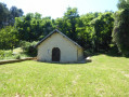
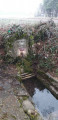
  • At the end of the walk: at the first wash house, turn left, then right onto the path that runs alongside the stream to the second wash house.

Machine-translated

cuzcodom
cuzcodom

Overall rating : 3.7 / 5

Date of your route : Sep 24, 2022
Reliability of the description : ★★★★☆ Good
Ease of following the route : ★★★☆☆ Average
Route interest : ★★★★☆ Good
Very busy route : No

A lovely walk through woodland and countryside.
GPS essential!
Best avoided during the hunting season
Managing to map out a pleasant walk despite having to cross under the motorway twice is quite a challenge: yet it works! Well done.

Machine-translated

monnerief
monnerief

Thank you very much

Machine-translated

LAURENT FRANCOIS
LAURENT FRANCOIS

Hello
After half a day’s work by three people using two chainsaws, the path leading up between points 1 and 2 has been cleared of all the trees blocking the way.
Enjoy your walk

Machine-translated

monnerief
monnerief

Overall rating : 3.7 / 5

Date of your route : Jul 21, 2021
Reliability of the description : ★★★★☆ Good
Ease of following the route : ★★★☆☆ Average
Route interest : ★★★★☆ Good
Very busy route : No

Hello,
We went on this walk on 21 July in the heat.
To avoid getting too hot, we walked the route in the opposite direction to avoid the sections outside the woods at the end of the route (along the motorway and on to Boussenois).
One problem on this route is section (1): at the junction before the pond, look for a path leading uphill to the left
(it’s quite tricky to spot at first), follow it until you reach another path. Turn right to cross a small bridge and continue uphill, turning left. Join another path on the right, then one on the left, and carry on straight ahead. You’ll come to a T-junction.”
Coming from the top (though the problem is the same coming from the bottom), the GPS track does not correspond to any visible path or any route on the IGN map (Openrunner app). Much of this section is overgrown with trees...
I have three images of the routes
Kind regards
F. Monnerie

Machine-translated

Other walks in the area

For more walks, use our search engine .

The GPS track and description are the property of this route's author. Please do not copy them without permission.