Country:
 City:
City:


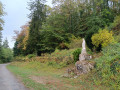
Park in the (unobtrusive) car park on the left just before the Porte de Bourgogne.
(S/E) Go through the gate, continue to the castle gate, from where you can see the interesting architecture of its outbuildings and the collegiate church. Then head back to the crossroads, turn right downhill and you’ll reach a bridge.
(1) Turn right before the bridge (towards Église Saint-Germain) and follow the road to the church.
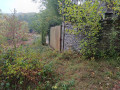
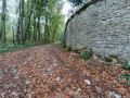
(2) Take the path on the far right, which climbs gently. The path soon meets the high dry-stone boundary wall of the castle grounds. Continue along this path, keeping the wall on your right. Climb up to a pass, then descend into a valley.
After about 2 km along this wall, you’ll reach a sharp bend with a gate.
(3) Leave the wall and the path running alongside it and continue straight ahead for about 100 m.
(4) Turn right (GR®) at a hairpin bend and, 300 m further down, you’ll reach a good track; follow it to the right. Walk alongside an old railway line, pass the former ‘Mauricette’ station and come to a tarmac road with a picnic area.
(5) Turn left, then right. Walk past the castle, then past the church, and turn right in front of Courlon Town Hall.
(6) Cross the bridge, then at the start of the right-hand bend, take Chemin Neuf on the left.
(7) Initially tarmac, this path becomes grassy after the last house.
(8) At the top of the steady climb, as you reach the fields (at elevation 403), turn sharply right onto the path at the edge of the forest. Continue until you reach the D112.
(9) Follow it to the left uphill. Just before the pass, take the path on the left. After a little over 1 km across the plateau, you’ll reach a fork at a slight pass.
(10) Turn right, then descend gently to a very new farm on the right (two large sheds). Continue to the next junction marked by a stone cross. The village of Neuvelle-lès-Grancey lies above you.
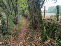
(11) Turn right onto the track, which quickly turns into a very pleasant, shaded path. At one point, this well-marked path veers left to climb a sort of embankment, then turns right and then left again to reach the sports grounds.
(12) Carry on to the D1121, follow it to the right and arrive at the Grancey-le-Château car park (S/E).
 Visorando Member
 Difficult
 Very difficult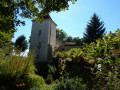
 Local authority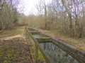
 Easy
Easy