Between Boussenois and Rivière-les-Fosses

A walk between Boussenois and Rivière-les-Fosses via La Montagne and the woods of Grand Maisonnais

Details

1099753
Creation:
Last update:
Last review:
  • Walking
    Activity: Walking
  • ↔
    Distance: 9.41 mi
  • ◔
    Average duration: 5h 00 
  • ▲
    Difficulty: Difficult

  • ⚐
    Back to start: Yes
  • ↗
    Ascent: + 787 ft
  • ↘
    Descent: - 758 ft

  • ▲
    Highest point: 1,535 ft
  • ▼
    Lowest point: 1,024 ft
  • ⚐ Country: France
  • ⚐ City: Boussenois (21260)
  • ⚑
    Start/End: N 47.629608° / E 5.210059°
  • ❏
    IGN map(s): Ref. 3121SB
  • Hour-by-hour weather

Photos

Description of the walk

Start at Boussenois Town Hall; parking is available on the square 50 metres away.

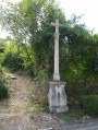
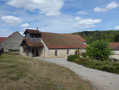
(S/E) Head towards the church and take the first street on the right, Rue de Chevie, then continue along the D103. Pass the wayside cross, go up the hill, then cross into the Haute-Marne department.

(1) Before the gas pipeline marked by yellow posts, take a track on the left and carry on straight ahead.

(2) At the end of the track, at the T-junction, turn right; as you come out of the woods, pass the picnic area, enjoy the view and carry on straight ahead.

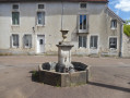
(3) At the Y-junction, turn left and walk past an aerial. At the next junction, turn right and carry on straight on towards the village. Take Rue de Vernois and carry on straight on along Rue des Charriers to reach the fountain in the centre of the village.

(4) At the fountain, turn left, then right onto the first street leading downhill past the church, Rue des Roches. At the end of the street, turn left onto Rue de Cheville and carry on straight ahead to leave the village via the D140A.

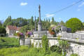
(5) At the second wayside cross, veer left and carry on straight ahead, passing alongside the farm buildings.

(6) At the edge of the forest, carry on straight ahead along a forest track, then at the next junction, turn right and carry on straight ahead.

(7) You’ll come to a stone marker; turn left onto a forest track and carry on straight ahead.

(8) At the end of the track, turn right.

(9) At the major junction, turn left twice and follow the track.

(10) Please note that the military map is no longer up to date; turn left, then right.

(11) Take a little-used track on the left.

(12) Turn right onto a very narrow track and, at the next junction, turn left. Pass in front of an old bridge and turn right. Please note that as the track is rarely used, it is difficult to follow and, in the lower section, you must take care not to mistake it for the bed of an old stream.

(13) Join a track at the far end of the pond and carry on straight ahead to reach the Vernois road. At the road, turn left and return to the starting point (S/E).

Waypoints

  1. S/E : mi 0 - alt. 1,184 ft - Boussenois Town Hall
  2. 1 : mi 1.14 - alt. 1,273 ft - Champ Ferrot
  3. 2 : mi 1.9 - alt. 1,457 ft - Combe Clémenceau
  4. 3 : mi 2.83 - alt. 1,312 ft - Crossroads near a mast
  5. 4 : mi 3.92 - alt. 1,083 ft - The fountain
  6. 5 : mi 4.39 - alt. 1,079 ft - The second wayside cross
  7. 6 : mi 5.01 - alt. 1,217 ft - At the edge of the forest
  8. 7 : mi 5.89 - alt. 1,309 ft - A stone marker
  9. 8 : mi 7.22 - alt. 1,529 ft - End of trail
  10. 9 : mi 7.48 - alt. 1,512 ft - Top of La Greuze
  11. 10 : mi 8.22 - alt. 1,457 ft - Combe Gorin Woods
  12. 11 : mi 8.27 - alt. 1,450 ft - A little-used track
  13. 12 : mi 8.39 - alt. 1,444 ft - A very narrow path shaped like a tunnel
  14. 13 : mi 8.82 - alt. 1,224 ft - After the pond
  15. S/E : mi 9.41 - alt. 1,188 ft - Boussenois Town Hall

Notes

This walk is classified as ‘difficult’ as the last 2 km are on paths that are hard to follow.

At (11), one option is to continue straight on to join the Vernois road and walk down to Boussenois along the road.

Worth a visit

Walk through fields and woods.
Visit to the village of Rivière-les-Fosses.
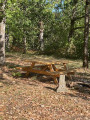
There’s a lovely view from the picnic table at L’Orme.

Reviews and comments

3.8 / 5
Based on 3 reviews

Reliability of the description
3.7 / 5
Ease of following the route
3.7 / 5
Route interest
4 / 5
DROUILLOT
DROUILLOT

Overall rating : 2.7 / 5

Date of your route : Aug 15, 2024
Reliability of the description : ★★☆☆☆ Disappointing
Ease of following the route : ★★☆☆☆ Disappointing
Route interest : ★★★★☆ Good
Very busy route : No

This pleasant circular walk, which presents no technical difficulties, alternates between shaded and sunny sections. Its highlights include the views, the village of Rivière-Les-Fosses and some lovely paths through the woodland.
What a shame that the route description is so vague! Apart from the two villages, we were often unsure of the way, which meant we had to keep checking the map. The GPS track wasn’t working that day, and we ended up walking more kilometres than planned. It is true that the description mentions the paths for the last 2 kilometres are hard to follow, but we encountered difficulties right from point (9). The map and the route description no longer matched, and we ended up wandering all over the woods until we found ourselves on the road to Vernois without having seen the old bridge (12) or the pond (13).
There is a picnic table on the outskirts of Rivière-Les-Fosses, just before point (5).

Machine-translated

LAURENT FRANCOIS
LAURENT FRANCOIS

Hello
I’ve taken note; the error has been corrected. Thank you, and have a lovely day
Kind regards

Machine-translated

MARTDomi
MARTDomi

Overall rating : 4 / 5

Date of your route : Jul 13, 2022
Reliability of the description : ★★★★☆ Good
Ease of following the route : ★★★★☆ Good
Route interest : ★★★★☆ Good
Very busy route : No

A lovely walk

One detail to correct: when heading from the town hall towards the church, you should turn right, not left.

Machine-translated

LAURENT FRANCOIS
LAURENT FRANCOIS

Hello
After point 12 at the small bridge, you can cross the bridge and turn left; the path has been cleared of all fallen trees by two friends and the author of this walk.

Machine-translated

LAURENT FRANCOIS
LAURENT FRANCOIS

Hello
That’s one possible variation; the author

Machine-translated

cuzcodom
cuzcodom

Overall rating : 4.7 / 5

Date of your route : Oct 04, 2020
Reliability of the description : ★★★★★ Very good
Ease of following the route : ★★★★★ Very good
Route interest : ★★★★☆ Good
Very busy route : No

A lovely, varied hike with surprising scenery and a magnificent forest.
The final stretch through the valley is a bit ‘rock ’n’ roll’ but nothing insurmountable, and the valley is well worth exploring.
I’m just wondering whether, instead of taking that long straight stretch from point 7, it might be better to carry on to point 411 and head back up via the path that leads to point 9?
In any case, well done!

Machine-translated

Other walks in the area

For more walks, use our search engine .

The GPS track and description are the property of this route's author. Please do not copy them without permission.