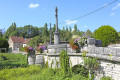
From Vernois-lès-Vesvres to Cussey-les-Forges via the woods

A circular route between the two villages, mainly through woodland. Unfortunately, on leaving Cussey-les-Forges, you have to take a section of the D120e as the Cussey Forest is completely fenced off.

Details

n°16403368
Creation:
Last update:
Last review:
  • Walking
    Activity: Walking
  • ↔
    Distance: 8.28 mi
  • ◔
    Average duration: 4h 35 
  • ▲
    Difficulty: Moderate

  • ⚐
    Back to start: Yes
  • ↗
    Ascent: + 906 ft
  • ↘
    Descent: - 896 ft

  • ▲
    Highest point: 1,542 ft
  • ▼
    Lowest point: 1,033 ft

Photos

Description of the walk

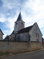
The walk starts at the church in Vernois-lès-Vesvres; there is a small car park to the right of the church.

(S/E) Set off along the street opposite the church, the Grande Rue.

(1) Walk past the cemetery, leaving the return route on your left, and follow the road as it winds round a series of bends.

(2) At the end of the road, at the T-junction, carry on straight ahead along the track. At the T-junction at elevation 464, carry on straight ahead until the next fork.

(3) Carry on straight ahead along the grassy field path at the edge of the woodland, and enter the Bois de la Grande Montagne via a wide path. Keep going in the same direction until you reach a track.

(4) Turn left and continue straight on, following this downhill track. Exit the woods and join the D120a.

(5) Turn left and head towards the village of Cussey-les-Forges, continuing straight on along Rue de Villemoron. Walk past the cemetery.

(6) At the corner of the cemetery, take the first street on the left, Rue de l’Église, to walk round the cemetery and visit the church

(7) At the junction, turn right onto Rue de Foncegrive, leave the village and continue along this quiet little road.

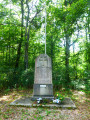
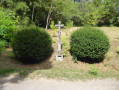
(8) Walk past the Source de l’Ermitage and you’ll come to a monument by the roadside.

(9) Take the forest path on the left and join a stony track at a junction where several paths meet.

(10) Carry straight on.

(11) At the Y-junction, turn left onto the stony track and continue until you reach a small clearing.

(12) Carry on straight ahead along the straight grassy path.

(13) At the end of the path, at Combe des Noyers, turn left and then immediately take the second path on the right. On the descent, at the T-junction, keep left. Join the Grande Rue at the cemetery.

(1) Turn right and head for the car park (S/E).

Waypoints

  1. S/E : mi 0 - alt. 1,086 ft - Church of Vernois-lès-Vesvres - Venelle (rivière) - Affluent de la Tille
  2. 1 : mi 0.17 - alt. 1,155 ft - Cemetery, junction of the circular loop
  3. 2 : mi 0.73 - alt. 1,365 ft - End of route
  4. 3 : mi 1.71 - alt. 1,529 ft - Lande des Genévriers
  5. 4 : mi 2.73 - alt. 1,424 ft - Bois de la Montagne, trail junction
  6. 5 : mi 3.5 - alt. 1,047 ft - D120a
  7. 6 : mi 3.79 - alt. 1,040 ft - Cemetery wall
  8. 7 : mi 3.89 - alt. 1,047 ft - Route de Foncegrive
  9. 8 : mi 5.14 - alt. 1,168 ft - Source de l'Ermitage (Cussey-les-Forges)
  10. 9 : mi 6.42 - alt. 1,526 ft - Monument
  11. 10 : mi 6.87 - alt. 1,532 ft - Multi-path junction
  12. 11 : mi 7.06 - alt. 1,542 ft - Y-junction
  13. 12 : mi 7.56 - alt. 1,483 ft - Bois des Rangis
  14. 13 : mi 7.82 - alt. 1,329 ft - Combe des Noyers
  15. S/E : mi 8.28 - alt. 1,086 ft - Church of Vernois-lès-Vesvres - Église Saint-Gengoult (Vernois-lès-Vesvres)

Reviews and comments

4.3 / 5
Based on 2 reviews

Reliability of the description
4.5 / 5
Ease of following the route
4.5 / 5
Route interest
4 / 5
Chabanis
Chabanis

Overall rating : 4.7 / 5

Date of your route : Jul 13, 2026
Reliability of the description : ★★★★★ Very good
Ease of following the route : ★★★★★ Very good
Route interest : ★★★★☆ Good
Very busy route : No

A pleasant walk, mostly through woodland on good paths.
The climb up the small road after Cussey-les-Forges is a bit long and tedious, but thankfully it’s in the shade!

Machine-translated

Marc21
Marc21

Overall rating : 4 / 5

Date of your route : Feb 17, 2025
Reliability of the description : ★★★★☆ Good
Ease of following the route : ★★★★☆ Good
Route interest : ★★★★☆ Good
Very busy route : No

A lovely walk, not too difficult, though the ground was very heavy after the rain
Lots of paths through the woods, very good

Machine-translated

Other walks in the area

For more walks, use our search engine .

The GPS track and description are the property of this route's author. Please do not copy them without permission.