Farms and villages starting from Grancey-le-Château

A challenging hike classified as very difficult due to both its length and the difficult sections on certain parts of the route, requiring a good sense of direction and observation due to sections through woodland and meadows off the beaten track (between (9) and (10), near (12)), as well as a poorly maintained woodland path (between (12) and (13)). It is recommended that you follow the GPX track. In good weather, the scenery is pleasant and varied. There are charming rural villages.

Details

27560187
Creation:
Last update:
Last review:
  • Walking
    Activity: Walking
  • ↔
    Distance: 16.10 mi
  • ◔
    Duration according to the author: 7 hrs 
  • ▲
    Difficulty: Very difficult

  • ⚐
    Back to start: Yes
  • ↗
    Ascent: + 1,690 ft
  • ↘
    Descent: - 1,693 ft

  • ▲
    Highest point: 1,565 ft
  • ▼
    Lowest point: 1,027 ft

Photos

Description of the walk

Head to Grancey-le-Château Neuvelle via the D959. Park on the hillside, on Allée des Tilleuls, in front of the former gendarmerie.

(S/E) Set off towards the well-preserved medieval gate. Pass through it via Rue de Bourgogne, continuing straight ahead until you reach the castle gate. Take a few steps back and turn right onto Rue des Halles. Walk past the public fountain and the Town Hall, as well as the birthplace (at No. 7) of Mother Marie-Odile Garnier. Head down Rue de La Pérouse to the right, then continue left along Rue du Bourg until you reach the junction with the D959 (Route de Dijon). Cross the junction and head up Rue du Meunier on the opposite side.

(1) At the next junction, after a slight bend to the right, take the Voie aux Chèvres. Walk up this stony track and follow it all the way, passing farm outbuildings at a place called Les Crais de Jeu, until you come out onto a tarmac road.

(2) At this junction, turn left towards the Ferme de Jeu. Walk past it and follow the partly tarmac-surfaced track leading uphill to the right until you reach a crossroads (with a hunting lookout post marking the end of the track).

(3) Turn right onto a grassy path heading towards the woodland. Continue along the path through the woodland until you reach a clearly marked four-way crossroads.

(4) Veer to the right and continue through the woodland. This path narrows before widening out further on and running alongside a meadow on the left. You’ll arrive at the Combe Cotébillé signpost at an altitude of 420m.

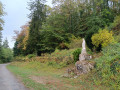
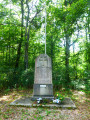
(5) Turn left and follow a wide, gravel-surfaced white track, marked in yellow and part of the Camino de Santiago route, for its entire length. Further on, the path becomes tarmac, passing a hunting lodge (on the right) and a wayside cross dating from 1877 (on the left). You’ll end up at the church of Cussey-Les Forges via Rue des Ponts (after crossing La Tille de Villemervry) and the Place d’Armes.

(6) Carefully cross the main road to the left and take Rue du Four opposite (towards Foncegrive). Walk past the church and its cemetery before turning left onto Rue des Ruelles. Keep to the right until you reach a T-junction. Turn left onto Rue des Routoirs, following the stream Le Molvau. Return to the main road. Turn right onto the D120a, crossing a small bridge. Continue to the outskirts of Cussey.

(7) Turn left onto the D120b towards Villemervry. Follow this quiet road carefully for about 700 m to reach the hamlet of Côte Quéquet.

(8) Turn right onto a gravel track and continue along this ascending track until you reach PC 372.

(9) Shortly after a slight bend to the left, turn right onto a grassy path leading to a field gate. In front of the gate, turn left onto a path that runs alongside the field, veering to the right. Continue along this path until you reach a junction with a track branching off to the left across the fields and no further track straight ahead. Cross the fence on the right to cut diagonally across the meadow (look for a pile of rubble) and follow the GPX track to rejoin, shortly afterwards, a wide, clearly visible dirt track which leads to the left, across fields, until it meets the tarmac road to Chateaulion. Turn right to reach Villemoron.

(10) At thefirst junction, turn left onto Rue de Vauloge towards Villemervry. Follow this quiet road carefully for just over 700 metres.

(11) Leave this road before a bend to the left and turn right onto a white, gravelly track. Follow it until you reach a Fork in the road at PC 386, then keep to the right and continue to the end of the track at the edge of the woodland, where it enters a meadow.

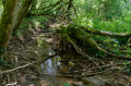
(12) Be careful here: follow the GPX track as there is no marked path. Head diagonally to the far right to cross a fence and two gates whilst cutting through patches of woodland and meadows in succession, covering a distance of just over 130 metres, before reaching a woodland path near a spring. Follow this poorly maintained path to the left; further on, it merges with a dry stream bed. The route is more or less visible on the ground. Return to the GPX track so that you can veer left at the right moment to climb through the woods along a narrow track, despite the obstacles (fallen trees). As soon as the edge of the woodland comes into view, cut left to reach the boundary where the woodland meets a meadow. Follow the meadow to the right until you reach the track leading to Vauloge Farm (buildings visible).

(13) At the shed, join the tarmac access road. Follow it uphill, passing the Vauloge astronomical observatory. At the next crossroads, turn sharp right to follow the signposted Vals des Tilles route towards Chalmessin via the Plat des Aulx forest road.

(14) Leave this road at thefirst bend on the left (PC449) and turn right onto a white gravel track. Continue to follow the route towards Chalmessin, which overlooks and then runs alongside the Étang de la Combe des Creux Trop before joining the D289a and heading right towards the village of Chalmessin – Vals des Tilles as far as the wash house/fountain.

(15) Turn left onto Rue de La Fontaine au Loup towards the church. Further on, at a right-hand bend, leave the road and head straight on along a white gravel track. Follow it all the way to where it ends. It joins the VC2 at the entrance to Lamargelle-aux-Bois, on Rue de l’Étang. Continue to the wash house, going round the church on the right. Here, rejoin theGR®7

(16). Turn left and follow the red and whiteGR® markings. Walk down Rue Basse and, shortly afterwards, turn left into Rue du Poirier at a place called La Cure. Pass a wayside cross and a picnic table. Further on, turn left, still on theGR®, then head uphill through fields and woods. On the climb through the woodland, veer far to the left and then, further on, to the right.

(17) Climb the fairly steep path and cut straight across a clearing and a track before beginning a descent. At the bottom, theGR® continues to the right before branching off to the left onto a small track, less than 400 m further on.

(18) Carry on without ever leaving theGR® until you emerge from the woods onto a field. Follow the path down the edge of the field, keeping to the right. You’ll reach a crossroads of tracks at a place called Étang de Borgirault.

(19) Keep to the right towards Grancey. Follow the track up to reach and pass straight through the Borgirault farm.

(20) On leaving, turn left onto theGR® via a white, stony track which eventually descends. You’ll reach the crossroads of tracks (PC402).

(21) Leave theGR®7here, turn right and take a gently ascending field path which then bends to the left. Descend to the hamlet of Sur La Coudre.

(22) Just after passing a property on the right, surrounded by a low wall, turn right onto a grassy track. Cross the Tilles stream without getting your feet wet before veering left and joining the D959 a little further on.
Cross this road carefully and head up a clearly visible path through the woodland almost directly opposite.
Join the tarmac-surfaced Chemin de Sébastopol. Cross this road again to head straight up the Chemin de Bois de l’Étang-Neuf. You’ll emerge onto the Allée des Tilleuls. Turn left, with the medieval Burgundy Gate in view, to reach the car park in front of the former gendarmerie (S/E).

Waypoints

  1. S/E : mi 0 - alt. 1,365 ft - Car park in front of the former gendarmerie
  2. 1 : mi 0.52 - alt. 1,201 ft - Chemin de la Voie aux Chèvres
  3. 2 : mi 1.25 - alt. 1,296 ft - T-junction on a tarmac road
  4. 3 : mi 1.73 - alt. 1,450 ft - Crossroads of footpaths
  5. 4 : mi 2.24 - alt. 1,447 ft - Four-way crossroads
  6. 5 : mi 2.49 - alt. 1,391 ft - Combe Cotébillé
  7. 6 : mi 4.57 - alt. 1,043 ft - Cussey-les-Forges
  8. 7 : mi 4.87 - alt. 1,037 ft - Crossroads at the Cussey exit
  9. 8 : mi 5.28 - alt. 1,053 ft - Côte Quéquet
  10. 9 : mi 6.02 - alt. 1,230 ft - Crossroads with barrier
  11. 10 : mi 7.34 - alt. 1,132 ft - Crossroads towards Villemoron
  12. 11 : mi 7.78 - alt. 1,283 ft - Crossroads
  13. 12 : mi 8.35 - alt. 1,234 ft - End of the trail
  14. 13 : mi 9.11 - alt. 1,299 ft - Vauloge Farm
  15. 14 : mi 9.72 - alt. 1,467 ft - Crossroads
  16. 15 : mi 11.24 - alt. 1,230 ft - Chalmessin washhouse
  17. 16 : mi 12.57 - alt. 1,280 ft - Lamargelle-aux-Bois
  18. 17 : mi 13.19 - alt. 1,480 ft - GR7
  19. 18 : mi 13.69 - alt. 1,516 ft - GR7
  20. 19 : mi 14.48 - alt. 1,342 ft - Étang de Borgirault
  21. 20 : mi 14.75 - alt. 1,430 ft - Borgirault Farm
  22. 21 : mi 15.18 - alt. 1,325 ft - Leaving the GR7
  23. 22 : mi 15.6 - alt. 1,293 ft - On the Coudre
  24. S/E : mi 16.1 - alt. 1,365 ft - Car park in front of the former gendarmerie

Notes

On leaving Grancey, before crossing the D959 (Voie de Saint-Germain), to the right of the Tilles stream, there is a picnic area, Square de la Demi-Lune, with five tables and benches.
In Grancey, there is a large car park at the junction of the D959 and Rue du Bourg.
There is a potential picnic spot on the grass near the hunting lodge (PC 356) in the Bois de la Voie de Grancey.
Cussey-les-Forges: near the two bridges over the Tille de Villemervry, there is a picnic area with two tables and benches.
Picnic table near the village hall and its car park, just before entering Chalmessin (near the wayside shrine).
Picnic table at a place called La Cure in Lamargelle-aux-Bois.
Group lodge at the Borgirault farm (20).
Shelter beneath the wash houses in Chalmessin and Lamargelle.
Walking sticks are useful on ascents and descents in wet weather.

Worth a visit

Côte d’Or department.
- Grancey means ‘stony place’.
- The Porte de Bourgogne was built in the 13th century to protect the northern entrance to the village. It was widened and raised in 1886 and listed as a historic monument in 1941. It originally featured a drawbridge that allowed access across the moat, which is now hidden by the gardens of the surrounding properties. At the top, one can see a niche housing a statue of the Virgin and Child. Another gate, situated at the southern entrance to the village, before the market square, was a replica of this one: the Porte Sainte-Marie. It was demolished around 1840 to improve traffic flow.
- Grancey Castle, from whose gate you can see the old drawbridge, buildings with painted roofs and the imposing chapel, was originally a wooden fortified castle built around 1038 by Guy de Grancey. The lords of Grancey were very powerful, serving both the court of the Kings of France and that of the Dukes of Burgundy.
Following the partial demolition of the fortress, a Renaissance-style manor house was erected; some remains of this are incorporated into the present-day building. This was succeeded by the first classical-style château at the end of the 17th century. It was demolished in the 18th century by the Rouxel de Médavy family to make way for the construction of the château as it stands today. Finally, on the initiative of its current owner, Baron Jacques de Mandat Grancey, the château and its ramparts have been undergoing continuous restoration since 1960.
- In the village square stands the building which currently houses the town hall, the schools and the after-school care centre. This building was constructed in 1836 on the site of a farm. The market halls were originally open at both ends to accommodate fairs and markets. The building housed the justice of the peace’s courtroom, the archives, the schools and the town hall.
- Also of note is the ‘Diane de Gabies’ which adorns the fountain. This statue is a cast-iron replica of a work discovered in Italy and housed in the Louvre Museum since 1820. It is usually identified as Artemis, the virgin goddess of the hunt and the wilderness, solely on the basis of her clothing.
- From 1882 to 2 March 1969, the railway line from Troyes to Gray ran through the commune; coming from Poinson-Beneuvre station, it followed the course of the River Tille, passed to the south of the village, stopped at the station at a place called Le Pavillon, and then continued on to Marey-sur-Tille station.
- Mother Marie-Odile Garnier: 1838–1924 – a member of the Order of Saint Benedict and founder of the Congregation of the Benedictine Sisters of the Sacred Heart of Montmartre.
- Saint-Rémi Church in Cussey-les-Forges: built in the Gothic style, listed as a historic monument in 1909.

Department of Haute-Marne
- Villemoron – Chalmessin – Lamargelle (Vals des Tilles): In the 18th century, the commune of Villemoron did not exist. There were three separate parishes in the area.
To the north-east, the village of La Margelle, which was later renamed Lamargelle, then La Margelle-aux-Bois in 1935.
To the east, the village of Chalmessin, situated on the left bank of the Tille, near its source. A watermill, symbolised by a cogwheel – the Vossin Vologes Furnace – was likely used for ironworking. Its name is recalled today by the Combe du Vieux Fourneau.
Further east, the village of Musseau, situated on the right bank of the Tille de Villemoron, had its own church and castle, as well as a mill.
To the south, two hamlets were attached to the parish of Chalmessin: Villemervry-sur-La-Tille, with its Vossin mill, and Villemoron-sur-La-Tille-de-Villemoron, which also had its own watermill.
In 1789, Villemoron came under the province of Champagne within the bailiwick of Langres.
On1 April 1973, the commune of Villemoron was merged with that of Chalmessin under the ‘fusion-association’ scheme, forming Vals-des-Tilles.
- From 1883 to 1963, the railway line from Poinson-Beneuvre to Langres ran through the commune of Vals-les-Tilles; coming from Vaillant, it headed towards the terminus at Poinson-Beneuvre station.
Remarkably, three villages in Vals-les-Tilles – which were independent municipalities at the time – had their own stations: Musseau, Chalmessin (whose station was shared with the village of Virey) and La Margelle. At a time when the railway was the most convenient means of transport, this line carried a significant volume of passenger and freight traffic.
The Vauloge Astronomical Observatory, situated right next to the farm of the same name.

Always be cautious and plan ahead when you're outdoors. Visorando and the author of this route cannot be held responsible for any accidents occurring on this route.

The GR® and PR® markings are the intellectual property of the Fédération Française de Randonnée Pédestre.

Reviews and comments

4 / 5
Based on 3 reviews

Reliability of the description
4.3 / 5
Ease of following the route
3.7 / 5
Route interest
4 / 5
Xigor
Xigor

Overall rating : 4 / 5

Date of your route : Jul 14, 2025
Reliability of the description : ★★★★☆ Good
Ease of following the route : ★★★★☆ Good
Route interest : ★★★★☆ Good
Very busy route : No

A beautiful hike, but be sure to refer to the directions at point (12) and watch out for the dog that is not tied up at the farm in Vauloge just after.

Machine-translated

Fox2100
Fox2100

Overall rating : 3.7 / 5

Date of your route : Apr 30, 2025
Reliability of the description : ★★★★☆ Good
Ease of following the route : ★★★☆☆ Average
Route interest : ★★★★☆ Good
Very busy route : No

At point 12, on arriving at Vauloge Farm, I’m not sure whether we’re on a local footpath; I really get the impression we’re on private land, as there are ropes blocking this path!

Machine-translated

jcehenne
jcehenne
• Edited:

Overall rating : 4.3 / 5

Date of your route : May 18, 2023
Reliability of the description : ★★★★★ Very good
Ease of following the route : ★★★★☆ Good
Route interest : ★★★★☆ Good
Very busy route : No

Hello,

A long walk but without any major climbs… phew!
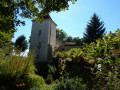
(6) A very beautiful church with a lava-stone roof in Cussey-les-Forges.
(9) We didn’t cut across the meadow diagonally because the crops hadn’t been harvested.
The tricky bit for us was at (12), where we had to go ‘wild boar’ style under two fences and make our way through a fairly dense copse for a few metres.
It was business as usual for the rest of the route, and we had a good day, all in all.
Thank you.

Machine-translated

Other walks in the area

For more walks, use our search engine .

The GPS track and description are the property of this route's author. Please do not copy them without permission.