


Pierre11

 Visorando Member
 Premium user
 - Location: Narbonne (11100)
- Gender: man
Sign up:
Published route(s)
 Between the forest and the Montagne Noire drainage ditch
 7.58 mi
 +774 ft
 -784 ft
 4h 10
4h 10
 Average
 Departure from Lacombe (Aude)
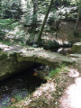
A refreshing walk in the Montagne Noire from the small village of Lacombe (11310) to the Ramondens national forest (Tarn) with a picnic stop near the retaining dyke of the St-Denis basin.
Return via the right bank of the Alzeau and passage at the Prise d'Alzeau, source of the Canal du Midi, before climbing back up to Lacombe.
Walk checked on 18/06/23. A few details have been added by the author
Around the Cesse
 9.57 mi
+1,545 ft
-1,549 ft
5h 45
Average
Departure from La Livinière (Hérault)
9.57 mi
+1,545 ft
-1,549 ft
5h 45
Average
Departure from La Livinière (Hérault)
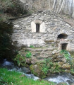
This small river, which flows into the Aude after 50 km, is the focus of this circular route starting from Cantignergues, a hamlet in La Livinière, in the commune of Hérault, to its source near the village of Ferrals-les-Montagne, a village in the Haut-Languedoc Regional Nature Park. A picnic area (with tables and barbecue) has been set up near the stone "gatehouse" where the waters of the Cesse emerge, disappearing during periods of drought at the foot of the Cathar citadel of Minerve.
Between forests and ditches, in the footsteps of P.P. Riquet
 9.94 mi
+741 ft
-758 ft
5h 15
Average
Departure from Saissac (Aude)
9.94 mi
+741 ft
-758 ft
5h 15
Average
Departure from Saissac (Aude)
On the watershed between the Aude and Tarn rivers, we follow in the footsteps of P.P. Riquet once again, discovering other water resources that enabled this self-taught engineer to demonstrate to the experts sent by Colbert the merits of his project to supply his Canal des Deux Mers. However, the forest remains present on this easy route, and Arfons, with its slate roofs, is a picturesque little village in the Haut-Languedoc Regional Nature Park.
Circular forest starting from Lac de Laprade Basse
10.05 mi
+1,047 ft
-1,060 ft
5h 30
Average
Departure from Cuxac-Cabardès (Aude)
From Lac de Laprade Basse in the commune of Cuxac-Cabardès, "Let's go for a walk in the woods to see if the wolf is there!"
In fact, let's set off to explore the Loubatière National Forest, from the Dure River, which feeds the lake, to the Linon Stream, which joins it upstream from Montolieu. Beneath centuries-old trees stand the ruins of an old Carthusian monastery abandoned long before the Revolution, due, among other things, to wolves... which have since been replaced by deer.
The path to Sauclières school
 4.06 mi
+325 ft
-318 ft
2h 10
4.06 mi
+325 ft
-318 ft
2h 10
 Easy
Departure from Sauclières (Aveyron)
Easy
Departure from Sauclières (Aveyron)
This trail was created by the RPI (Inter-municipal Educational Group) of Saint-Jean-du-Bruel and Sauclières. It is usually walked in the opposite direction to the one suggested here, so as to tackle the route’s only difficulty (a short, stony climb to reach the realigned D7) at the start of the walk. A torch is required to cross the Bousquillous tunnel before returning to Sauclières, a small village well worth spending a little time exploring.
From Sainte-Enimie to La Malène
 9.13 mi
+1,483 ft
-1,572 ft
5h 30
Average
Departure from Sainte-Enimie (Lozère)
9.13 mi
+1,483 ft
-1,572 ft
5h 30
Average
Departure from Sainte-Enimie (Lozère)
Stage 5 in the heart of the Gorges du Tarn via the Sentier des Gorges du Tarn (left bank) from Sainte-Enimie to La Malène, passing through the picturesque hamlet (with no road access) of Hauterives.
Le Pas de Montsarrat
 8.00 mi
+1,047 ft
-1,024 ft
4h 35
Average
Departure from Pradelles-Cabardès (Aude)
8.00 mi
+1,047 ft
-1,024 ft
4h 35
Average
Departure from Pradelles-Cabardès (Aude)
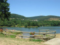
Facing the Pic de Nore, which saw the Tour de France pass through in 2018, the wind turbines installed on Mont Sarrat and spread across the municipalities of Pradelles-Cabardès and Cabrespine immediately catch the eye. TheGR®36, coming from Pic de Nore, winds its way at the foot of the masts before plunging towards Carcassonne via the Pas de Montsarrat, an ancient "Roman" communication route.
The short length of the route offers the opportunity to extend the hike along the lake (see practical information).
From Monistrol to Aurec-sur-Loire
 9.64 mi
+1,220 ft
-1,325 ft
5h 30
Average
Departure from Bas-en-Basset (Haute-Loire)
9.64 mi
+1,220 ft
-1,325 ft
5h 30
Average
Departure from Bas-en-Basset (Haute-Loire)
A linear walk along the “Chemin de Ter” between Bas-Monistrol and Aurec-sur-Loire stations, following theGR® de Pays des Gorges de la Loire trail – now reclassified asthe GR® 302 – with a few shortcuts.
The return journey by train, which is very short (11 mins), offers the chance to discover a picturesque stretch of the Loire riverbank, such as around Le Chambon-sur-Loire, which was deliberately avoided on the outward journey.
The author followed this route prior to the publication of the walk guide in issue No. 157 of *Balades Randos*.
The Sainte-Reine Chapel in Aurec-sur-Loire
 9.92 mi
+1,542 ft
-1,542 ft
5h 55
Average
Departure from Aurec-sur-Loire (Haute-Loire)
9.92 mi
+1,542 ft
-1,542 ft
5h 55
Average
Departure from Aurec-sur-Loire (Haute-Loire)
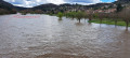
A circular walk starting from Aurec-sur-Loire along the banks of the Loire and the footbridges at “Saut du Chien”, before heading uphill to reach the village of Malvalette via thePR®® “Le Pont d’Angelard”. The route passes through the Chapelle Sainte-Reine on theGR®® de Pays des Gorges de la Loire, which leads back to Aurec via the valley of the Rivoire stream.
Rieussec Route
 9.45 mi
+1,519 ft
-1,486 ft
5h 40
Average
Departure from Vélieux (Hérault)
9.45 mi
+1,519 ft
-1,486 ft
5h 40
Average
Departure from Vélieux (Hérault)
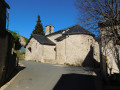
A walk through the Avants-Monts region towards the small village of Rieussec, along the road linking Narbonne to Saint-Pons-de-Thomières, making use of a section ofthe GR® 77 starting from Vélieux and a stretch of the Grande Traversée de l’Hérault to return to this village in the Haut-Languedoc Regional Nature Park
The marble circuit in Caunes-Minervois
 7.68 mi
+1,686 ft
-1,696 ft
5h 00
Average
Departure from Caunes-Minervois (Aude)
7.68 mi
+1,686 ft
-1,696 ft
5h 00
Average
Departure from Caunes-Minervois (Aude)
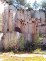
From Notre-Dame du Cros (Caunes-Minervois), a route takes you to former marble quarries, with a picnic stop at the renovated Ventajou refuge, near the ruins of the castle of the old village that has disappeared. On the way back, you pass by the Moulin de Biot, a former witness to a technique of using wind energy for sawing marble.
Warning from the author of the route in the "practical information" tab (2/11/2021)
Séauve-Bénite route
 9.06 mi
+1,010 ft
-1,004 ft
5h 05
Average
Departure from Monistrol-sur-Loire (Haute-Loire)
9.06 mi
+1,010 ft
-1,004 ft
5h 05
Average
Departure from Monistrol-sur-Loire (Haute-Loire)
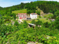
From Paulin, above Monistrol-sur-Loire, let’s set off to explore a former Cistercian abbey on the banks of the Semène, a tributary of the Loire, via a circular route combining twoPR®® trails: the Dames de la Séauve-Bénite and the Route de l’Ecureuil, developed by the Loire-Semène Tourist Office. The stretch of the Semène around the former abbey offers an attractive spot to stop off halfway along the route, with its picnic area, children’s play area and landscaped riverbanks.
The chapels of Marcillac-Vallon
 8.05 mi
+1,532 ft
-1,526 ft
5h 00
Average
Departure from Marcillac-Vallon (Aveyron)
8.05 mi
+1,532 ft
-1,526 ft
5h 00
Average
Departure from Marcillac-Vallon (Aveyron)
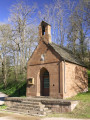
This circular route combines tarmac sections with an original route to discover four chapels located around the village of Marcillac-Vallon. Two marked sections (GR® 62 andPR®) make it easier to follow thesecond part of the route, from Saint-Jean-le-Froid, the highest point of this itinerary focused on small religious heritage sites.
Please note: a return variant has just been published following the deterioration of the path in the Bruéjouls ravine.
The Créneau balcony
 10.31 mi
+1,325 ft
-1,306 ft
5h 55
Average
Departure from Marcillac-Vallon (Aveyron)
10.31 mi
+1,325 ft
-1,306 ft
5h 55
Average
Departure from Marcillac-Vallon (Aveyron)
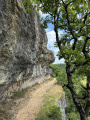
From Marcillac-Vallon, climb up to admire the Créneau valley on the right bank, with its waterfall gushing out in the middle of the village of Salles-la-Source. Then cross to the other bank to return first along a balcony path and then along a small road and shaded paths, inviting you to enjoy a bucolic walk that ends with a view of the valley from the famous Pont Rouge bridge in Marcillac-Vallon.
La Montagnole, land of renewable energy
 9.56 mi
+614 ft
-633 ft
4h 55
Average
Departure from Les Martys (Aude)
9.56 mi
+614 ft
-633 ft
4h 55
Average
Departure from Les Martys (Aude)
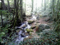
Forest hike to the Cuxac-Cabardès wind farm, above the Dure valley, and almost complete tour of Lake Laprade Basse via the recently constructed path that avoids the D101 between the hamlet and the dam dyke (see info).
The Bois de la Serre Haute
 6.54 mi
+738 ft
-735 ft
3h 40
Average
Departure from Lacombe (Aude)
6.54 mi
+738 ft
-735 ft
3h 40
Average
Departure from Lacombe (Aude)
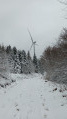
Walk along forest paths towards the Bois de la Serre Haute and the Forêt Domaniale de la Loubatière from Lacombe, stopping at the source of the Canal du Midi, the Prise d'Alzeau, before following the left bank of the Lac de la Galaube.
The route is marked locally (yellow line). It is taken in the opposite direction to the description with a few modifications for greater comfort (descent at the end of the route).
The sources of the Clamoux
 8.33 mi
+1,781 ft
-1,775 ft
5h 25
Average
Departure from Castans (Aude)
8.33 mi
+1,781 ft
-1,775 ft
5h 25
Average
Departure from Castans (Aude)
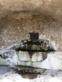
The Clamoux, a small river and tributary of the Orbiel, rises on the slopes of Pic de Nore, the iconic peak of the Montagne Noire, where a Tour de France relay station stands. Following forest tracks, with climbs of varying difficulty, you arrive near the source of the Clamoux, a small stream at the start, which you follow on the right bank, off the marked trail, descending into the Soulanes de Nore National Forest to Laviale, which, along with six other hamlets, makes up the village of Castans.
The Combe d'Enfer in the Massif de Fontfroide
 8.46 mi
+965 ft
-948 ft
4h 45
Average
Departure from Narbonne (Aude)
8.46 mi
+965 ft
-948 ft
4h 45
Average
Departure from Narbonne (Aude)
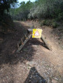
You'll discover part of the Massif de Fontfroide between the Domaine de Jonquières and the Abbaye de Fontfroide (visit possible), thanks to the many DFCI trails closed to motor vehicle traffic. The demanding section of the Combe d'Enfer should be walked with care, or even avoided after rain. An alternative route, described in the practical information section, allows you to bypass this tricky section.
The high meadows of Ferrals-les-Montagnes
 8.41 mi
+1,683 ft
-1,713 ft
5h 20
Average
Departure from Ferrals-les-Montagnes (Hérault)
8.41 mi
+1,683 ft
-1,713 ft
5h 20
Average
Departure from Ferrals-les-Montagnes (Hérault)
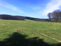
This hike starts from Ferrals-les-Montagnes and follows twoPR® trails among those that criss-cross the Haut-Languedoc Regional Nature Park, where the south of France becomes mountainous and the rivers flow either towards the Mediterranean or the ocean, thus determining the "watershed line". The source of the Cesse, at the end of this circular route, is a testament to this unspoilt area.
Le Roc Tremblaïre
 8.58 mi
+1,204 ft
-1,184 ft
5h 00
Average
Departure from Bize-Minervois (Aude)
8.58 mi
+1,204 ft
-1,184 ft
5h 00
Average
Departure from Bize-Minervois (Aude)
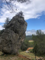
Between Aude and Hérault, this route alternates between flat and steep paths, crossing hills and plateaus between Bize-Minervois and Montouliers. On a balcony overlooking the Cesse valley, via the Travers de Verdeyre, let's set off to discover the Roc Tremblaïre before stopping at Montouliers for a break near its famous Roman fountain. The return journey, following a section ofthe GR®78combined with a Saint-Jacques slip road, allows you to overlook the Argeliers plain before arriving at Bize-Minervois.
The Répudre Canal Bridge at the start of Paraza
 8.08 mi
+472 ft
-489 ft
4h 10
Average
Departure from Paraza (Aude)
8.08 mi
+472 ft
-489 ft
4h 10
Average
Departure from Paraza (Aude)
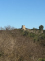
The Pont-Canal du Répudre bridge is the highlight of this circular route starting from Paraza towards the Minervois vineyards and the Jardin de Bacchus, near the Pouzols-Minervois cooperative winery. Before that, the passage through Sainte-Valière brings a hint of Saint-Jacques with a section of the Camin Romieu. Due to its location on the route, this Languedoc village is an essential stop for pilgrims looking for an enriching break on the Voie des Piémonts.
The Duzou balcony
 7.89 mi
+860 ft
-853 ft
4h 25
Average
Departure from Saint-Cyprien-sur-Dourdou (Aveyron)
7.89 mi
+860 ft
-853 ft
4h 25
Average
Departure from Saint-Cyprien-sur-Dourdou (Aveyron)
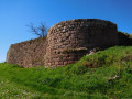
From Saint-Cyprien-sur-Dourdou, let's explore the ruins of a feudal castle at the confluence of the Créneau and Dourdou rivers, near the village of Nauviale with its red sandstone houses. The route is mainly on small roads with no traffic, but there is a climb up a forest track, following a section of a fitness trail and then a section along the ridge, which offers a superb view of the Duzou valley.
In the Loubatière Forest
4.50 mi
+528 ft
-531 ft
2h 30
Easy
Departure from Lacombe (Aude)
In hot weather, here’s a short, shaded walk in the Loubatière State Forest along paths not necessarily marked on the IGN map but very pleasant to walk along with little elevation gain. The route shares a section with the Lacombe PR°°®°° trail
The Valadour Footbridge in Chaliers
 6.19 mi
+1,007 ft
-981 ft
3h 45
Average
Departure from Loubaresse (Cantal) (Cantal)
6.19 mi
+1,007 ft
-981 ft
3h 45
Average
Departure from Loubaresse (Cantal) (Cantal)
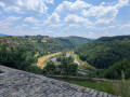
Starting from Loubaresse, near an exit from the A75 motorway, this route follows the GR® de Pays circular Boucle de la Truyère and a variant that "turns" around the Truyère river to the village of Chaliers, which is well worth taking the time to explore. The route takes small local roads on both the left and right banks of this river with its wild gorges, crossing it twice via footbridges at Valadour and Terran.
The actual duration of the route is 4 hours and 40 minutes (GPS watch data), including a short stop in Chaliers.
Roc de Nouret
 7.51 mi
+1,352 ft
-1,335 ft
4h 40
Average
Departure from Pradelles-Cabardès (Aude)
7.51 mi
+1,352 ft
-1,335 ft
4h 40
Average
Departure from Pradelles-Cabardès (Aude)
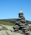
On the western slopes of the Pic de Nore lies a block of gneiss, the Roc de Nouret, isolated on this windswept moorland, where broom and thorn bushes share the space. Higher up, the Bois de Combe Escure, which overlooks the ravine of the same name – the border between the Aude and Tarn departments – marks the watershed between the Atlantic and the Mediterranean. A leisurely return to the village via the Bayours forest track.
The Avène Reservoir
 6.86 mi
+1,043 ft
-1,043 ft
4h 05
Average
Departure from Ceilhes-et-Rocozels (Hérault)
6.86 mi
+1,043 ft
-1,043 ft
4h 05
Average
Departure from Ceilhes-et-Rocozels (Hérault)
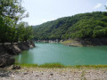
Here is a brief overview of the Avène Reservoir, starting from Ceilhes-et-Rocozels, first climbing up Mont Redon, south of the village. After the Rouvignac chapel and the holiday lodges, the route approaches the left bank of the Orb, which feeds the Bouloc lake, developed for outdoor leisure activities (water sports, camping).
⚠️ 11/05/2026:In winter and spring, and after heavy rain, when the reservoir is full, the walk may be impassable between points 8 and 10. It is possible to avoid walking along the banks by following the route shown on the IGN map between points 7 and 10.
The Jure Stream
 5.73 mi
+1,060 ft
-1,060 ft
3h 35
Average
Departure from Ceilhes-et-Rocozels (Hérault)
5.73 mi
+1,060 ft
-1,060 ft
3h 35
Average
Departure from Ceilhes-et-Rocozels (Hérault)
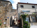
From Ceilhes-et-Rocozels, in Haut-Languedoc, near the ‘border’ with Aveyron, here’s an opportunity to head for the hills, in the Monts d’Orb State Forest, towards the Rocher du Canari on the edge of the Tesserièyres Plateau. The Ruisseau de Jure will then serve as your guide back to the village, which lies on the banks of the Orb, a coastal river regulated by the Avène Reservoir.
The Chappe Tower at Narbonne-Jonquières
 4.25 mi
+420 ft
-404 ft
2h 20
Easy
Departure from Narbonne (Aude)
4.25 mi
+420 ft
-404 ft
2h 20
Easy
Departure from Narbonne (Aude)
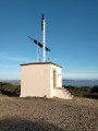
A half-day walk in the hills of Roches Grises in Narbonne to discover the forerunner of telecommunications, with a superb view of the Étang de Bages-Sigean.
The Recoux Calvary and the Wobbly Rock at La Roche
 8.14 mi
+712 ft
-728 ft
4h 20
Average
Departure from Faverolles (Cantal) (Cantal)
8.14 mi
+712 ft
-728 ft
4h 20
Average
Departure from Faverolles (Cantal) (Cantal)
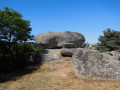
From Montchanson, with a rucksack on your back – in place of the schoolbag that children of yesteryear used to carry on their backs to get to school in one of the villages of the Arcomie Valley – let’s follow in their footsteps to discover the hamlets and local heritage. On the way, don’t forget to climb up to the Trois Croix du Bloc du Recoux for an exceptional view, before trying your hand at making the Pierre Branlante de la Roche wobble, north of Saint-Marc.
The Grandval Dam via La Mourache
 5.76 mi
+1,168 ft
-1,184 ft
3h 40
Average
Departure from Fridefont (Cantal)
5.76 mi
+1,168 ft
-1,184 ft
3h 40
Average
Departure from Fridefont (Cantal)
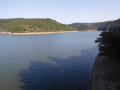
Over the centuries, the Truyère has carved out deep gorges which, with the rising water levels caused by the construction of the Grandval and Lanau dams, have given way to a natural landscape of surprising and contrasting beauty: islands and peninsulas, cirques with distant shores, mysterious meanders, narrow gorges opening onto vast expanses of water, a wooded valley… Following the PR la Mourache route, the walk offers magnificent views from the embankment supporting the Alleuze road.
Walking the route in the opposite direction offers more shade, but do keep an eye out for the signposting – which, to be honest, is rather sparse.
From Les Barralets to Les Guitardes
 8.78 mi
+850 ft
-820 ft
4h 45
Average
Departure from Saint-Chinian (Hérault)
8.78 mi
+850 ft
-820 ft
4h 45
Average
Departure from Saint-Chinian (Hérault)
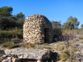
Between Saint-Chinian and Assignan, this route follows a GR® de Pays trail to explore woods and vineyards. On the way back, the Combelongue valley offers the chance to discover a "village" of drystone shelters and a plaster mill, now used for grain, which dates from 1854 and was originally used to grind gypsum.
Creissels Waterfalls, Tournal Mill and St-Martin Cirque
 4.11 mi
+502 ft
-525 ft
2h 20
Average
Departure from Creissels (Aveyron)
4.11 mi
+502 ft
-525 ft
2h 20
Average
Departure from Creissels (Aveyron)
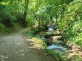
Starting from Creissels, there is a combination of marked trails, created on the initiative of the Millau Grands Causses Community of Communes, allowing you to discover the area by following in the footsteps of Mr Clapassou. (Symbolic iron signpost in the shape of a pile of stones)
Don't miss the Creissels waterfalls, the Moulin de Tournal mill and the Cirque de St-Martin (or Cirque du Boundoulaou). At the end of the route, you can visit the lower, very pretty part of the village, right on the banks of the Tarn.
Around the Ravin du Valat de la Curée
 4.66 mi
+876 ft
-869 ft
2h 55
Average
Departure from La Canourgue (Lozère)
4.66 mi
+876 ft
-869 ft
2h 55
Average
Departure from La Canourgue (Lozère)
This fairly demanding route, despite being only 8 km long, takes you along the edge of the Ravin du Valat de la Curée before returning via the hamlet of Les Balmes. A steep descent then follows to reach the site of the Chapelle Saint-Frézal, a picnic area to the south of the village of La Canourgue.
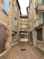
To extend the walk, a visit to this picturesque village – known as ‘the little Venice of Lozère’ – allows you to discover, as you wander through the old cobbled streets, a Renaissance house, the Place au Blé, with its medieval half-timbered house, the Place du Portal and the Clock Tower – a remnant of the old citadel – as well as many other sights, by following a route suggested by the tourist office.
The Château de la Reine Margot
 9.57 mi
+525 ft
-545 ft
4h 50
Average
Departure from Beauregard (Lot) (Lot)
9.57 mi
+525 ft
-545 ft
4h 50
Average
Departure from Beauregard (Lot) (Lot)
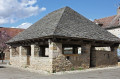
Here is a suggested route showcasing exceptional heritage, from Beauregard to Saint-Projet, where the Château de la Reine Margot awaits your visit. The circular route follows theGR® 36 and 46 trails, as well as theGR® de Pays Midi-Quercy and twoPR® trails, one of which leads to the Perte du Cros site (access to which has already been described on another route), with just a short stretch of tarmac needed to link these different sections.
The Saint-Laurent Chapel in Moussan
 9.85 mi
+627 ft
-617 ft
5h 05
Average
Departure from Montredon-des-Corbières (Aude)
9.85 mi
+627 ft
-617 ft
5h 05
Average
Departure from Montredon-des-Corbières (Aude)
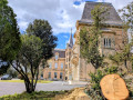
Nestled between hills and vineyards, the route suggested here takes you to discover the Saint-Laurent Chapel, situated beside an ancient Roman road, following the paths and cycle routes of the “Littorale”, developed by Grand Narbonne. After the Plana viewpoint, the return to Montredon-lès-Corbières offers the added bonus of passing by the Château de Levrettes, which is barely visible from the road between Narbonne and Marcorignan – a route mostly used by cars!
As there are no signposts on this route, apart from the access to the chapel from Marcorignan and the Sentier du Plana, it is advisable to have the route downloaded onto your smartphone so you can set off on the walk without worrying about getting lost.
En forêt de Ramondens
6.55 mi
+610 ft
-636 ft
3h 35
Average
Departure from Arfons (Tarn)
Balade vers le Parc éolien d'Arfons-Sor, situé sur la commune d'Arfons, depuis le château de Ramondens, qui a été un temps la propriété de P.P Riquet, et siège maintenant du CCAS d'EDF qui y organise des colonies de vacances pour les enfants. Le parcours, sans balisage (ou presque), se situe entièrement dans la Forêt Domaniale de la Montagne Noire, au Nord du torrent de l'Alzeau, "frontière" naturelle entre Aude et Tarn, à deux pas de la célèbre Prise d'Alzeau. Après l'arrêt à une ancienne cabane de pisciculture, réaménagée par l'ONF, le retour s'effectue par le vallon de Bergnassonne pour retrouver le château de Ramondens.
The Lampy Neuf Reservoir as seen from Ramondens
9.00 mi
+692 ft
-719 ft
4h 45
Average
Departure from Arfons (Tarn)
From Ramondens Castle, follow in the footsteps of P.P. Riquet as you discover the ingenious water supply system for his “Canal des Deux Mers”, established over four centuries ago in the Montagne Noire, before reaching the Lampy Neuf Reservoir, subsequently created to provide the extra water needed for the Canal de Jonction, the link between the Canal du Midi and the Canal de la Robine in Narbonne.
Please take care on a section of the route that goes off the beaten track (further details in the description)
The Lot balcony in Chanac
 5.54 mi
+643 ft
-643 ft
3h 05
Average
Departure from Chanac (Lozère)
5.54 mi
+643 ft
-643 ft
3h 05
Average
Departure from Chanac (Lozère)
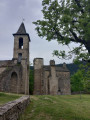
On the rocky spur overlooking the Lot, downstream from Chanac, there are two settlements: Le Villard Vieux, the first hilltop village, and Le Villard Jeune, the second village. In the Middle Ages, Le Villard was part of the domain of the Château de Chanac, an episcopal possession of which only the famous keep remains today.The route differs from the marked route by remaining below the Causse du Villard before reaching the "fortified" village. The return to Chanac, along the Lot, allows you to see the Château de Ressouches (private) along the way and offers the opportunity to visit the village at the end of the walk.
The Gailhousty spillway
5.64 mi
+20 ft
-20 ft
2h 35
Easy
Departure from Cuxac-d'Aude (Aude)
This two- to three-hour walk takes you to the Gailhousty site, where you can discover a number of structures of great architectural quality. Their function is linked to the danger of flooding from the River Aude, which has always been a threat. This part of the Canal de Jonction was built in the river's floodplain. The floods of 1999 prompted decision-makers to build the dykes that are part of the scenery along this route.
In the footsteps of Pierre Paul Riquet's "Rigole d'Essai"
 1.73 mi
+292 ft
-289 ft
1h 05
Easy
Departure from Lacombe (Aude)
1.73 mi
+292 ft
-289 ft
1h 05
Easy
Departure from Lacombe (Aude)
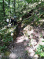
360 years ago, Pierre Paul Riquet had the trial trench for the Canal du Midi dug. The official purpose of this small diversion canal was to prove that large quantities of water could be brought from the Montagne Noire to the Naurouze threshold, where the planned navigation canal would have its "dividing point", its highest watercourse. However, for Riquet, the stakes were much higher: he also wanted to prove that he was fully capable of managing a project as large as the gigantic structure he had planned. To convince Colbert and the commission responsible for examining the feasibility of the project, he offered to finance the test canal himself and only be reimbursed if the objectives were achieved... Theoutcome proved this stubborn man right!
This walk takes you on a journey of discovery to find traces of this "Rigole d'Essai" in the Alzeau valley, starting from the village of Lacombe. Parking is available opposite the town hall.
Between pink rocks and green valleys, around Perros-Guirec
 10.66 mi
+489 ft
-482 ft
5h 20
Average
Departure from Perros-Guirec (Côtes-d'Armor)
10.66 mi
+489 ft
-482 ft
5h 20
Average
Departure from Perros-Guirec (Côtes-d'Armor)
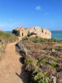
While the GR®34 or "Sentier des Douaniers" is one of the best-known walks in the region, impressive with its piles of pink granite, some of which reach 20 metres in height, the Vallée des Traouïéros is more secret but remains a magical world with the Maison des Korrigans, the Auge du Lépreux, the Trou de l'Enfer and its caves. The route proposed here takes you "from pink to green" as close to nature as possible, with a touch of grey from the slate roofs of Breton houses. This is definitely a hike that will show you all the colours of the rainbow!
Between hills and ancient Breton polders in Roz-sur-Couesnon
 7.69 mi
+443 ft
-436 ft
3h 55
Average
Departure from Roz-sur-Couesnon (Ille-et-Vilaine)
7.69 mi
+443 ft
-436 ft
3h 55
Average
Departure from Roz-sur-Couesnon (Ille-et-Vilaine)
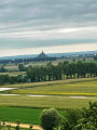
Roz-sur-Couesnon consists, as its name suggests, of an upper part (roz = hill in Breton) where the village is located, and a lower part made up of former marshes, polders and salt marshes, where the Couesnon river once flowed. This unique feature gives the town an exceptional view of the bay and Mont Saint-Michel, as well as a wide variety of landscapes, which the route proposed here seeks to highlight.
In the Loubatière National Forest
2.96 mi
+446 ft
-443 ft
1h 45
Easy
Departure from Lacombe (Aude)
Nestled between Lake Galaube and Lake Laprade Basse, the Loubatière State Forest covers 450 hectares. It is located in the western part of the vast forest that covers the southern slope of the Montagne Noire in the Aude department. A single, completely wooded area, this forest, which ranges in altitude from 660 to 885 metres, forms the headwaters of the Linon stream. In autumn, it offers a dream setting for hikers in search of mushrooms and chestnuts, with the golden colours of oak, beech, birch and chestnut leaves carpeting the ground. This is the ideal playground for an easy walk starting from the hamlet of Cals Haut, part of the commune of Lacombe, between Saissac and Les Martys.
The Brahunal Balcony
4.20 mi
+476 ft
-472 ft
2h 20
Average
Departure from Aigues-Vives (Hérault) (Hérault)
Between 55 and 45 million years ago, a warm, shallow sea flooded the older terrain forming the Montagne Noire, covering it with limestone rich in foraminifera (microscopic organisms encased in a calcareous shell). This limestone forms the Causses du Minervois. Rivers flowing down from the Montagne Noire cross these plateaus and carve out narrow valleys: the canyons. This network of canyons is home to numerous karstic caves and caves harbouring ancient traces of human presence and rare animal species. Bats, which inhabit the Grotte de l’Aldène in the Cesse Gorges, the peregrine falcon, the Montagu’s harrier and the red-backed shrike all contribute to the biodiversity of this site. This walk remains on the limestone plateau, amongst vineyards and valleys, and offers an exceptional view of the Brahunal Gorges, a stream that joins the Cessière. See warning in the practical information tab
A visit to Bonnieux
 1.19 mi
+259 ft
-259 ft
0h 45
Easy
Departure from Bonnieux (Vaucluse)
1.19 mi
+259 ft
-259 ft
0h 45
Easy
Departure from Bonnieux (Vaucluse)
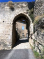
Bonnieux stands on the northern slope of the Petit Luberon, facing the village of Lacoste. The village is situated on the northern side of the Combe de Lourmarin, which was – and still is – the only road crossing the Luberon. This hilltop village boasts an exceptional panorama stretching from the Petit Luberon to Mont Ventoux, via the Monts du Vaucluse. The village, dominated by its old church flanked by centuries-old cedar trees, offers visitors a wide variety of natural and historical sites. As you wander through its steep, winding alleyways, remarkable mansions, the remains of ramparts, fountains and wash houses come into view.The Tourist Office has set up a heritage route featuring fifteen information panels that trace the history of the village. The route suggested here does not follow it exactly, and the GPS signal was disrupted by the village’s unique layout.
The Narse de Lascols
 7.52 mi
+417 ft
-417 ft
3h 50
Average
Departure from Paulhac (Cantal)
7.52 mi
+417 ft
-417 ft
3h 50
Average
Departure from Paulhac (Cantal)
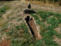
The ‘Grande Randonnée’ trail in the Pays de Saint-Flour allows you to walk several circular routes around the capital of the Planèze and Margeride regions and passes through the village of Paulhac. The circular route crosses the Narse de Lascols from south to north, starting from Cussac, passing the Puy de Mercou, and heading back up towards the Bois des Fraux via the mountain pastures. The route described below is inspired by this, offering a wonderful exploration of the Planèze de Saint-Flour by combining the GR® de Pays and PR® trails around Paulhac.
Route du Bois des Fraux
 6.59 mi
+486 ft
-489 ft
3h 25
Average
Departure from Valuéjols (Cantal)
6.59 mi
+486 ft
-489 ft
3h 25
Average
Departure from Valuéjols (Cantal)
This is a route that captures the mountain atmosphere of the Haute Planèze – the land of burons and summer pastures – starting from Saint-Maurice, a hamlet of Valuéjols, and leading to one of the few wooded areas in the Planèze. The route follows signposted sections (local PR® and GRP® trails) along tracks suitable for vehicles, which link the hamlets and farms scattered across the area. The Bois des Fraux, meanwhile, is maintained by foresters who have cleared tracks there for walking or cross-country skiing, provided there is still snow in winter.