Country:

 City:
City:


(S) Bas-Monistrol station (see ‘Practical Information’ section)
GR® 302 signposting: white and red
From the station, head left (north) onto the D124, following the GR® with the railway line on your left. You’ll come to a junction and a level crossing on your left. Ignore this and continue straight on along the Chemin du Garnay. After a long straight stretch, leave the GR® – which heads towards Cheucle – and take a track on the right, between two rows of trees.
Yellow PR® signposts
Turn south-east, then make a detour southwards to cross a stream. You’ll reach Bois Pilé.
(1) At the junction, leave thePR® and turn left onto Chemin de Foletier heading south-east. Navigate a bend to cross the stream of the same name. Walk alongside the castle walls and its outbuildings. Then turn left at a right angle. 80 metres further on, at the crossroads, turn right, ignore the entrance to a property on the right and continue south-east then south, before a left-hand bend. Then walk alongside a boundary wall and emerge (concrete cross) onto the Route de Cheucle (alt. 555). Turn left onto the road, then immediately turn right onto the track between the pastures. Turn left at a hut and arrive at the Combeaux crossroads
White-red markings forthe GR® 302
(2) Turn right and head downhill. At the next junction, ignore the PR® signposting to the right and continue on theGR® to the left, which descends to the Route des Razes.
(3) Turn left at the corner of a property and take the road that crosses the Ruisseau des Razes before climbing back up to the Domaine de la Rivoire crossroads. Turn right onto a small lane, the Route du Pinet, heading north, to the right of the housing estate. After a straight stretch, you’ll reach a crossroads.
(4) Turn right, towards ‘Monistrol-Aurec’. After a bus shelter, look out for the start of a dirt track on the left, 40 metres further on, which leads to Peyron Haut. Leave the hamlet on your right to reach the Peyron plateau, then head down to a small road
Leave theGR® – Junction with PR®, yellow signposting
To shorten the route, skip the detour via Le Chambon-sur-Loire and take thePR® instead.
(5) Take the road on the right towards Le Mas. Continue along the tarmac and turn left to reach Tranchard. Cross the hamlet and join the D47 (alt. 551). Cut across the road, as the PR® does, and follow a reservoir on the Ruisseau de Martinas. Head towards Antonianes and you’ll come to a path at an acute angle to the left.
Leave the PR® route
(6) Leave the signposted route, changing direction to take the track at the edge of the forest, then enter the woods and join the D471. Follow it to the left until you reach the junction with the D47. Turn right and cross a bridge over the Ruisseau du Cluzel.
(7) Leave the road immediately afterwards and take the track known as the Côte d’Hiverneboeuf. Take a detour and head uphill to a few houses. Return to the tarmac road before emerging onto the plateau. Rejoin theGR® after its detour via Le Chambon-sur-Loire and follow it for a few metres to the houses at La Sagne. Look out for a pumping station for a penstock on the right.
(8) Temporarily leave the signposted route by turning left into the meadows onto the path created when the Lignon water pressure pipeline was buried, and make your way through the meadows of Plat du Porc to the small Thève road.
(9) Turn right (away from the hamlet) and head towards the D471. Walk past a single-storey house (a prefabricated building on the left).
GR® signposting
At a fork in the road, take the path leading down to the left. Cross the valley below the D471 to cross a stream, then head uphill to the houses at Grange Neuve. Continue along a tarmac road, then turn right and join the D471. Turn left (with a cross and a wash house opposite) and head for the centre of La Chapelle d’Aurec.
(10) On the church square, set off along the street to the left of the restaurant ‘À la Table de Christelle’. Walk through the village heading north. After the cemetery, carry on straight ahead along Rue de Bel Air. Then begin the descent to fords the Ruisseau du Moulina. Turn right immediately afterwards and, after a short climb, join a small road at a bend.
Turn left onto this straight track, which leads onto the D45. Join the D45 on the left, then follow it briefly to the right along a footpath near a pumping station. You’ll come to another, wider path at a bend in the road.
(11) Leave this path by turning right onto the track wedged between the D45 and the farm building. High above the road, head towards the Faye crossroads.
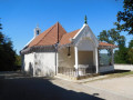
(12) At the Fork in the road, marked by a crucifix, leave the GR® and take the path on the right leading to the Notre-Dame de la Faye Chapel, where you can enjoy a superb view of the town of Aurec from the viewing platform. Continue along the Chemin de Croix, which descends to the D45; cross the road and continue down the slope to Rue des Trois Croix, opposite a mobile phone mast, before rejoining the signposted route.
(13) Turn right and, before taking the side street on the right, take a look at the three concrete crosses set on a plinth. Take the side street down into Rue des Genêts, then, after a left-right turn, take Rue du Calvaire. Join Rue des Tuileries, which crosses the D47 before continuing straight on to end in a cul-de-sac.
(14) Take the pedestrian path leading to a square near the “Les Tilleuls” care home. Turn right onto Rue du 19 Mars 1962 and walk past the Notre-Dame de la Faye private school complex.
(15) At Place des Marronniers, turn left onto Chemin des Remparts. Walk past the headquarters of the “Amis du Vieil Aurec” association and turn right into the narrow lane that leads to Rue de la Loire, with its traditional cobblestones. The surface becomes more modern as you approach the road bridge and the footbridge. There are just a few metres left to walk to reach the forecourt of Aurec station (E).

 Visorando Member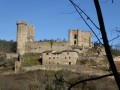
 Easy
Easy