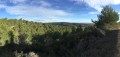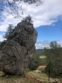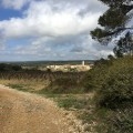
Amidst vineyards and heath in the Minervois, on the hills above Agel

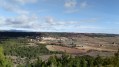
Starting from Agel, taking in the history of its castle and its winding alleyways, the route leads to one of its hamlets, Cazelles, via pleasant paths and quiet country lanes, through forests, heaths and the vineyards of the Minervois, allowing you to discover the beauty of the local landscapes and heritage. The unusual return journey, crossing the River Cesse at a ford, brings home – if proof were needed – the reality of a drought that is set to worsen in the coming years...

Details

n°93415022
Creation:
Last update:
Last review:
–
  • Walking
    Activity: Walking
  • ↔
    Distance: 5.01 mi
  • ◔
    Average duration: 2h 40 
  • ▲
    Difficulty: Easy

  • ⚐
    Back to start: Yes
  • ↗
    Ascent: + 459 ft
  • ↘
    Descent: - 463 ft

  • ▲
    Highest point: 689 ft
  • ▼
    Lowest point: 279 ft

Photos

Description of the walk

Start from the car park behind Agel church.

PR® “Cazelles” 1 blue line ( taken in the opposite direction to that shown in the official guidebook)

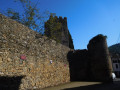
(S/E) From the car park on the banks of the Cesse, head back along Rue de la Cesse towards the D20 (Route de Bize), cross it and turn into Rue de la Fontaine, then into Rue du Château, which is for pedestrians only. At the castle square, turn left and walk along the surrounding wall.

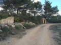
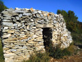
(1) Walk past a corner tower of the ramparts and leave the village by following Rue Principale. Continue along this tarmac road, which passes near a water reservoir (1932) and climbs the hill. After passing two blocked paths, you’ll reach a Fork in the road at a sign pointing to a drystone shelter on the left.

(2) After taking a detour along the track to see it, turn right onto the track between vineyards and shrubs. You’ll find yourself for a while on a sheltered path that descends to the right, then runs alongside the dry bed of the Olivel stream. Continue along the Chemin du Bosquet, which passes through vineyard plots and past a beautiful, imposing house before emerging onto the D173E10 at Cazelles. Turn left and you’ll reach a junction.

Change of PR® route: Paguignan replaces Cazelles (blue line)

(3) Leave the road leading to Paguignan and turn left onto the Chemin de Chantovent. Stay on the tarmac road until you reach a bend, then continue straight ahead along a vineyard track. Ignore the signposting on the right towards Paguignan and turn right at a T-junction in front of a plot where the vines have been grubbed up. Join the PR® Les Rives de la Cessière coming from the right (no obvious signposting).

(4) Turn left onto the path running alongside the vineyard. After a few bends, you’ll reach a Fork in the road in the Combe Lauzy.

(5) Leave the PR® at the bend in the gravel track which joins the D20. Walk a few metres to the left along the road.

(6) Cross the Cesse via the ford without getting your feet wet and head to the other bank. Go round a plot of vines (either to the right or left, it doesn’t matter).

(7) At the corner of the vineyard, look out for a vineyard hut at the start of a steep path leading up into the Ribaud woods. Follow a good track, which runs alongside the D20 for a while, before veering away from it in a wide curve around the Pierre Plantée estate, where olive trees have replaced the vines. You’ll come out onto a small road.

(8) Turn left, following the GRP® St-Chinian-Faugères signposts for a short while, then head towards Agel after crossing the Cesse via a concrete bridge. On your right, you’ll find the car park behind the church (S/E).

Waypoints

  1. S/E : mi 0 - alt. 289 ft - Car park - Église Saint-Pierre et Saint-Paul (Agel)
  2. 1 : mi 0.13 - alt. 338 ft - Château d'Agel
  3. 2 : mi 0.58 - alt. 472 ft - Fourche – Drystone shelter
  4. 3 : mi 1.79 - alt. 689 ft - Cazelles
  5. 4 : mi 2.71 - alt. 541 ft - T-junction – PR junction
  6. 5 : mi 3.26 - alt. 351 ft - Combe Lauzy
  7. 6 : mi 3.49 - alt. 305 ft - Fording - Cesse (rivière) - Affluent de l'Aude
  8. 7 : mi 3.77 - alt. 331 ft - Rapaillou du Ribaud
  9. 8 : mi 4.43 - alt. 377 ft - T-junction – Junction with the GRP
  10. S/E : mi 5.01 - alt. 289 ft - Car park - Église Saint-Pierre et Saint-Paul (Agel)

Notes

At the church car park, a sign for “Cazelles” marks the start of a circular route, part of which has inspired a section of this route. This route starts in the opposite direction: the signposting, which is poorly maintained, is even less visible on this route.
Two other sections of the PR® are also affected. Be careful not to get confused as they are also marked with a blue line! (Paguignan and Rives de la Cessière).

Recommendations: do not undertake this route in very hot weather.

Worth a visit

Agel Castle

In the heart of the Cesse Valley, between Bize-Minervois and Minerve, the village of Agel is harmoniously clustered around its castle. It is one of the oldest villages in the region. Settlements dating back to prehistoric times have been discovered in the vicinity of the village. Under Charlemagne, Agel was a fortified settlement: indeed, the castle still retains a tower from this period. It was, however, demolished on three occasions: in the 13th, 14th and 16th centuries. Today, after numerous restorations, it retains its imposing appearance and features a Renaissance-style façade.

The karst formations of the Boulidou and the Cesse

As well as the charm of its narrow streets, Agel is inextricably linked to the winding course of the River Cesse. In summer, the river seeps into the limestone subsoil before re-emerging further downstream at a place known as Le Boulidou. This natural resurgence creates a cool body of water bordered by large, flat stone slabs – a much-loved haven of peace for observing the riverine flora and fauna.
This resurgence is situated 2 km from Agel, near the D20 before the turn-off for Bize-Minervois.

A few kilometres away, don’t miss the Olibou, the olive oil cellar in Bize-Minervois.

Always be cautious and plan ahead when you're outdoors. Visorando and the author of this route cannot be held responsible for any accidents occurring on this route.

The GR® and PR® markings are the intellectual property of the Fédération Française de Randonnée Pédestre.

Other walks in the area

For more walks, use our search engine .

The GPS track and description are the property of this route's author. Please do not copy them without permission.