The Recoux Calvary and the Wobbly Rock at La Roche

From Montchanson, with a rucksack on your back – in place of the schoolbag that children of yesteryear used to carry on their backs to get to school in one of the villages of the Arcomie Valley – let’s follow in their footsteps to discover the hamlets and local heritage. On the way, don’t forget to climb up to the Trois Croix du Bloc du Recoux for an exceptional view, before trying your hand at making the Pierre Branlante de la Roche wobble, north of Saint-Marc.

Details

29393136
Creation:
Last update:
Last review:
  • Walking
    Activity: Walking
  • ↔
    Distance: 8.14 mi
  • ◔
    Average duration: 4h 20 
  • ▲
    Difficulty: Moderate

  • ⚐
    Back to start: Yes
  • ↗
    Ascent: + 712 ft
  • ↘
    Descent: - 728 ft

  • ▲
    Highest point: 3,501 ft
  • ▼
    Lowest point: 3,058 ft

Photos

Description of the walk

:Park in the car park by the cemetery on the D248 in Montchanson.

PR Chemin des Écoliers de Montchanson (1 yellow line)

(S/E) From the car park, head towards the hamlet, keeping the church spire in sight. You’ll reach the junction with Rue de la Plaine.

(1) Ignore another signpost coming from the left and continue to the right on the D248 for about 80 metres. Then turn right into Rue de la Cabale. About a hundred metres further on, turn right and follow a circular loop around Puech la Cavale. You’ll arrive near the D248.

Leave thePR®

(2) At the road, take a path on the right and head towards the Route de Sagnère

End of signposting

(3) Almost directly opposite, follow a path that branches off southwards towards the Champ de Charles. At the junction (elevation 1010), turn left and join the D248.

(4) Cross it and follow the signs for Saint-Marc and La Bessière. After 500 m on tarmac, look out for a turn-off to the right.

(5) Take this turn-off into the woods. Then turn eastwards and arrive at the junction for the Bloc de Recoux site

(6) Turn right and head for the site, which is accessible via a footpath past a reservoir. A well-known climbing spot with orientation boards.

(7) Retrace your steps.

(6) Turn right. Pass a crossroads (cross) and join aPR® trail.

Markings (1 yellow stripe) Chemin des Écoliers de Saint-Marc

(8) At the Fork in the road, turn left and go round the right-hand side of the Puech Chanson. Head north and join the Route de Saint-Marc. Leave the hamlet and thePR® on your left for a moment.

(9) At the left-hand bend, take the cross-country path almost directly opposite, heading down towards the cemetery. Pass a junction and come out onto the road (calvary) before the junction with the D348.

(10) Join thePR® again and head right towards the hamlet of La Roche. Walk past the few houses to reach the site of La Roche Branlante (Roc del Burre on the map; picnic table).

(11) Turn back.

(10) Turn right onto the road to Nalhac and Rageac. Leave the D348 to head for Rageac and walk through the hamlet.

(12) At the end of the hamlet, turn left and continue to follow the “Chemin des Écoliers”.

(13) At the junction for La Bessière, leave it by going straight on along a track that crosses the alluvial plain before approaching the D248.

(14) About a hundred metres before the road, turn right and follow thePR® des Écoliers de Montchanson again. Cross the headwaters of the Ruisseau de Ferval and join a small road

(15) Turn left, leaving thePR® behind, and head towards the hamlet.

(1) Walk a few dozen metres to the right to return to the cemetery car park (S/E).

Waypoints

  1. S/E : mi 0 - alt. 3,346 ft - Cemetery car park - Église Sainye-Croix (Montchanson)
  2. 1 : mi 0.12 - alt. 3,333 ft - Crossroads of the circular loop
  3. 2 : mi 1.14 - alt. 3,323 ft - D248 road
  4. 3 : mi 1.57 - alt. 3,235 ft - Crossroads on the Route de Sanière
  5. 4 : mi 2.27 - alt. 3,373 ft - Crossing the D248
  6. 5 : mi 2.61 - alt. 3,415 ft - Turn right onto the Route de la Bessière
  7. 6 : mi 2.92 - alt. 3,422 ft - Access to the wayside shrine
  8. 7 : mi 3.1 - alt. 3,501 ft - Calvaire de Recoux
  9. 8 : mi 3.74 - alt. 3,396 ft - Fork in the road
  10. 9 : mi 4.5 - alt. 3,245 ft - Saint-Marc
  11. 10 : mi 4.71 - alt. 3,143 ft - D348 junction
  12. 11 : mi 4.91 - alt. 3,146 ft - Roc del Burre
  13. 12 : mi 5.84 - alt. 3,212 ft - Exit at Rageac
  14. 13 : mi 6.55 - alt. 3,268 ft - Junction towards La Bessière
  15. 14 : mi 7.25 - alt. 3,297 ft - Junction before the D248
  16. 15 : mi 7.78 - alt. 3,245 ft - Deneyres crossroads
  17. S/E : mi 8.14 - alt. 3,346 ft - Cemetery car park - Église Sainye-Croix (Montchanson)

Notes

Picnic table (11).

Worth a visit

(7) the Calvaire de Recoux,
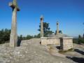
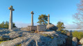
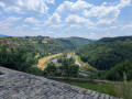
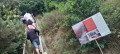
The granite boulder field, nestled amongst the pine trees, is well worth a detour of a few hundred metres. The three granite crosses overlooking the site and the steps carved into the rock bear witness to the traditional craftsmanship of the stonemasons. The orientation board helps you make sense of the sweeping panorama across the Cantal mountains, the Margeride and the Aubrac. It is also a well-known rock-climbing spot.

The Wobbly Rock (Roc del Burre)
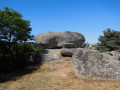
In Saint-Marc, in the hamlet of La Roche, the granite takes the rounded form of an enormous boulder, estimated to weigh over 400 tonnes, which can be made to wobble slightly by applying pressure with your hand at a specific point. Picnics are possible on site, but the tables are in the sun.

Always be cautious and plan ahead when you're outdoors. Visorando and the author of this route cannot be held responsible for any accidents occurring on this route.

The GR® and PR® markings are the intellectual property of the Fédération Française de Randonnée Pédestre.

Reviews and comments

5 / 5
Based on 2 reviews

Reliability of the description
5 / 5
Ease of following the route
5 / 5
Route interest
5 / 5
User 3044802

Overall rating : 5 / 5

Date of your route : Oct 12, 2025
Reliability of the description : ★★★★★ Very good
Ease of following the route : ★★★★★ Very good
Route interest : ★★★★★ Very good
Very busy route : No

Superb hike with views of the Cantal and Margeride mountains, and on this particular day, clear skies all the way to the Sancy Massif.
Beautiful discoveries of the unexpected and majestic Calvary of Recou and the imposing and fascinating Rocking Stone of St Marc.

Machine-translated

lyllatsrando
lyllatsrando

Overall rating : 5 / 5

Date of your route : Jul 16, 2024
Reliability of the description : ★★★★★ Very good
Ease of following the route : ★★★★★ Very good
Route interest : ★★★★★ Very good
Very busy route : No

A lovely walk with no particular difficulties
We had a picnic at the Recoux rock formation, with magnificent views and an orientation table.
Then came the rocky chaos and the ‘wobbly stone’ site.
Pleasant walks, alternating between woodland and open views
The Cantal is so beautiful!!

Machine-translated

Other walks in the area

For more walks, use our search engine .

The GPS track and description are the property of this route's author. Please do not copy them without permission.