The Château de la Reine Margot

Here is a suggested route showcasing exceptional heritage, from Beauregard to Saint-Projet, where the Château de la Reine Margot awaits your visit. The circular route follows theGR® 36 and 46 trails, as well as theGR® de Pays Midi-Quercy and twoPR® trails, one of which leads to the Perte du Cros site (access to which has already been described on another route), with just a short stretch of tarmac needed to link these different sections.

Details

44668242
Creation:
Last update:
Last review:
  • Walking
    Activity: Walking
  • ↔
    Distance: 9.57 mi
  • ◔
    Average duration: 4h 50 
  • ▲
    Difficulty: Moderate

  • ⚐
    Back to start: Yes
  • ↗
    Ascent: + 525 ft
  • ↘
    Descent: - 545 ft

  • ▲
    Highest point: 1,276 ft
  • ▼
    Lowest point: 1,017 ft

Photos

Description of the walk

Start at Beauregard – Place de la Halle. Parking available.

(S/E) After taking a moment to admire the superb market hall in Beauregard (see inset), head towards the belfry and turn right onto the D55. Walk past the village hall and leave the village. Take the Route de Varaire by turning right. Walk past the cemetery and continue for a further 200 m along the road.

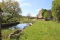
(1) At the junction with the Route de Guiralet on the right, turn left onto a grassy track. After a bend, pass by a pair of wash houses, one of which is covered (see the ‘During the walk’ tab). Return along a small road

SignpostedGR® 46 –GR® 36 –GRP® de Midi-Quercy

(2) Turn right and walk alongside the boundary wall of Marsa Castle. At the crossroads (with a cross in a niche), behind the castle outbuildings, take the small road on the left towards Mas de Proumilhou (incorrectly spelt on the map). After the houses, turn right at the Fork in the road, continuing to follow theGR® markings. You’ll come out onto the D53 (elevation 361).

End of signposting

(3) Head straight on towards Saillac. Cut across the D52 towards Varaire and reach the village. Leave the D53 by turning left towards the church and arrive at the town hall.

Yellow-striped markings: La Perte du Cros

(4) Below the town hall square, before turning left onto the Chemin de Mas Faucon, stay on the road to the right to visit, just a few metres away, Saillac’s pretty butterfly-shaped wash house: situated on the edge of a small pool fed by runoff, it stands alongside a lovely well with a corbelled vault.

(5) Return to the junction below the town hall.

(4) Turn right onto the signposted path. Pass Mas Faucon and then carry on straight ahead until you reach a multi-way junction.

(6) Turn left. At the next junction, facing a wall, head down to the right, then turn left to pass between a house and the old mill. The cave is on the right with its porch, and the sinkhole is on the left of the path in the bend.

(7) Retrace your steps to the previous junction and head left, leaving thePR® behind. You’ll rejoin it briefly after it loops through the hamlet of Le Cros. Continue southwards along the Lot–Tarn-et-Garonne departmental boundary. You’ll reach the Limaginaire junction.

(8) Leave the small road leading to the farm on your left and follow the D33bis straight ahead. Turn off onto a straight stretch, joining thePR® LaChapelle de Saint-Caprais (yellow markings)__ coming from the Chemin du Mas de Granil on the right. Follow it for 300 m.

(9) Leave the tarmac road at the start of a bend and follow the markings along a path below on the right. Join the D19 and follow it for about a hundred metres.

(10) Then turn left onto the Route des Moulins with thePR® and join theGR® 46__

Signposting: YellowPR® +GR®

Follow both markings to the left along a path that climbs up to the village of Saint-Projet. You’ll arrive at the Esplanade du Pech Mial (amenities – see § Practical Information). Cross the village via the D19 (Grande Rue).

Temporary departure fromthe GR® 46

(11) Head straight ahead to make a detour via the town hall and continue to the Château de la Reine Margot, leaving thePR® which descends towards the cemetery. Take Rue des Horts back to the D33ter and leave the village by turning right.

Return to the GR®.

Reach a roundabout.

(12) Go round the attractively landscaped roundabout on the right or left to head straight ahead onto Chemin de Pissaucou. Leave the signposted route behind, keeping to the right. Turn left onto the small track leading to Les Grelades, pass the property on your left and continue along the track until you reach a cross-track.

Back onto theGR®

(13) Turn right and cross the D33 (take care) to climb the hill of Pech and Couaille. Turn right and cross the Lamothe countryside before reaching a junction 100 m from the D19.

(14) Turn left onto the Caussat cross-country track. Pass through the hamlet, crossing a small road. Follow the path opposite and pass the Bournaguet farm. Cross the Ruisseau de Boulat before returning to the Lot. Continue north-west to the D53.

Junction of theGR® 46 andGR® 36coming from Beauregard

(15) Turn right onto the road. 300 m further on, let theGR®36continue along the D53 and turn right onto Rue de la Voie Romaine, which runs parallel to the D53 and leads to the village. Turn left before Route de Saint-Projet into Passage du Fort to reach Grand Rue, which runs alongside Place de la Halle (S/E).

Waypoints

  1. S/E : mi 0 - alt. 1,220 ft - Beauregard – Place de la Halle
  2. 1 : mi 0.3 - alt. 1,184 ft - Champ de Marsa
  3. 2 : mi 0.54 - alt. 1,155 ft - Marsa wash house - Château de Marsa (Beauregard)
  4. 3 : mi 1.3 - alt. 1,198 ft - Junction with the D53
  5. 4 : mi 2.06 - alt. 1,188 ft - Saillac – Chemin de Mas Faucon - Église Saint-Martin (Saillac)
  6. 5 : mi 2.11 - alt. 1,168 ft - Saillac’s ‘Lavoir-Papillon’
  7. 6 : mi 2.93 - alt. 1,152 ft - Junction with several paths; turn left
  8. 7 : mi 3.32 - alt. 1,079 ft - Perte du Cros (Saillac)
  9. 8 : mi 4.03 - alt. 1,158 ft - Junction of the D33bis and Chemin de Limaginaire
  10. 9 : mi 4.86 - alt. 1,063 ft - Marked path on the right
  11. 10 : mi 5.18 - alt. 1,024 ft - Take Route des Moulins on the left
  12. 11 : mi 5.57 - alt. 1,132 ft - Château de la Reine Margot (Saint-Projet)
  13. 12 : mi 5.89 - alt. 1,076 ft - Roundabout at the village exit
  14. 13 : mi 6.3 - alt. 1,129 ft - Junction with the GR°°®°°
  15. 14 : mi 7.63 - alt. 1,171 ft - Head left through Caussat
  16. 15 : mi 9.14 - alt. 1,194 ft - D53 junction, turn right
  17. S/E : mi 9.57 - alt. 1,220 ft - Beauregard – Place de la Halle

Notes

In Saint-Projet, Place du Pech Mial: public toilets and picnic tables – boules court – large car park.

Worth a visit

Beauregard Market Hall
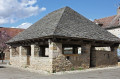
Listed as a Historic Monument, the Beauregard Market Hall in the Lot was built in the early 17th century. This low-rise building, with its very simple architecture, comprises only a ground floor with a masonry plinth and a lava-stone roof. Square piers rise above the plinth wall to support the roof structure, whilst the circular openings of the grain measures, carved into the stone slab used to clad the boundary wall, can be admired.

The Marsa washhouse
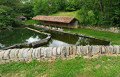
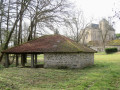
Situated at the foot of the castle of the same name, the washhouse also served as a watering place. It has retained its gentle slope at one end, allowing herds to come and drink. On one side are the V-shaped slabs, a local feature, which gave rise to the name ‘butterfly washhouse’. Under a shelter, more V-shaped slabs awaited the washerwomen, who would kneel there to beat their laundry. Thankfully, the washing machine has changed all that! Finally, a well protected by a vaulted ceiling brings the tour to a close.

Labastide Castle, also known as Marsa Castle
The château consists of a main building and two wings which, together with the central section, form two obtuse angles. The orderly and regular layout suggests that the château as a whole dates from the 17th century. Some features, however, are older: the square tower flanking the château to the north-east is thought to date from the 13th century. The south-east wing still bears traces of a machicolation and is thought to date from the 15th century. Inside, little remains of the original décor. The first floor of the central section consists of a single, spacious room which still retains some traces of frescoes, a stone floor and a French-style ceiling.
(Source: Ministry of Culture)

The Papillon Fountain and Washhouse in Saillac
The fountain and washhouse complex is a remarkable piece of heritage. The fountain, protected by a dry-stone structure covered with slabs of the same material, has been beautifully restored. Given its depth, which is similar to that of a well, a pumping system has been installed; this consists of a hand-operated wheel which, with the aid of a piston, raises the water to the spout.

La Perte du Cros
This site is a distinctive feature of the causses: a stream that disappears into a cavity and re-emerges a few kilometres further on. Between impermeable marl layers and the limestone plateau, the Cros stream vanishes into a fissure in the limestone massif known as the Perte du Cros. The water re-emerges 3.5 km further on at the Saint-Géry cave. But the site’s true significance lies primarily in the proven presence of human habitation here for the past 8,500 years

The Château de la Reine Margot
was built on a Gallo-Roman burial mound at the end of the 13th century. During the Wars of Religion, in September 1585, Queen Margot and her lover, pursued by the armies of the King of France, took refuge in the château. They were welcomed by the lord of the manor, who gave them shelter. After their departure, the room was bricked up and it was not until 1990 that it was discovered by chance, complete with all its furnishings.
In June 1622, Louis XIII stopped off at the château before going into battle against the Protestants.
Today, the château is open to the public and brings this historical narrative to life in rooms decorated with 16th- and 17th-century furniture.
Visits available: Enquiries

ThePR® trail at the Chapel of Saint-Caprais, marked in yellow, is a 12 km route offering a glimpse of the landscape and architectural heritage of Midi-Quercy. The route starts in Loze, south of Saint-Projet.

Always be cautious and plan ahead when you're outdoors. Visorando and the author of this route cannot be held responsible for any accidents occurring on this route.

The GR® and PR® markings are the intellectual property of the Fédération Française de Randonnée Pédestre.

Reviews and comments

5 / 5
Based on 2 reviews

Reliability of the description
5 / 5
Ease of following the route
5 / 5
Route interest
5 / 5
Fabouen
Fabouen

Overall rating : 5 / 5

Date of your route : May 03, 2025
Reliability of the description : ★★★★★ Very good
Ease of following the route : ★★★★★ Very good
Route interest : ★★★★★ Very good
Very busy route : No

A lovely walk, well described, an easy route, with very little road walking. A lovely time out in the countryside, which was in full bloom – a real treat! Thanks to the author.
Fabienne

Machine-translated

cclo6381
cclo6381

Overall rating : 5 / 5

Date of your route : Mar 11, 2024
Reliability of the description : ★★★★★ Very good
Ease of following the route : ★★★★★ Very good
Route interest : ★★★★★ Very good
Very busy route : Yes

A lovely walk of moderate difficulty, mainly due to its length.
Discover two lovely villages, Beauregard and Saint-Projet, including the Château de la Reine Margot.

Machine-translated

Other walks in the area

For more walks, use our search engine .

The GPS track and description are the property of this route's author. Please do not copy them without permission.