A visit to Bonnieux

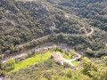
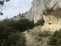
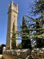
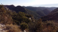
Bonnieux stands on the northern slope of the Petit Luberon, facing the village of Lacoste. The village is situated on the northern side of the Combe de Lourmarin, which was – and still is – the only road crossing the Luberon. This hilltop village boasts an exceptional panorama stretching from the Petit Luberon to Mont Ventoux, via the Monts du Vaucluse. The village, dominated by its old church flanked by centuries-old cedar trees, offers visitors a wide variety of natural and historical sites. As you wander through its steep, winding alleyways, remarkable mansions, the remains of ramparts, fountains and wash houses come into view.
The Tourist Office has set up a heritage route featuring fifteen information panels that trace the history of the village. The route suggested here does not follow it exactly, and the GPS signal was disrupted by the village’s unique layout.

Details

101426156
Creation:
Last update:
Last review:
  • Walking
    Activity: Walking
  • ↔
    Distance: 1.19 mi
  • ◔
    Average duration: 0h 45 
  • ▲
    Difficulty: Easy

  • ⚐
    Back to start: Yes
  • ↗
    Ascent: + 259 ft
  • ↘
    Descent: - 259 ft

  • ▲
    Highest point: 1,358 ft
  • ▼
    Lowest point: 1,099 ft
  • ⚐ Country: France
  • ⚐
    Area: Luberon
  • ⚐ City: Bonnieux (84480)
  • ⚑
    Start/End: N 43.825168° / E 5.306936°
  • ❏
    IGN map(s): Ref. 3142OT, 3242OT, 3243OT
  • Hour-by-hour weather

Photos

Description of the walk

From Apt, take the D900 towards Cavaillon for 10 km. Turn left at the roundabout. Ignore the first car park (car-sharing) and continue to the next one, accessible via the first exit of a second roundabout.
Stop off to see the famous Pont Julien (see details). Then take the D149 to Bonnieux and park at the bottom of the village, near the Church of the Transfiguration in Bonnieux (car park).

(S/E) Take the time to visit the church, if it is open. Head to the D3 roundabout.

(1) Cross the roundabout and take the ramp above Rue Victor Hugo to climb up to the upper part of the village. Follow Rue Pasteur to reach Place Carnot. A majestic plane tree stands on the terrace of a restaurant, which also features a fountain. Rue Voltaire then leads to Cours Elzéar Pin, where a portico marks the start of Rue des Pénitents Blancs.

(2) Its magnificent stone steps lead up to the viewpoint, a spot particularly popular for admiring the Luberon countryside. From this vantage point, situated below the upper church, the view opens out over the Bonnieux valley, the surrounding hills and the ever-changing light that enhances the scenery at all times of day. This viewpoint stands on the site of the Chapel of Our Lady of the Seven Sorrows of the White Penitents, which was demolished following the earthquake of 11 June 1909.
From this viewpoint, there are still 79 steps to climb to reach the highest point, where the former Romanesque church of Saint-Gervais and Saint-Protais stands.

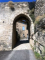
(3) Walk past the church on the right, turning onto Rue du Castellas until you reach the medieval gate. A calvary stands on a hillock. Leave Chemin Maurice Ronet (the film actor is buried in the village cemetery) and take Chemin de la Tour Blaise, which runs alongside the town’s ramparts on the north side. Return to the viewpoint below the upper church and continue along Rue de l’Ancien Presbytère.

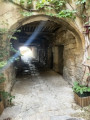
(4) At the junction with Rue Droite, head down to the right towards Rue de la République. At the fountain and its vaulted washhouse (where Rue François Julien begins), look out for a porch on the left, where Rue Émile Appy starts. Turn into the narrow lane, taking care not to go all the way down to the Ancien Chemin de Lourmarin. Pass close to the Passage de la Juiverie. Follow the narrow streets to Rue JB Aurard, then Rue du Portalet. Cross the Place du 4 Septembre.

(5) Turn right and head for the car park, following Rue Victor Hugo to the right. Return to the D3 roundabout, then to the car park at the village exit on the D36 (S/E).

This route is just a glimpse of the rich heritage of this village in the Luberon, which, in my opinion, is more interesting than Gordes, which suffers from being too well-known.

Waypoints

  1. S/E : mi 0 - alt. 1,099 ft - Bonnieux – Car park at the Church of the Transfiguration
  2. 1 : mi 0.08 - alt. 1,112 ft - Ittenheim Ramp
  3. 2 : mi 0.25 - alt. 1,237 ft - Porch on Rue des Pénitents Blancs
  4. 3 : mi 0.34 - alt. 1,348 ft - Église Haute
  5. 4 : mi 0.71 - alt. 1,286 ft - Porch on Rue Émile Appy
  6. 5 : mi 1 - alt. 1,132 ft - “La Flambée” – Rue Victor Hugo, on the right
  7. S/E : mi 1.19 - alt. 1,099 ft - Bonnieux – Car park at the Church of the Transfiguration

Notes

Car parks in Bonnieux are free, which is quite rare in most villages in the Luberon. Do not take into account the 0h45 duration calculated automatically based on the distance. Allow around 2 hours instead to enjoy all the village has to offer. Although the tour of the village itself is rather short, it should be complemented by an unmissable walk through the Forêt des Cèdres (8 km by car – 15 mins – signposted from the upper entrance to the village).

Visits to other nearby villages (Lacoste, Ménerbes) can be added to this ‘Provençal road trip’!

Worth a visit

The New Church (of the Transfiguration)
It was built at the end of the 19th century on the “Pra de Bourg” because the location of the old Saint-Gervais church made it too difficult for elderly parishioners to reach. Built in the shape of a Latin cross, the building houses four 16th-century altarpieces from the Église Haute, depicting scenes from the Passion of Christ: the Flagellation, the Crowning with Thorns, Christ before Pilate and Jesus Carrying the Cross. Also worth noting are the fleur-de-lis stained-glass windows and the sculptures. After many years and lengthy discussions, the Upper Church became the parish church in 1907. Thus, these two churches bear witness here to the village’s local history.

The Old Church or Upper Church (Saint Gervais and Saint-Protais)
This 12th-century church overlooks the village of Bonnieux from a height of 425 metres. A blend of Gothic and Romanesque styles, it has been listed as a Historic Monument since 1980. It comprises a Romanesque section and two side chapels added at a later date. The interior features a large 16th-century altarpiece, a 17th-century high altar, numerous works of art and an 18th-century organ. It is mainly used for Sunday masses, ceremonies, weddings and funerals. It also hosts a few concerts during the summer. Under renovation for summer 2026.

Rue Voltaire and the Passage de la Juiverie
As you walk along Rue Voltaire, you are strolling along the old merchants’ street, the village’s main thoroughfare which led from the lower gate of the old ramparts to the upper gate.
Via Rue Émile Appy, you reach the Passage de la Juiverie, which recalls the presence of a Jewish community in the village until 1656. Jews arrived in what is now the south-east of France in ancient times, during the Roman rule of the Provincia.

The medieval gate, the Porte du Castellas – also known as the Portail des Chèvres
,“Located to the east of the castrum, it was probably the only entrance. On the outer side, the structure is built of fine ashlar, with well-cut stones fitted together around the doorway, which consists of a triple vault. The outer opening is a slightly pointed arch, the second is a semicircular arch; the portcullis would have been fitted between the two. The third vault, which is higher, forms a relieving arch on which the curtain wall rested. On the north side, one can still make out the remains of a structure that may have been a guardhouse.”
Extract from the book *Bonnieux* by René Bruni

The Place du Moulin à Huile
There were numerous oil mills (known as ‘hand-powered’ or ‘blood-powered’, i.e. animal-drawn) situated within the ramparts. In several houses, millstones and presses can still be found. The first cold pressing was for table use. The second hot pressing was intended for domestic use. Finally, the third pressing, unfit for consumption, was used in soap-making and then for lamps. The residues were burnt to heat the water used in the second pressing.

Other walks in the area

For more walks, use our search engine .

The GPS track and description are the property of this route's author. Please do not copy them without permission.