Country:

 City:
City:


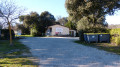
Fontiers-Cabardès – Place du Bosquet car park.
(S/E) Head towards Le Bosquet past restaurant Le 620, then, opposite the grocery shop, turn into Allée Le Notre, which is narrow at the start.
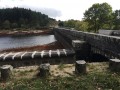
(1) At the junction with Route de la Loubatière, turn right. At the next junction, turn right onto Chemin de Bernadou, part of the PR® “Entre Pierres et Forêt” trail (yellow line – Blue Circle). Ignore the turn-off to the Bois Fleuri campsite and continue along the track which passes in front of the entrance to the Les Ânes d’Autan estate and then behind the Malouziès estate. Pass a reservoir.
(2) Immediately afterwards, leave a path on your left that descends to Route de Laprade, turning slightly to the right. After a straight stretch, leave the walking trail markings at a bend. Continue straight ahead on a dirt track (mountain bike route no. 8). Walk past the hamlet of Camp de las Brugos – literally ‘The Heather Field’ – skirting the edge of a wood. You’ll come out onto a gravel track. Take this to the left until you reach the Bruyères des Augers crossroads (access to the Sié farm on the left).
(3) Take the road on the right, heading down towards Les Augers. Cut across the Route de la Canade. Continue along a rough track leading to the farm.
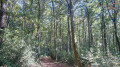
(4) At the entrance to Les Augers, leave the road and take a little-used path on the right. Pass a ruin and a duck pond. Head down through the woodland; there are no signposts but you won’t have any trouble finding your way. You’ll reach a fork in the path and rejoin the signposted route
(5) Please note: the PR® trail takes a detour through the Ruisseau du Pousset valley. A shortcut has been chosen for this walk (allow an extra 1 km via the valley). Therefore, at the fork, avoid the path on the left towards the Rec d’Alby. Continue through the meadows along the Chemin des Pierres Plantées until you reach another junction. Turn left and continue southwards, leaving the signposting behind.
(6) Join the PR® coming from the Pousset Valley. Walk past a house, taking the Chemin de Taurou on the right. You’ll come out onto the D203 as it enters the village, after passing some stone drinking troughs overgrown with vegetation.
(7) Turn right onto the road for a few metres, then turn left onto the Chemin de Montplaisir. At the Rue d’Autan, head up to the right of Saint-Clément Church until you reach the Place de l’Aubépine (fountain). Walk past the base of the Clock Tower (remains of the ramparts) and return to the car park via Rue de l’ancien Donjon, running alongside the Route de la Loubatière (S/E).
 Visorando Member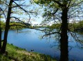


 Moderate