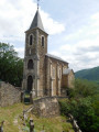
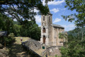
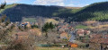
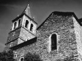
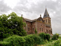
The Notre-Dame du Désert Chapel as seen from Melvieu

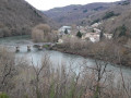
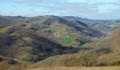
This is a ‘tourist’ walk from Melvieu to the Notre-Dame du Désert chapel, perched on the cliffside, without undertaking the full loop of the Chemin des Raspes. Overlooking the Gorges, the site offers a breathtaking view of the emerald waters of the Tarn and the Verdale suspension bridge, which links the two banks of the river. The walk is best combined with a stop in the village of Saint-Victor to visit the church and the watchtower. See the section: During the walk or nearby

Details

n°34879257
Creation:
Last update:
Last review:
  • Walking
    Activity: Walking
  • ↔
    Distance: 4.46 mi
  • ◔
    Average duration: 2h 30 
  • ▲
    Difficulty: Easy

  • ⚐
    Back to start: Yes
  • ↗
    Ascent: + 486 ft
  • ↘
    Descent: - 466 ft

  • ▲
    Highest point: 1,736 ft
  • ▼
    Lowest point: 1,316 ft

Photos

Description of the walk

After stopping at Saint-Victor for the highly recommended visits, get back in your car and follow the D31 for 3 km. Turn right at the entrance to Melvieu. Park on Rue du Cap del Loc.
Melvieu – Small car park (2–3 spaces)

(S/E) Walk to the Place des Acacias, then turn right onto the Grand Rue. Walk for about fifty metres until you spot a path on the right.

PR® Sentier de Bosc (1 yellow line)

(1) Turn right onto Chemin de la Fontaine, then left at the next junction. Head down into a small valley and cross a stream before a fork in the path.

(2) Go straight on (west) and, at the Fork in the road, follow the Chemin du Cun to the right, running alongside the D31. Turn north and pass over the Rioulach and under a high-voltage power line. You’ll emerge at a hairpin bend on the Tinayriol track.

End of the PR®

(3) Turn left downhill and skirt the Rioulach valley floor until the path splits.

(4) Turn right and pass between two EDF pylons, joining the Sentier des Raspes (1 yellow stripe). Continue along the ridge, following a curved path. You’ll look down on the Pouget power station as you reach the Fosse junction.

(5) Stay on the road to the right and cross the hamlet. Pass in front of the “Gare du Petit Train des Raspes” before reaching the junction marked by a welcome sign indicating the entrance to the Notre-Dame du Désert site.

(6) Go through the barrier and follow the circular Way of the Cross path to enjoy a stunning view of the Gorges des Raspes du Tarn. This is a great spot for a break, especially if the church is open. See the section: During the walk or nearby. At the end of the circular path, rejoin the path leading back to the road. Enjoy another viewpoint (Aire des Raspes) over a bend in the River Tarn at the corner of the road, on the left.

(6) Head southwards, passing beneath Le Bosc. You’ll reach the junction with the Route du Bosc.

(7) Join thePR® coming from the hamlet. Take the road opposite and, 350 metres further on, you’ll reach the forest path crossroads.

(8) Leave the signposted route by turning right onto a small road leading down to Melvieu. Pass the houses in the Benoit neighbourhood on your left and walk past some new builds before reaching the village. Turn right to return to the car park on Rue du Cap del Loc (S/E)

Waypoints

  1. S/E : mi 0 - alt. 1,572 ft - Melvieu – Car park on Rue du Cap del Loc
  2. 1 : mi 0.09 - alt. 1,572 ft - T-junction. Turn right
  3. 2 : mi 0.26 - alt. 1,424 ft - Junction – Opposite
  4. 3 : mi 1.07 - alt. 1,572 ft - Tinayriol Trail
  5. 4 : mi 1.61 - alt. 1,348 ft - Fork in the road – Turn right
  6. 5 : mi 2.25 - alt. 1,424 ft - Access to La Fosse - Tarn (rivère)
  7. 6 : mi 2.77 - alt. 1,496 ft - Junction. Return to the - Chapelle Notre-Dame-du-Désert (Saint-Victor-et-Melvieu)
  8. 7 : mi 3.98 - alt. 1,736 ft - Carrefour du Bosc
  9. 8 : mi 4.19 - alt. 1,729 ft - Carrefour de la Carral
  10. S/E : mi 4.46 - alt. 1,572 ft - Melvieu – Car park on Rue du Cap del Loc

Notes

This route follows a fair amount of tarmac, though cars are few and far between. You may encounter more at weekends when returning to the village from the chapel.

There are several picnic tables and toilets available at the Notre-Dame du Désert site.

Worth a visit

Off the route (3 km away): the village of Saint-Victor. Ask at the town hall for the keys to visit the watchtower and the church with its superb frescoes by Nicolaï Greschny. Also admire the ‘bestiary’ made from recycled scrap metal, displayed in various locations around the village (town hall, watchtower, etc.)
The watchtower of Saint-Victor:
Standing proudly in the centre of this charming village, the watchtower offers a breathtaking view of the surrounding countryside. Recently renovated, the rooms of this building mark the ascent via the spiral staircase to the summit platform with its orientation tables.

History of the village of Melvieu.
Melvieu, built of red sandstone, has always been part of Saint-Victor. Saint-Victor and Melvieu: two villages within the same parish.
Built on a sandstone ridge, Melvieu occupies a strategic position between the Tarn and Saint-Victor. Owned by the Salustre family until 1260, it then passed to the Gozon family. The Montcalm-Gozon family owned a manor house there, now partly destroyed, which oral tradition places near the western entrance to the village.
The layout of the village houses around the Chapel of Saint-Martin, an annexe to that of Saint-Victor, is reminiscent of a fortified settlement, of which medieval remains can still be seen: beautiful stonework on the façades, mullioned windows, half-timbered houses… The first chapel, now deconsecrated, is currently inhabited. “The parish of Saint-Martin was formerly a branch of the parish of Saint-Cyrice de Bourran or Notre-Dame de Gozon. At the end of the 18th century, Melvieu became a mother parish. The church is built on the site of a cemetery containing graves with gabled roofs. In the 20th century, Nicolaï Greschny embellished its façades with colourful frescoes.
Source: Saint-Victor-et-Melvieu Town Hall website

Notre-Dame du Désert Chapel
It was the local community who wanted a chapel to be built on this site. Notre-Dame du Désert, formerly known as Notre-Dame du Bosc, served as a parish church from 1675 to 1793. After the French Revolution, religious services were abolished, the church fell into ruin and, in 1894, it was demolished. The present chapel was rebuilt in 1900 thanks to Father Rolland, with the help of the parishioners. Its upkeep, along with that of the site, is now carried out by volunteers (the Association des Amis de Notre-Dame du Désert), who open the chapel every Sunday afternoon from the Whitsun pilgrimage until the last Sunday in September.

Always be cautious and plan ahead when you're outdoors. Visorando and the author of this route cannot be held responsible for any accidents occurring on this route.

The GR® and PR® markings are the intellectual property of the Fédération Française de Randonnée Pédestre.

Reviews and comments

4.2 / 5
Based on 2 reviews

Reliability of the description
4 / 5
Ease of following the route
4 / 5
Route interest
4.5 / 5
Christian 12170
Christian 12170

Overall rating : 4 / 5

Date of your route : Feb 02, 2025
Reliability of the description : ★★★★☆ Good
Ease of following the route : ★★★★☆ Good
Route interest : ★★★★☆ Good
Very busy route : Yes

Easy and enjoyable

Machine-translated

Pascal81
Pascal81
• Edited:

Overall rating : 4.3 / 5

Date of your route : May 12, 2024
Reliability of the description : ★★★★☆ Good
Ease of following the route : ★★★★☆ Good
Route interest : ★★★★★ Very good
Very busy route : No

We went on a lovely walk that offers stunning views of the deep, wooded valleys of the Tarn. Don’t miss the chapel on the way; carry on to the summit, where there is a statue of the Virgin Mary.
No particular difficulties. As this route isn’t very busy, make sure you don’t miss the start of the grassy path, on the left shortly after leaving the village.
There are plenty of viewpoints, benches and toilets along the route.
A visit to the Maison de la Châtaigne in Ayssenes provides a lovely end to the walk, with a stunning view from the promontory.

Machine-translated

Other walks in the area

For more walks, use our search engine .

The GPS track and description are the property of this route's author. Please do not copy them without permission.