


le dd

 Visorando Member
 Premium user
 - Location: Forcalqueiret (83136)
- Gender: man
Sign up:
Published route(s)
 On the trail of Manon des Sources - Le Mémorial de Signes
 9.55 mi
 +797 ft
 -810 ft
 5h 05
5h 05
 Average
 Departure from Signes (Var)
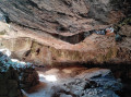
On this walk you'll discover some of the locations used to film Manon des Sources and Jean de Florette (1986): the Grotte de Mounoï cave, the dried-up stream and the Villa Renard - the hunchback's house.
This route will also let you discover the Vallon des Martyrs, with its monument commemorating resistance fighters executed by the SS in 1944. All along the walk you'll experience incredible Provence landscapes and the Sainte-Baume.
Le Capucin - Les Puys de Cliergue and Redon - Val de Courre
 7.17 mi
+2,175 ft
-2,201 ft
5h 10
Average
Departure from Mont-Dore (Puy-de-Dôme)
7.17 mi
+2,175 ft
-2,201 ft
5h 10
Average
Departure from Mont-Dore (Puy-de-Dôme)
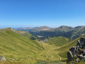
This hike will take you to the heights of the Massif du Sancy where, on a clear day, you will have a 360° view of the Chaîne des Puys, the Banne d'Ordanche, the Sancy, the Monts du Cantal, the Mont-Dore resort and Chastreix.
This route crosses the Chastreix-Sancy and/or Chaudefour Valley nature reserves. Dogs are not allowed, even on a leash, except on theGR® 30 marked trails. Mountain biking, picking and camping are prohibited. Please stay on the marked trails.
Above the Infernets and Coutronne-les Encanaux ravines
 8.11 mi
+1,877 ft
-1,886 ft
5h 20
Average
Departure from Auriol (Bouches-du-Rhône)
8.11 mi
+1,877 ft
-1,886 ft
5h 20
Average
Departure from Auriol (Bouches-du-Rhône)
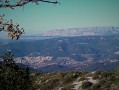
A splendid walk starting from the Encanaux, near Auriol, along the top of the Infernets and then the Coutronne ravines. At times along the cliffside ravines, similar to some sections of the Gorges du Verdon. From Lare Pass (Col de la Lare), you will have a magnificent view of the Sainte-Baume range and the Pic de Bertagne to the south and Sainte-Victoire Mountain, Mont Olympe and Mont Aurélien to the north.
Les Dardennes - Les Turcos - La Pyramide de Cassini
 8.28 mi
+2,165 ft
-2,178 ft
5h 40
Average
Departure from Le Revest-les-Eaux (Var)
8.28 mi
+2,165 ft
-2,178 ft
5h 40
Average
Departure from Le Revest-les-Eaux (Var)
I set off on two hikes taken from Visorando: "Le Revest - Château de Tourris" and "Tourris et la Pyramide de Cassini" before finding this route and suggesting it to you. The beginning of the first hike to the departmental road, then part of the beginning of the second hike. However, at the "Pyramide de Cassini", we discovered a route that does not appear on the maps but which joins the "Chemin des Turcos" in the undergrowth. This is a rugged hike that can be difficult at times.
The three caves of Marseilleveyre via the Pas du Pin and the Col des Chèvres
 6.59 mi
+2,129 ft
-2,139 ft
4h 55
6.59 mi
+2,129 ft
-2,139 ft
4h 55
 Difficult
Departure from Marseille (Bouches-du-Rhône)
Difficult
Departure from Marseille (Bouches-du-Rhône)
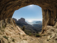
A splendid hike in the Marseilleveyre massif. The route takes you through the Ermite, St Michel d'Eau Douce and Ours caves, with their various chambers, some of which can be visited, so don't forget your torches.
The views are breathtaking and among the most beautiful in the Calanques park.
Please note: people who are prone to vertigo should be aware that there are some impressive aerial passages.
You are in the Calanques National Park, which is subject to specific regulations. Failure to comply with these regulations may result in a fine of up to €1,500.
The Devenson Cliffs
 10.26 mi
+2,690 ft
-2,700 ft
7h 05
Difficult
Departure from Marseille (Bouches-du-Rhône)
10.26 mi
+2,690 ft
-2,700 ft
7h 05
Difficult
Departure from Marseille (Bouches-du-Rhône)
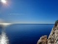
A magnificent hike through the calanques, with a route that runs along the edge of the Falaises de Devenson. Splendid panoramic views of the Calanques, Cap Canaille, the Îles de Riou, Mont Carpiagne, Sainte-Baume, Pic de Bertagne and, weather permitting, the Alps, when you reach the highest point of the Crête de l'Estret.
You are in the Calanques National Park, which is subject to specific regulations. Failure to comply with these regulations may result in a fine of up to €1,500.
Saint-Dalmas de Valdeblore – Le Boréon
 12.91 mi
+4,491 ft
-3,720 ft
10 hrs
12.91 mi
+4,491 ft
-3,720 ft
10 hrs
 Very difficult
Departure from Valdeblore (Alpes-Maritimes)
Very difficult
Departure from Valdeblore (Alpes-Maritimes)
Second stage of the route and first stage on theGR®52. A long 21km stage taking in the Col de Veillos, numerous lakes, the Col du Barn, the Vacherie du Collet and the Col de Salèse, ending at a place called Le Boréon.
A spectacular stage thanks to its landscapes and views, but very difficult.
Le Boreon - Refuge de Nice
 10.85 mi
+5,971 ft
-3,678 ft
12 hrs
Very difficult
Departure from Saint-Martin-Vésubie (Alpes-Maritimes)
10.85 mi
+5,971 ft
-3,678 ft
12 hrs
Very difficult
Departure from Saint-Martin-Vésubie (Alpes-Maritimes)
The most difficult stage of thisGR®, but the most beautiful for its landscapes, flora and fauna: chamois, marmots, ibex.
After the Pas des Ladres, we chose to take theGR®52via the alternative route that passes close to the Col de Fenestre, then descends to Lac de Fenestre before reaching La Madone de Fenestre.
Three sections are particularly difficult: between Lac de Trecolpas and the Pas des Ladres, the ascent of the Pas du Colomb, and the descent from the Pas du Colomb.
Nice Refuge - Merveilles Refuge
 5.74 mi
+1,995 ft
-2,303 ft
4h 20
Difficult
Departure from Belvédère (Alpes-Maritimes)
5.74 mi
+1,995 ft
-2,303 ft
4h 20
Difficult
Departure from Belvédère (Alpes-Maritimes)
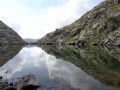
Starting from the Refuge de Nice, the fourth stage of this journey through the Mercantour is the shortest. Short but just as difficult. You’ll pass the Baisse du Basto, the highest point ofthe GR®52. You’ll cross over to Lac du Basto, then it’s the climb up the Baisse de la Valmasque, before descending into the Vallée des Merveilles.
La Baisse de Camp d'Argent – Sospel
 13.53 mi
+1,670 ft
-6,289 ft
10 hrs
Very difficult
Departure from La Bollène-Vésubie (Alpes-Maritimes)
13.53 mi
+1,670 ft
-6,289 ft
10 hrs
Very difficult
Departure from La Bollène-Vésubie (Alpes-Maritimes)
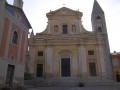
The sixth stage ofthe GR®52, where the landscapes change dramatically. Due to its length and significant descent of nearly 2,000 metres, the stage is very difficult. The descent to Sospel, which makes up two-thirds of the route, puts a real strain on the knees and ankles. Please note, it gets very hot in summer on this section.
Sospel - Menton
 10.24 mi
+3,691 ft
-4,767 ft
7h 55
Difficult
Departure from Sospel (Alpes-Maritimes)
10.24 mi
+3,691 ft
-4,767 ft
7h 55
Difficult
Departure from Sospel (Alpes-Maritimes)
This is the last stage ofthe GR® 52. It is certainly not the highest in altitude, but it is difficult due to its distance and the passage of certain passes with steep ascents and descents. The Mediterranean views are splendid, especially those from the Col du Razet and Col du Berceau, which rises to 1,100 metres above the town of Menton, the end point of theGR®. You walk along the Italian border throughout the route.
Be warned, in summer this stage is very challenging due to the heat, especially the descent from the Col du Berceau.
The Piégu oppidum, the Guillandiére fountain and the Castrum Saint-Jean
 8.28 mi
+1,611 ft
-1,611 ft
5h 15
Average
Departure from Rougiers (Var)
8.28 mi
+1,611 ft
-1,611 ft
5h 15
Average
Departure from Rougiers (Var)
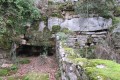
A beautiful hike starting from Les Rougiers at the foot of Sainte Baume, where you will discover historical sites dating from the Gallo-Roman period to the Middle Ages: the Piégu oppidum, the Fontaine de la Guillandiére, the Château Saint-Jean, the ruins of the fortified village and its troglodyte dwellings, and its 19th-century chapel.
Siou Blanc-l'Impluvium d'Orves-Pyramide de Cassini-L'Arche de la Garoute
 9.19 mi
+1,601 ft
-1,598 ft
5h 20
Average
Departure from Solliès-Toucas (Var)
9.19 mi
+1,601 ft
-1,598 ft
5h 20
Average
Departure from Solliès-Toucas (Var)
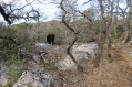
This hike will take you across the Siou Blanc plateau. First, head south towards the Impluvium d'Orves, the Pyramide de Cassini and its fabulous view of Mont Caume and the Rade de Toulon, as well as the Grand Cap. Then head north overlooking the Gapeau valley to discover the Arche de la Garoute hidden in the woods of the Morières-Montrieux national forest.
The south face of Sainte-Baume, Saint-Pilon and Pic de Bertagne
 11.85 mi
+2,254 ft
-2,238 ft
7h 25
Difficult
Departure from Riboux (Var)
11.85 mi
+2,254 ft
-2,238 ft
7h 25
Difficult
Departure from Riboux (Var)
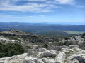
A very beautiful hike starting from Riboux, with the ascent of Sainte-Baume on the south side to Saint-Pilon. You will follow theGR® trail along the ridge of Sainte-Baume to Pic de Bertagne. The panoramic views are breathtaking.
In the heart of the Puys in the Volcanoes Regional Nature Park
 8.38 mi
+1,483 ft
-1,480 ft
5h 10
Average
Departure from Orcines (Puy-de-Dôme)
8.38 mi
+1,483 ft
-1,480 ft
5h 10
Average
Departure from Orcines (Puy-de-Dôme)
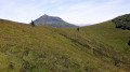
A magnificent hike, without any great difficulty, which will take you through the Parc des Volcans north of the Puy de Dôme. You will discover the Sarcoui and its cave, the Puy des Goules, the Puy de Côme, the Cliersou and its caves, the Petit and Grand Knolls, and the grandiose Puy Pariou.
At the top of each puy, you can enjoy 360° views of the Chaîne des Puys, the Puy de Dôme, the Limagne plain and Clermont-Ferrand.
Mercantour route via the GR®52
65.54 mi
+21,585 ft
-24,639 ft
7 days
Very difficult
Departure from Saint-Martin-Vésubie (Alpes-Maritimes)
TheGR® 52 is a route that crosses the Mercantour National Park, through the Alpes-Maritimes from Saint-Dalmas-de-Valdeblore to Menton.
ThisGR® route is very challenging due to the varied terrain and significant elevation changes.
You’ll reach altitudes of up to 2,700m, where you can admire the high-mountain landscapes, flora and fauna. Then, in the second half of the route, you’ll encounter panoramas that are more southern in character but just as extraordinary.
Refuge des Merveilles - Baisse de Camp
 8.26 mi
+1,946 ft
-3,150 ft
5h 30
Difficult
Departure from Tende (Alpes-Maritimes)
8.26 mi
+1,946 ft
-3,150 ft
5h 30
Difficult
Departure from Tende (Alpes-Maritimes)
The fifth stage ofthe GR®52, where southern landscapes give way to mountain scenery. Challenging due to its elevation gain, this stage follows the old Italian border, where you’ll discover numerous military remains. Notably at Authion, where one of the last battles in France took place, resulting in the deaths of 273 French soldiers just a few weeks before the armistice of 8 May 1945. The views here are fabulous.
The Great Calanques Crossing
 15.06 mi
+4,111 ft
-4,104 ft
12 hrs
Very difficult
Departure from Marseille (Bouches-du-Rhône)
15.06 mi
+4,111 ft
-4,104 ft
12 hrs
Very difficult
Departure from Marseille (Bouches-du-Rhône)
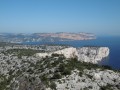
A very beautiful route, but demanding due to its distance and elevation gain. The scenery is extraordinary throughout the route.
We set off at 7.30 am from Callelongue and took 11.5 hours, including a 1-hour break during the day. Using the Visorando GPS app, I recorded 2,768 metres of elevation gain and 2,718 metres of elevation loss, which is significantly higher than stated in the description. You will need to leave a vehicle at the car park at Calanque de Port Miou upon arrival.
You are in the Calanques National Park, which is subject to specific regulations. Failure to comply with these regulations may result in a fine of up to €1,500.
Saint-Martin-de-Vésubie - Saint-Dalmas de Valdeblore
 4.01 mi
+1,821 ft
-732 ft
3h 25
Average
Departure from Saint-Martin-Vésubie (Alpes-Maritimes)
4.01 mi
+1,821 ft
-732 ft
3h 25
Average
Departure from Saint-Martin-Vésubie (Alpes-Maritimes)
The GR®52 starts in Saint-Dalmas de Valdeblore. This first stage is a transition to reach the starting point of the GR®.This is a lovely hike that passes through the small resort of La Colmiane and offers a relatively easy climb, following the GR®52 A through the woods for just over 6km.
The Trou des Fées, Notre-Dame du Glaive and the Gastée dolmen
 6.99 mi
+1,791 ft
-1,795 ft
4h 45
Average
Departure from Cabasse (Var)
6.99 mi
+1,791 ft
-1,795 ft
4h 45
Average
Departure from Cabasse (Var)
Hike starting from the charming village of Cabasse, near Carcès, where you can discover several historical sites.
Notre-Dame des Anges
 7.74 mi
+1,903 ft
-1,873 ft
5h 15
Average
Departure from Pignans (Var)
7.74 mi
+1,903 ft
-1,873 ft
5h 15
Average
Departure from Pignans (Var)
A beautiful hike in the Maures mountains, with the ascent of Notre-Dame des Anges. The 360° panorama includes views of the Hyères islands, the Collobrières valley, the Maures plain and Sainte-Baume.
The Hermitage of Saint-Jean-du-Puy, Mont Olympe and the Rocher de 11 Heures
 9.69 mi
+2,234 ft
-2,208 ft
6h 25
Average
Departure from Trets (Bouches-du-Rhône)
9.69 mi
+2,234 ft
-2,208 ft
6h 25
Average
Departure from Trets (Bouches-du-Rhône)
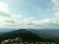
A magnificent hike towards Mont Olympe and Rocher de Onze Heures, where hikers can enjoy views of Sainte-Victoire, the Sainte-Baume massif and, finally, Mont Aurélien throughout the route.
This hike starts at Pas de la Couelle and passes by the Hermitage of Saint-Jean du Puy.
Valmeinier 1800 – Refuge du Thabor
 9.69 mi
+5,079 ft
-2,690 ft
10 hrs
Very difficult
Departure from Valmeinier (Savoie)
9.69 mi
+5,079 ft
-2,690 ft
10 hrs
Very difficult
Departure from Valmeinier (Savoie)
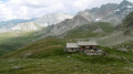
The route begins on theGRP® Tour du Mont Thabor trail, starting from the Petite Station in Valmeinier 1800. You’ll pass the Col des Marches, Lake Bissorte, the Refuge des Marches, Lake des Batailléres, the pass of the same name, Lake Long and Lake Rond before arriving at the Refuge du Thabor.
Thabor Refuge - Terzo Alpini Refuge
 10.06 mi
+2,690 ft
-5,069 ft
7h 00
Difficult
Departure from Modane (Savoie)
10.06 mi
+2,690 ft
-5,069 ft
7h 00
Difficult
Departure from Modane (Savoie)
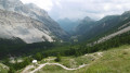
The second stage of this route is one of the most beautiful, thanks to the panoramic views and, above all, the ascent of Mont Thabor to an altitude of nearly 3,200 metres. Be mindful of the temperature and altitude. You’ll have your eyes fixed on the summit of Thabor, one of the day’s main objectives. The route takes you through the Peyron valley, with Thabor opposite, the Cheval Blanc to the right, Lake Peyron, the Grand Seru, the Col du Méandre, the ascent of Thabor, and then the descent towards the Granges de la Vallée Étroite.
Terzo Alpini Mountain Hut – Névache
 8.80 mi
+2,884 ft
-3,455 ft
6h 35
Difficult
Departure from Névache (Hautes-Alpes)
8.80 mi
+2,884 ft
-3,455 ft
6h 35
Difficult
Departure from Névache (Hautes-Alpes)
This third stage of the route will take you to the village of Névache via the Col du Vallon, once again following theGRP® “Tour du Thabor”. The climb to the pass is difficult, particularly the section through the scree slope, a former glacier. Due to its exposure, the gully leading up to the pass is prone to snowfields.
The scenery is fabulous. The descent towards Névache is superb, through a lush green valley, alongside a torrent and past a beautiful chapel.
Névache – Refuge des Drayeres
 10.88 mi
+3,451 ft
-1,512 ft
8h 00
Difficult
Departure from Névache (Hautes-Alpes)
10.88 mi
+3,451 ft
-1,512 ft
8h 00
Difficult
Departure from Névache (Hautes-Alpes)
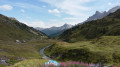
This is the fourth stage of the route, taking you from the village of Névache to the Drayéres mountain hut at the head of the Clarée Valley. The route follows the path known as the Chemin de Ronde, part of theGRP® Tour du Thabor trail. You’ll complete a circular route around Lake Laramon. Alternatively, from this lake you can also reach Lake aux Serpents.
The view over the valley from the top of the Chemin de Ronde is simply stunning.
When you reach the Refuge de la Terrasse, take a moment to admire the mountainous landscape of this valley.
Refuge des Drayeres – Valmeinier 1,800
 10.62 mi
+2,500 ft
-3,848 ft
7h 05
Difficult
Departure from Névache (Hautes-Alpes)
10.62 mi
+2,500 ft
-3,848 ft
7h 05
Difficult
Departure from Névache (Hautes-Alpes)
The final stage of this route runs from the Refuge des Drayeres in the Clarée Valley to the resort of Valmeinier. You will pass the Deuil des Rochilles before emerging onto three magnificent high-altitude lakes: Lac de la Clarée, Lac Rond and Lac du Grand Ban. Next comes the ascent of the Col des Plagnettes, followed by the descent with the rocky ridge of the Grande Paré to your left and the Aiguille Noire to your right, then the ascent of the Pas des Griffes, before descending back to Valmeinier, the end point of this 5-day route.
The Thabor Circuit in 5 days
50.44 mi
+16,581 ft
-16,614 ft
5 days
Difficult
Departure from Valmeinier (Savoie)
This 5-day route takes you from mountain hut to mountain hut along theGRP® Tour du Thabor route, offering fabulous high-mountain landscapes and panoramic views at altitudes often exceeding 2,500 metres. The ascent of Mont Thabor to nearly 3,200 metres gives you the feeling of being on top of the world, where you’ll experience the effects of high altitude.
Refuge de l'Orgére - Refuge Peclet Polset
 5.43 mi
+2,986 ft
-1,171 ft
5h 05
Difficult
Departure from Villarodin-Bourget (Savoie)
5.43 mi
+2,986 ft
-1,171 ft
5h 05
Difficult
Departure from Villarodin-Bourget (Savoie)
The first stage takes you from the Refuge d’Orgére to the Refuge de Peclet Polset. Although short, this first stage features a significant elevation gain, helping you get into your stride for the rest of the trek. The views above the Maurienne Valley are already splendid. You’ll cross your first pass, the Col de Chaviére, at nearly 2,800 metres. Views of the Écrins and the Thabor, reminding us of the 2018 route.
Gerbroulaz Glacier (alternative route)
 4.18 mi
+1,654 ft
-1,631 ft
3h 20
Average
Departure from Pralognan-la-Vanoise (Savoie)
4.18 mi
+1,654 ft
-1,631 ft
3h 20
Average
Departure from Pralognan-la-Vanoise (Savoie)
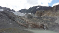
Alternative route, starting from the Peclet-Polset refuge. This alternative can be taken at the end of the first stage.
It allows you to get as close as possible to the gigantic Gebroulaz Glacier, at the foot of the Aiguilles de Peclet.
L'Espigoulier-Dents de la Roque-Forcade-Pic de Bertagne-Pas de Cugens
 10.42 mi
+3,684 ft
-3,655 ft
8h 00
Difficult
Departure from Gémenos (Bouches-du-Rhône)
10.42 mi
+3,684 ft
-3,655 ft
8h 00
Difficult
Departure from Gémenos (Bouches-du-Rhône)
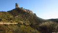
A very beautiful and challenging hike starting from Saint-Pons Park in Gémenos, where you will begin by climbing the Col de l'Espigoulier, then the Dents de Roque Forcade and the Pic de Bertagne. You will begin your return to Saint-Pons Park via the Col du Fauge and the Pas de Cugens.
Some sections are tricky, but the views are magnificent throughout.
Tour des Glaciers de la Vanoise starting from Modane
 66.01 mi
+23,921 ft
-23,917 ft
8 days
Difficult
Departure from Villarodin-Bourget (Savoie)
66.01 mi
+23,921 ft
-23,917 ft
8 days
Difficult
Departure from Villarodin-Bourget (Savoie)
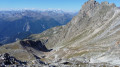
This fabulous 8-stage route (+ 2 variants) is challenging and requires excellent physical fitness, as some passes reach an altitude of nearly 3,000m.
The first two stages deviate from the usual route, making this route even more appealing. The mountain landscapes, glaciers, pastures and flora are among the most beautiful in the Alps. Wildlife is particularly abundant, as in the Mercantour. Every day we saw marmots, ibex and chamois.
Peclet-Polset Refuge - Merlets Lakes Refuge
 9.26 mi
+3,114 ft
-3,314 ft
7h 00
Difficult
Departure from Pralognan-la-Vanoise (Savoie)
9.26 mi
+3,114 ft
-3,314 ft
7h 00
Difficult
Departure from Pralognan-la-Vanoise (Savoie)
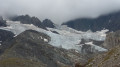
This second stage links the Peclet Polset Refuge to the Lacs Merlets Refuge via the Col du Soufre. You walk alongside the great Gebroulaz Glacier before reaching the Refuge du Saut. Next comes the ascent of the Col de Chanrouge and the arrival at the Lacs Merlets.
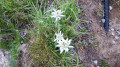
This stage takes you off the usual route through the Vanoise National Park. The landscapes are very wild. You’ll find plenty of edelweiss here.
Refuge des Lacs Merlets – Refuge de la Valette
 10.22 mi
+4,514 ft
-3,917 ft
8 hrs
Very difficult
Departure from Saint-Bon-Tarentaise (Savoie)
10.22 mi
+4,514 ft
-3,917 ft
8 hrs
Very difficult
Departure from Saint-Bon-Tarentaise (Savoie)
This third stage will take you from the Refuge des Lacs Merlets to the Refuge de la Valette.
This stage is undoubtedly the most challenging, with 1,400 metres of elevation gain. The ascent of the Petit Mont Blanc, a difficult descent to Les Prioux, followed by another beautiful and long climb (900m of elevation gain) to the Col de la Valette and its refuge, will make for a memorable day.
Valette Refuge - Col de la Vanoise Refuge
 7.67 mi
+3,901 ft
-4,154 ft
6h 55
Difficult
Departure from Pralognan-la-Vanoise (Savoie)
7.67 mi
+3,901 ft
-4,154 ft
6h 55
Difficult
Departure from Pralognan-la-Vanoise (Savoie)
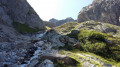
The 4th stage of this route, which will take you from the Valette refuge to the Col de la Vanoise refuge. One of the most challenging stages, featuring the ascent of the Col du Grand Marchet and its highly technical descent.
A balcony-like route above Pralognan, the Petit Marchet, the Grand Marchet cirque, and the pass of the same name, leading to the Lac des Vaches and its ford, with the Grande Casse and the Col de La Vanoise refuge in the background. A technical stage, but one of the most beautiful.
Refuge de l'Arpont - Refuge de la Fournache
 10.62 mi
+2,533 ft
-2,365 ft
7h 05
Difficult
Departure from Termignon (Savoie)
10.62 mi
+2,533 ft
-2,365 ft
7h 05
Difficult
Departure from Termignon (Savoie)
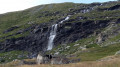
Stage7 of this journey takes you from the Refuge de l’Arpont to the very welcoming Refuge de la Fournache. This stage skirts around the Dent Parrachée. This is the last time you will see the Vanoise glaciers. This trail, which is at times technical and challenging due to its elevation gain, overlooks the Maurienne Valley, Val Cénis and, on the other side, Italy. You will also catch a glimpse of the Thabor, before arriving at the bottom of Aussois, with its two lakes and the Aussois dam.
Refuge du col de la Vanoise - Refuge de l'Arpont
 8.64 mi
+1,145 ft
-1,837 ft
5h 00
Average
Departure from Pralognan-la-Vanoise (Savoie)
8.64 mi
+1,145 ft
-1,837 ft
5h 00
Average
Departure from Pralognan-la-Vanoise (Savoie)
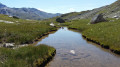
Stage5 of this route between the Col de la Vanoise refuge and the Arpont refuge. A stage without any major difficulty. The scenery is extraordinary, as you walk alongside the Vanoise Glacier for the entire hike. You will catch sight of the Rechasse, Roche Ferran and Arpont glaciers. You will pass at the foot of the Grande Casse and its glacier, the Pointe de la Réchasse and Mont Pelve.
Le Piolit via Rouanne Haute
 7.96 mi
+2,802 ft
-2,831 ft
6h 05
Difficult
Departure from Ancelle (Hautes-Alpes)
7.96 mi
+2,802 ft
-2,831 ft
6h 05
Difficult
Departure from Ancelle (Hautes-Alpes)
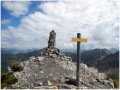
A splendid hike with a difficult route that will take you to the Col de Chorges. Climb Piolit and enjoy its 360° panorama, then descend via the Col de la Pourrachiére.
From Piolit (2,464 m), there are views to the south over Lake Serre-Ponçon and Mercantour, and to the north-east, north and north-west over the peaks of Champsaur, Dévoluy and Ecrins.
Caution: do not attempt this route too early in the season, as there is still a lot of snow due to the exposure. See § practical information.
Refuge de l'Arpont - The lakes and the Arpont Glacier (alternative route)
 3.98 mi
+1,742 ft
-1,729 ft
3h 20
Average
Departure from Termignon (Savoie)
3.98 mi
+1,742 ft
-1,729 ft
3h 20
Average
Departure from Termignon (Savoie)
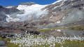
This6th stage is a variation on the route starting from the Refuge de l'Arpont. We decided to spend two days on this hike to explore the Lacs de l'Arpont and its magnificent glacier. An exceptional hike that will allow you to get as close as possible to this glacier. The lakes are splendid. If you’re feeling brave, don’t hesitate to take a very refreshing dip.
Refuge de la Fournache - Refuge de l'Orgére
5.91 mi
+2,336 ft
-3,750 ft
4h 45
Difficult
Departure from Aussois (Savoie)
The final stage of this fabulous route from the Refuge de la Fournache to the Refuge de l'Orgére, via the Col de la Masse. The ascent of this pass is difficult due to the steep gradient. The end of the ascent and a good part of the descent are very technical. The view from the pass is absolutely exceptional; you will be able to see the Écrins and the Thabor massif.
Le Chiran via Blieux
 9.42 mi
+3,028 ft
-3,031 ft
7h 00
Average
Departure from Blieux (Alpes-de-Haute-Provence)
9.42 mi
+3,028 ft
-3,031 ft
7h 00
Average
Departure from Blieux (Alpes-de-Haute-Provence)
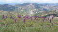
Climb Chiran via another route, starting from the village of Blieux. You will reach the Chiran observatory after a beautiful 1,000 m climb through vegetation typical of the Southern Alps. In spring, this hike is beautiful with its colourful orchids on the plateau. At the summit, there is a magnificent 360° view. This hike is not technically difficult and is very easy to navigate.
The Pic de Chamatte, starting from Vergons
 8.95 mi
+2,815 ft
-2,815 ft
6h 35
Difficult
Departure from Vergons (Alpes-de-Haute-Provence)
8.95 mi
+2,815 ft
-2,815 ft
6h 35
Difficult
Departure from Vergons (Alpes-de-Haute-Provence)
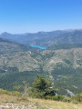
A very lovely walk leading to the Pic de Chamatte at an altitude of 1,879 metres. This walk may prove challenging due to the elevation gain for inexperienced walkers. However, there are no technical sections. Only the descent requires a sense of direction. The path, although marked on the map, is barely visible in places. From the summit, a magnificent 360° view awaits you, taking in the Mercantour, the Verdon massifs and Lac du Castillon.
Puy de Rent
 10.25 mi
+3,301 ft
-3,274 ft
7h 35
Difficult
Departure from Allons (Alpes-de-Haute-Provence)
10.25 mi
+3,301 ft
-3,274 ft
7h 35
Difficult
Departure from Allons (Alpes-de-Haute-Provence)
A magnificent hike with no great technical difficulty, apart from the 1,000 m elevation gain and a distance of over 17 km. The ascent is gradual through a magnificent larch forest. At the summit, a 360° panorama awaits you. Breathtaking views at an altitude of nearly 2,000 metres over the Mercantour: the Grand Coyer, the Mole, the Pic de Chamatte, the Cheval Blanc, the Montagne de Cordeil and the Estrop in the distance, to name the most important. In spring, the flora is in full bloom.
Cheval Blanc summit
 11.22 mi
+3,986 ft
-3,960 ft
8h 40
Difficult
Departure from Thorame-Basse (Alpes-de-Haute-Provence)
11.22 mi
+3,986 ft
-3,960 ft
8h 40
Difficult
Departure from Thorame-Basse (Alpes-de-Haute-Provence)
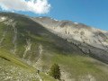
A lovely walk to a magnificent, barren peak rising to an altitude of nearly 2,350 metres. The climb remains challenging due to the elevation gain, but the view on arrival is truly extraordinary, with a 360° panorama. The mountain is also known as the ‘cursed mountain’ due to the two plane crashes that occurred on 27 and 30 January 1948 (see information below).
Saint-Véran – Agnel Mountain Hut
 9.64 mi
+3,963 ft
-2,103 ft
7h 55
Difficult
Departure from Saint-Véran (Hautes-Alpes)
9.64 mi
+3,963 ft
-2,103 ft
7h 55
Difficult
Departure from Saint-Véran (Hautes-Alpes)
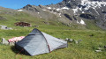
This is the second stage ofthe GR®®58, but it takes a variant route via the Col de Saint-Véran or the Col de la Cavale and includes an ascent to an altitude of 3,000 metres at the Pic de Caramantran. There’s a magnificent view of Mount Viso at the highest point of this route. At the start of the season, there were still plenty of snowfields. This is a very wild route, which I recommend as an alternative to the Col de Chamoussière path, which tends to be quite busy.
Agnel Mountain Hut – La Monta Mountain Hut
 8.25 mi
+1,434 ft
-4,390 ft
5h 00
Difficult
Departure from Molines-en-Queyras (Hautes-Alpes)
8.25 mi
+1,434 ft
-4,390 ft
5h 00
Difficult
Departure from Molines-en-Queyras (Hautes-Alpes)
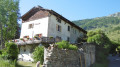
The third stage of this journey presents no major difficulties, with exceptional views around the lakes. Only the descent from the Col Vieux to the Refuge de la Monta quickly takes its toll on your legs.
The abundance of flora makes this stage even more beautiful.
Lodge du Grand Rochebrune – Lodge le Teppio
 9.80 mi
+2,635 ft
-3,176 ft
6h 50
Difficult
Departure from Château-Ville-Vieille (Hautes-Alpes)
9.80 mi
+2,635 ft
-3,176 ft
6h 50
Difficult
Departure from Château-Ville-Vieille (Hautes-Alpes)
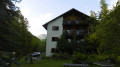
This stage follows part of theGR®® 58, then takes a route offthe GR®® to climb to the Col d’Izoard. Admittedly, this ascent is via the road, but on a day when vehicles are banned, allowing you to enjoy this lunar landscape with its monoliths. The return journey takes you through a deserted ravine. The limestone landscapes of this stage are nothing like those encountered since the start of the Tour du Queyras, which is characterised by slate.
A 13-day grand tour of the Parc des Ecrins via the GR® 54
 105.16 mi
+37,625 ft
-39,075 ft
13 days
Very difficult
Departure from La Chapelle-en-Valgaudemar (Hautes-Alpes)
105.16 mi
+37,625 ft
-39,075 ft
13 days
Very difficult
Departure from La Chapelle-en-Valgaudemar (Hautes-Alpes)
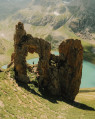
A very challenging 180 km route with 12,000 metres of elevation gain, requiring excellent physical fitness. Stages offering spectacular scenery, steep mountains, passes, wildlife, flora and colours. The most beautifulGR® route we have ever done. We completed the route in August, the ideal time to tackle the most difficult passes, which are likely to be snow-covered early in the season, such as La Muzelle, l’Aup Martin, the Pas de la Cavale, de la Valette, Vallonpierre and de La Vaurze.
Le Grand Sarcoui and Le Puy des Goules
 5.04 mi
+1,112 ft
-1,115 ft
3h 15
Average
Departure from Orcines (Puy-de-Dôme)
5.04 mi
+1,112 ft
-1,115 ft
3h 15
Average
Departure from Orcines (Puy-de-Dôme)
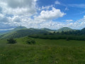
Short hike to the summit of Grand Sarcoui and the magnificent volcano with its perfect crater, Puy des Goules.
A magnificent view of the volcano park from each of the two summits.
This hike is not technically difficult and is suitable for families who want to discover the magic of volcanoes.
Moderator's note added on 13/09/2021: access to the Sarcoui caves is difficult and the summit is now off-limits (see comments).
La Chapelle-en-Valgaudemar - Refuge des Souffles
 6.40 mi
+4,393 ft
-1,496 ft
7 hrs
Very difficult
Departure from La Chapelle-en-Valgaudemar (Hautes-Alpes)
6.40 mi
+4,393 ft
-1,496 ft
7 hrs
Very difficult
Departure from La Chapelle-en-Valgaudemar (Hautes-Alpes)
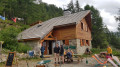
Thefirst stage begins with a variant ofthe GR® 54 and takes you to the Refuge des Souffles via the Col de Colombes, Lac Lautier and the Col des Clochettes, avoiding the route through Villar-Loubière.
A challenging route with a 1,400-metre climb and steep gradients right from the start. A good way to get your legs going for thefirst stage and a good warm-up for the rest of the route.
The scenery is already exceptional, promising some fabulous stages ahead.