Ceillac – Saint-Véran

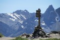
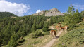
A good warm-up for thisfirst stage. Thefirst pass is the Col des Estronques, followed by a round trip to the nearby summit of the Tête de la Jacquette, where an exceptional panorama awaits you, taking in the Pics de la Font Sancte, the Aiguille de Chambeyron, the Bric de Rubren, the Peouvou and, to the north, the Grand Glaiza and the Rochebrune.

This walk is part of a multi-day hike: Tour complet du Queyras par le GR®58 et ses variantes

Details

n°3562445
Creation:
Last update:
Last review:
  • Walking
    Activity: Walking
  • ↔
    Distance: 8.54 mi
  • ◔
    Average duration: 7h 40 
  • ▲
    Difficulty: Difficult

  • ⚐
    Back to start: No
  • ↗
    Ascent: + 4,252 ft
  • ↘
    Descent: - 2,986 ft

  • ▲
    Highest point: 9,042 ft
  • ▼
    Lowest point: 5,361 ft
  • ⚐ Country: France
  • ⚐
  • ⚐ City: Ceillac (05600)
  • ⚑
    Start: N 44.666207° / E 6.775676°
  • ⚑
    End: N 44.69922° / E 6.870091°
  • ❏
    IGN map(s): Ref. 3537ET, 3537ETR, 3637OT, 3637OTR
  • Hour-by-hour weather

Photos

Description of the walk

(S) From the Baladins Lodge, head up to the centre of the village of Ceillac. Cross the village and take theGR® 58 along a forest track until you reach a junction with a path branching off to the left.

(1) Take the path on the left, staying on theGR®, which climbs gradually until it reaches a forest track. Follow this track, passing above the hamlet of Le Villard. Leave theGR®5–GR® 58variant, which leads to the Col Fromage, on your left.

(2) Continue along the wide forest track to Le Tioure and carry on along a footpath. Pass a signpost indicating theGR®58Philippe Lamour at a further junction.

(3) Take theGR® to the left, then left again at the next junction. Here, begin the ascent of the Col des Estronques, first through woodland and then entirely across mountain pastures. You’ll emerge at the junction with the path coming from the Col Fromage. Continue to the right on theGR® to reach the Col des Estronques.

(4) Turn right to reach the Tête de Jacquette via a ridge path. At the summit, there is a magnificent view of the highest peaks in the Queyras. To enjoy this panorama from even higher up, you must reach the Tête de la Jacquette. Take in the superb panoramic view here.

(5) Return via the same route to the Col des Estronques.

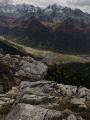
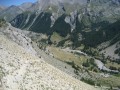
(4) Turn right onto theGR® for the long descent towards the Saint-Véran valley. After passing through a slate-covered area, walk through a magnificent larch wood. Pass beneath the Cabane du Puy and, further on, reach the ford at the Torrent de Curlet.

(6) Cross the torrent, with a beautiful waterfall on your right. Continue to the bottom of the valley at the Pont du Moulin.

(7) Cross the bridge to tackle the day’s final climb, reaching the Gabelous lodge (E) in the centre of Saint-Véran – today’s destination. The final climb up to the village really takes its toll after this first day.

Waypoints

  1. S : mi 0 - alt. 5,361 ft - Gîte des Baladins
  2. 1 : mi 0.57 - alt. 5,558 ft - Le Villard
  3. 2 : mi 1.4 - alt. 6,020 ft - Continue along the wide forest track
  4. 3 : mi 2.53 - alt. 6,434 ft - GR junction
  5. 4 : mi 4.52 - alt. 8,688 ft - Col des Estronques
  6. 5 : mi 4.81 - alt. 9,035 ft - Tête de Jacquette (2757m)
  7. 6 : mi 7.15 - alt. 6,394 ft - Ford
  8. 7 : mi 7.66 - alt. 6,063 ft - Pont du Moulin - Aigue blanche
  9. E : mi 8.54 - alt. 6,637 ft - Gîte des Gabelous

Notes

Note regarding the start: having arrived in Ceillac the day before, we didn’t camp on that first night but stayed at the Gîte des Baladins, where it’s easy to leave your car for the duration of the route. The welcome is extremely warm. The food and accommodation are of a high standard.
There are plenty of water sources throughout this stage.
Binoculars and a camera are essential. Don’t forget that this 9-day route is a mountain trek, which requires a good level of fitness and suitable kit, even in summer. The weather can change very quickly, as can temperature fluctuations.

Worth a visit

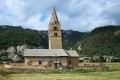
(2) Le Villard: destroyed in January 1978 by an avalanche, along with the villages of Tioure, Rabinoux and Chalmette. Most of the houses in Le Villard have been restored.
(5) La Tête de Jacquette: a 360° panorama offering views of the Pics de la Font Sancte, the Aiguille de Chambeyron, the Bric de Rubren and the Peouvou; to the north, you can see the Grand Glaiza and the Rochebrune.
(E) As wild camping is prohibited in the commune of Saint-Véran, we chose the Gîte des Gabelous.

Always be cautious and plan ahead when you're outdoors. Visorando and the author of this route cannot be held responsible for any accidents occurring on this route.

The GR® and PR® markings are the intellectual property of the Fédération Française de Randonnée Pédestre.

Reviews and comments

5 / 5
Based on 1 review

Reliability of the description
5 / 5
Ease of following the route
5 / 5
Route interest
5 / 5
Samuel Maginot
Samuel Maginot

Overall rating : 5 / 5

Date of your route : Jul 15, 2024
Reliability of the description : ★★★★★ Very good
Ease of following the route : ★★★★★ Very good
Route interest : ★★★★★ Very good
Very busy route : Yes

A very good route. I might add that wild camping is permitted in the commune of Saint-Véran, more than an hour’s walk from the village centre.

Machine-translated

Other walks in the area

For more walks, use our search engine .

The GPS track and description are the property of this route's author. Please do not copy them without permission.