Country:

 City:


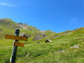
(S) From the refuge, head right along the road towards the pass and take the wide path on the left which climbs gradually until you reach the first junction.
(1) Ignore the path branching off to the right towards La Foux and continue along theGR® to the left until you reach another junction at the 2,356-metre point, known as the Baisse de Prenier.
(2) Ignore the path branching off to the right towards the summit of the Rochegrand, and continue left on theGR®, which descends to another junction.
(3) Ignore theGR® 56 B which branches off to the right towards Lac d’Allos – a variant of thisGR® route. Take theGR® 56 on the left.
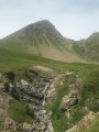
(4) Pass through the Ravin de la Clapiére and continue along the path, which runs along a ledge at the foot of the Grand Cheval de Bois. Some very narrow sections on the mountainside, with very crumbly rock, require the utmost care. Landslides have made the path loose.
Carry on and pass the Ravin de Rivachasse, then the Ravin du Pichs.
(5) Begin a lovely descent, pass through a wooded area above the Waterfall du Pich and continue to the Cabane du Talon, where there is a junction.
(6) A path descends towards Allos. Follow theGR® straight on.
From this point, the gradient increases rapidly, leading to the foot of a rocky outcrop and the Cimet waterfalls.
(7) Take care in this section as you walk past the base of the waterfalls on very slippery slabs.
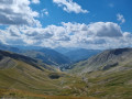
Reach the plateau at the top of the waterfalls, with a superb view over the whole valley, towards Allos and the peaks of the Cimet and the Pelat. The landscape becomes increasingly rocky.
Pass a path that climbs to the left towards the Pas de l’Âne. Continue the ascent towards the Petit Col du Talon. You’ll emerge onto a plateau with wild, unspoilt scenery, with Lac Cimet in your sights. To the right is Mont Pelat and, to the left, the Cimet, with the Petit Col du Talon in the background.
(8) Pass a scree slope at the foot of the Cimet, above the lake, to reach the pass at an altitude of 2,678 metres, offering a beautiful panorama of the Grande Cayolle to the east and the valley leading down to Allos to the west.
You will have covered 17 km and completed the day’s challenges.
(9) After this long and tiring climb, begin the descent through a very rocky landscape to a junction at the 2,461-metre mark.
(10) Leave the path that climbs to the left towards the Col des Esbéliousses and continue along theGR® as it descends through mountain pastures and streams. Pass above the Grande Cayolle ravine on a ledge, then past La Cayolle farm.
(11) Carry on until you reach the D902, which climbs to the right towards the Col de la Cayolle and its eponymous refuge.
(12) Turn left, following the road for about a hundred metres, until you reach the first bridge on the right.
(13) Leave the road which descends to the right, turn left onto theGR® and, a little further on, cross the departmental road again.
(14) Cross it and rejoin the path opposite. Follow the Bachelard stream along the left bank. TheGR® sometimes passes through beautiful meadows, sometimes through woodland. You’ll come to a lovely footbridge.
(15) Cross over to the right bank of the stream and follow theGR® to the hamlet of Bayasse.
(16) Turn left at the bottom of the village, pass the first junction and take the road leading uphill to the right. Walk past the lodge/hotel, then round a bend to the right and reach Les Cordiers, with the Bayasse stopover lodge on your left (E).

 Visorando Member
 Moderate
 Tourist office
 Easy
 Difficult