The Col de la Gardette and the Cabane de la Gardette via the Balcons du Piolit

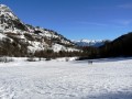
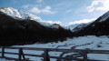
A magnificent hike in the hills above Chorges, featuring the ascent to the Col de la Gardette, continuing on to the hut of the same name and returning via the Piolit balconies. The view from the pass is spectacular and the section leading to the hut is very wild.

This hike is recommended for snowshoes, hence its ‘Difficult’ rating, but it can also be done on foot.

Details

n°18657580
Creation:
Last update:
Last review:
  • Snowshoeing
    Activity: Snowshoeing
  • ↔
    Distance: 9.95 mi
  • ◔
    Duration according to the author: 6 hrs 
  • ▲
    Difficulty: Difficult

  • ⚐
    Back to start: Yes
  • ↗
    Ascent: + 2,513 ft
  • ↘
    Descent: - 2,500 ft

  • ▲
    Highest point: 6,991 ft
  • ▼
    Lowest point: 4,770 ft
  • ⚐ Country: France
  • ⚐
    Areas: Alps, Dauphiné
  • ⚐ City: Chorges (05230)
  • ⚑
    Start/End: N 44.576609° / E 6.278335°
  • ❏
    IGN map(s): Ref. 3437ET, 3437ETR, 3437OT, 3437OTR, 3438ET, 3438ETR
  • Hour-by-hour weather

Photos

Description of the walk

Drive through Chorges towards the hills via the D69. At the end of the tarmac road, park at the junction of the tracks leading to Naune Raze and Les Gontards.

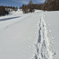
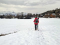
(S/E) Set off to the right heading south, following the snowshoe route signs, then turn due east across Champ Froid, following snowshoe tracks and signs for the snowshoe route. Enjoy a magnificent view of Lake Serre-Ponçon. Join theGR®50.

(1) Head straight on along it and continue towards Clot Chaud. Pass through the Forest des Barthiers without leaving theGR® until you reach a junction of paths.

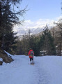
(2) Leave theGR® and follow the F8 snowshoe trail to the left. Climb gradually through a larch woodland until you reach another track with a car park.

(3) Turn right, go through a gate and you’ll very quickly come to another junction.

(4) Turn right and continue the ascent through the larch trees. Leave the woodland and follow the winding path to reach the Col de la Gardette. Enjoy the exceptional views from here.

(5) Take the path on the left or follow the snowshoe tracks, heading north. Follow an almost flat path to reach the Cabane de la Gardette.

(6) Retrace your steps to return to the crossroads you passed on the way there.

(4) Turn right onto the wide track towards the Balcons du Piolit. You’ll reach the Torrent des Réallons.

(7) Cross it and then turn left to reach an interesting viewpoint. Continue on a very gentle climb, passing some drinking troughs, before rejoining theGR®50.

(8) Turn left onto it and descend steeply to reach the wide track leading to Le Tuchet.

(9) Continue along theGR® to the left until you reach the Goutards junction.

(10) Turn right onto the small path – this is theGRP® Tour du Lac de Serre-Ponçon – and leave it shortly afterwards on the left to return to the car park between Naune Raze and Gontards (S/E).

Waypoints

  1. S/E : mi 0 - alt. 4,770 ft - Car park between Naune Raze and Gontards
  2. 1 : mi 0.52 - alt. 4,928 ft - GR°°®°°50
  3. 2 : mi 1.4 - alt. 5,243 ft - GR junction – footpath
  4. 3 : mi 2.09 - alt. 5,548 ft - Trail and car park
  5. 4 : mi 2.24 - alt. 5,610 ft - Crossroads of the circular loop
  6. 5 : mi 3.83 - alt. 6,972 ft - Col de la Gardette
  7. 6 : mi 4.54 - alt. 6,972 ft - La Gardette Hut
  8. 7 : mi 7.72 - alt. 5,728 ft - Réallons torrent
  9. 8 : mi 8.46 - alt. 5,512 ft - GR50
  10. 9 : mi 8.86 - alt. 5,121 ft - Crossroads towards Le Truchet
  11. 10 : mi 9.67 - alt. 4,961 ft - GRP Tour du Lac
  12. S/E : mi 9.95 - alt. 4,777 ft - Car park between Naune Raze and Gontards

Notes

This route presents no technical difficulties but requires a good level of fitness, particularly if undertaken on snowshoes.
As with any winter snowshoe hike, be very vigilant about the risk of avalanches.
Bring a pair of binoculars to enjoy the panoramic views at the Col de la Gardette.

Worth a visit

(5) Col de la Gardette, view here:
- to the south, the Mercantour, the Gapençais, the Digne Pre-Alps, Lake Serre Ponçon and the Champsaur;
- to the north, the Écrins National Park and the Gourmiers valley.

Always be cautious and plan ahead when you're outdoors. Visorando and the author of this route cannot be held responsible for any accidents occurring on this route.

The GR® and PR® markings are the intellectual property of the Fédération Française de Randonnée Pédestre.

Reviews and comments

5 / 5
Based on 1 review

Reliability of the description
5 / 5
Ease of following the route
5 / 5
Route interest
5 / 5
Lili_Rousse
Lili_Rousse
• Edited:

Overall rating : 5 / 5

Date of your route : Nov 20, 2024
Reliability of the description : ★★★★★ Very good
Ease of following the route : ★★★★★ Very good
Route interest : ★★★★★ Very good
Very busy route : No

Filmed with three dogs in a dog-sled team
Done just after the first snowfall.
The upper section can already be tackled on snowshoes; we didn’t go all the way to the hut. We’d had enough of breaking trail.
At times there was a good 50 cm of snow
In summer it must be very busy; on Wednesday we came across someone who had turned back. I saw their tracks heading back the way they’d come

Machine-translated

le dd
le dd

Good evening,
I’m really sorry, but I don’t have any information on that. When we did that walk, the car park was accessible.
Perhaps you could park further up the hill
Kind regards
The dd

Machine-translated

LEMEL RENEE
LEMEL RENEE

Hello,
Looking at the map, the Chirouzes car park is marked as ‘temporarily closed’.
Is it simply not up to date?
Alain

Machine-translated

Other walks in the area

For more walks, use our search engine .

The GPS track and description are the property of this route's author. Please do not copy them without permission.