Agnel Mountain Hut – La Monta Mountain Hut

The third stage of this journey presents no major difficulties, with exceptional views around the lakes. Only the descent from the Col Vieux to the Refuge de la Monta quickly takes its toll on your legs.
The abundance of flora makes this stage even more beautiful.

This walk is part of a multi-day hike: Tour complet du Queyras par le GR®58 et ses variantes

Details

3562448
Creation:
Last update:
Last review:
  • Walking
    Activity: Walking
  • ↔
    Distance: 8.25 mi
  • ◔
    Average duration: 5h 00 
  • ▲
    Difficulty: Difficult

  • ⚐
    Back to start: No
  • ↗
    Ascent: + 1,434 ft
  • ↘
    Descent: - 4,390 ft

  • ▲
    Highest point: 9,754 ft
  • ▼
    Lowest point: 5,449 ft

Photos

Description of the walk

(S) Cross the departmental road and begin the ascent of the Col Vieux via theGR® 58. The path presents no technical difficulties.

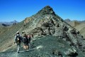
(1) Turn right to begin the ascent; the gradient steepens rapidly. Halfway up, before reaching a flat section covered in slate, take in the view over Lac Foréant and the whole valley as it descends towards the Ristolas valley. Reach the Italian border at the start of the ascent up the Pain de Sucre.

(2) Return to the pass via the same route.

(1) Join theGR® again and descend to Lac de Foréant.

(3) Walk alongside it and continue on theGR® to reach Lac Egorgéou. Take care on this section; the path is very steep in places and the ground is slippery.

(4) Walk alongside this lake, then leave this rocky landscape behind to find larch woods, herds of livestock and mountain dogs. Continue downhill, keeping the Torrent de Bouchouse – the stream draining the lakes – at a distance. Then veer away from it to reach the Torrent des Gavies

(5) Cross it to quickly reach the Guil valley. Continue the descent to the left bank of the Guil. Carry on along a wide path until you reach the bridge leading to the hamlet of L’Échalp.

(6) Stay on theGR® on the left bank; further on, you’ll come to asecond bridge; take it to the right to reach the Refuge de la Monta (E), today’s stop.

Waypoints

  1. S : mi 0 - alt. 8,432 ft - Refuge Agnel
  2. 1 : mi 1.12 - alt. 9,209 ft - Col Vieux
  3. 2 : mi 1.68 - alt. 9,754 ft - Foot of - Le Pain de Sucre (Queyras)
  4. 3 : mi 3 - alt. 8,602 ft - Lac Foréant
  5. 4 : mi 4.31 - alt. 7,874 ft - Lac Egorgéou
  6. 5 : mi 6.22 - alt. 6,526 ft - Torrent des Gavies
  7. 6 : mi 7.39 - alt. 5,571 ft - Bridge to L’Échalp - Guil (rivière)
  8. E : mi 8.25 - alt. 5,502 ft - Refuge de la Monta

Notes

There are plenty of water sources throughout this stage.
Binoculars and a camera are a must. Don’t forget that this 9-day route is a mountain trek, which requires good physical fitness and suitable equipment, even in summer. The weather can change very quickly, as can temperature fluctuations.
Note: It’s a shame that the large number of electric mountain bikes on this section is causing irreversible erosion.

Worth a visit

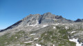
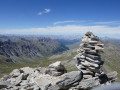
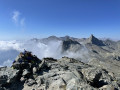
(2) At the foot of the Pain de Sucre: the panoramic view over the Col d’Agnel valley and all the surrounding mountain ranges, with the Barre des Écrins in the background, is truly spectacular. Further north, the view of the climb up the pass on the Italian side is equally breathtaking.
Note: It is possible to climb the Pain de Sucre by continuing along this path. Given the weight of our rucksacks, we preferred to play it safe, especially as the ascent is steep and the ground very loose.
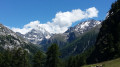
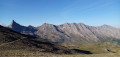
Between (3) and (4) Take in the scenery to identify:
- on the right, a beautiful, long rocky ridge: the Crête de la Taillante,
- to the left, the Eychassier ridge, the Pic de Foréant and the Grand Queyras.
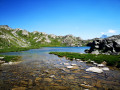
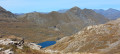
At the end of each lake, turn round – the scenery is extraordinarily beautiful (photos).
(4) Lac Égourgeou: you can take a detour to the right towards Lac Baricle.
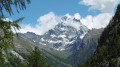
Between (5) and (6), with Mont Viso in your sights.
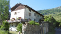
(E) Refuge de la Monta: situated next to a beautiful chapel, where the owner will give you a warm welcome. His brother will treat you to a sumptuous, hearty and delicious meal. One of the best stops on our journey. What’s more, the owner has set up a very pleasant camping area.

Always be cautious and plan ahead when you're outdoors. Visorando and the author of this route cannot be held responsible for any accidents occurring on this route.

The GR® and PR® markings are the intellectual property of the Fédération Française de Randonnée Pédestre.

Reviews and comments

5 / 5
Based on 2 reviews

Reliability of the description
5 / 5
Ease of following the route
5 / 5
Route interest
5 / 5
Nono 88
Nono 88

Overall rating : 5 / 5

Date of your route : Jul 17, 2023
Reliability of the description : ★★★★★ Very good
Ease of following the route : ★★★★★ Very good
Route interest : ★★★★★ Very good
Very busy route : Yes

A brilliant route – what’s more, there was still quite a lot of snow and the first lake was still frozen over. A lovely stage. And the Mont Olivier mountain refuge was really friendly, with staff who were attentive to everyone’s needs and served excellent food......See you soon, Nono 🌲

Machine-translated

Afab
Afab

Overall rating : 5 / 5

Date of your route : Aug 04, 2022
Reliability of the description : ★★★★★ Very good
Ease of following the route : ★★★★★ Very good
Route interest : ★★★★★ Very good
Very busy route : Yes

Great!

Machine-translated

Other walks in the area

For more walks, use our search engine .

The GPS track and description are the property of this route's author. Please do not copy them without permission.