Cheval Blanc summit

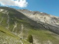
A lovely walk to a magnificent, barren peak rising to an altitude of nearly 2,350 metres. The climb remains challenging due to the elevation gain, but the view on arrival is truly extraordinary, with a 360° panorama. The mountain is also known as the ‘cursed mountain’ due to the two plane crashes that occurred on 27 and 30 January 1948 (see information below).

Details

3336571
Creation:
Last update:
Last review:
  • Walking
    Activity: Walking
  • ↔
    Distance: 11.22 mi
  • ◔
    Average duration: 8h 40 
  • ▲
    Difficulty: Difficult

  • ⚐
    Back to start: Yes
  • ↗
    Ascent: + 3,986 ft
  • ↘
    Descent: - 3,960 ft

  • ▲
    Highest point: 7,615 ft
  • ▼
    Lowest point: 3,891 ft

Photos

Description of the walk

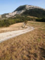
From Saint-André-les-Alpes, take the D2 towards Thorame-Basse. Drive through the village until you reach the hamlet of Château-Garnier. Turn right into the hamlet and take the track running perpendicular to the D2 you’ve just left. Continue up the well-maintained track that runs alongside the Estelle, cross a bridge and carry on until you reach a junction.

(S/E) Carry on straight ahead along the yellow-marked track until you reach point 1372.

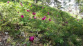
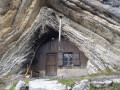
(1) The track ends; continue along the path which climbs steeply through the larch woodland. If you’re doing this walk in spring, you’ll be able to admire some magnificent wild peonies during this first section. Follow the yellow markings all the way to the magnificent Cabane du Cheval Blanc without straying from them.

(2) At the hut, take a path on the left. The path crosses the Ravin de l’Ajasson and continues along a ridge path to the foot of the Montagne de Tournon, in the middle of a beautiful, flat meadow. You’ll join theGRP® Tour du Haut Verdon.

(3) Turn right and begin the ascent of the Montagne de Tournon. There is a hut on your left. The path, which is not very visible, climbs steeply through the mountain pastures, generally following the ridge.

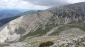
(4) At the top of this first ascent – which is challenging due to the steep gradient – turn right, heading due north, and follow the ridge line and its rollercoaster-like ups and downs before reaching the Sommet des Croquets, marked by a cairn. Beautiful panoramic views.
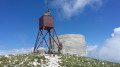
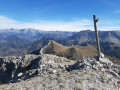
From there, you can see the Sommet du Cheval Blanc with its cylindrical concrete structure at the end of the ridge, which serves as the summit observatory.

(5) Carry on straight ahead, still following the ridge, to the summit of Cheval Blanc.

(6) We were able to have a picnic and enjoy the view:

  • to the north, the Trois Evêchés with the Tête de l’Estrop;
  • to the east, in the foreground, the Montagne de Coste Longue, then in the distance, the Frema and the Grand Coyer;
  • to the south-east, the Cordeil, the Chalvet and the Montagne de Rent;
  • at the foot of the northern slope, the Bléone valley.

(6) From the summit, begin the descent to the right, following the cairns and markings through the scree. Caution: the path is barely visible. At the edge of the first small larch trees, look for a signpost indicating the direction of the Cabane du Cheval Blanc.

(7) Turn sharply right and continue the descent along a ledge above a larch wood to reach the Cabane du Cheval Blanc once more. This section may be vertiginous for those prone to vertigo.

(2) Once at the hut, turn left and follow the path back in the opposite direction until you reach the track, which you then follow down to the starting point (S/E).

Waypoints

  1. S/E : mi 0 - alt. 3,891 ft - Crossroads of trails
  2. 1 : mi 1.05 - alt. 4,501 ft - End of the track, start of the footpath
  3. 2 : mi 2.8 - alt. 6,056 ft - Crossroads of the circular loop - Cabane du Cheval Blanc (1850m)
  4. 3 : mi 3.23 - alt. 6,263 ft - Junction °°GRP®°°, on the right
  5. 4 : mi 3.88 - alt. 7,090 ft - Arrival at the ridge
  6. 5 : mi 5.21 - alt. 7,441 ft - Sommet des Croquets (2270m)
  7. 6 : mi 5.75 - alt. 7,615 ft - Sommet du Cheval Blanc (2323m)
  8. 7 : mi 6.2 - alt. 7,123 ft - Signpost, turn right at the fork
  9. S/E : mi 11.22 - alt. 3,891 ft - Crossroads of trails

Notes

(S/E) You can continue along this track for a few hundred metres towards the water intake, if your vehicle is able to get through.

Water points are located at the start of the walk.

Do not attempt this route in strong winds; there is no shelter along the ridge.

In spring, the flora is magnificent and you’ll spot marmots. Beautiful wild peonies add to the beauty of the landscape.

You are in the mountains, where temperatures and weather conditions can change very quickly.

Good walking boots and a good level of fitness are essential for this hike, which involves 1,200 metres of ascent and the same again in descent.

Don’t forget your binoculars and camera.

A QUICK REMINDER FROM BERBER, OWNER OF THE CHEVAL BLANC HUT:
Hello, I’m the shepherd who looks after the flock of sheep at Cheval Blanc during the summer. I’d therefore like to inform you that the Cheval Blanc hut is reserved for the shepherd’s professional use from early July to late October. Please respect the privacy of my work accommodation during this period. Please be aware, in particular, that when you arrive from your hike around midday, I am just finishing thefirst part of my working day, which began at 4 am… I am starting to rest at that point… please respect the peace and quiet I need…
The flock is accompanied by a pack of guard dogs, which watch over it 24 hours a day to protect it from wolves, which are numerous in the area (see maploup.fr). Please avoid getting too close to the herd when it is resting near the hut. If the dogs come up to you (“Stop right there, show me your papers!”), stop for a moment to let them sniff you, and they’ll move on.
When I’ve finished my summer grazing season, I leave the hut clean and unlocked, with a supply of wood. You’re more than welcome to stay, provided you treat the hut with respect! So please do take your rubbish and empty bottles with you, and close the door when you leave. Because I’m a bit fed up with having to clean up after those who’ve enjoyed this spot every spring when I return to prepare for the season… Thank you!

Worth a visit

The mountain has been the scene of several air disasters. On 27 January 1948, a C-47 Dakota from the 61st Troop Carrier Group (US Air Force) crashed on the mountain, claiming twelve lives. A few days later, on 30 January, a B-17 (Flying Fortress), which had set out to photograph the crash site, also crashed, claiming nine more lives. A single survivor was rescued by a German prisoner of war, himself a former pilot.
I recommend visiting the Wikipedia page: here.
Another starting point for this hike is possible after the hamlet of Château Garnier, shortly after the Saint-Thomas Chapel, by following theGRP® Tour du Haut Verdon trail. This allows you to avoid taking the track.

Reviews and comments

4.2 / 5
Based on 4 reviews

Reliability of the description
4.3 / 5
Ease of following the route
4 / 5
Route interest
4.3 / 5
Nousky38
Nousky38

Overall rating : 3.3 / 5

Date of your route : Aug 16, 2024
Reliability of the description : ★★★☆☆ Average
Ease of following the route : ★★★☆☆ Average
Route interest : ★★★★☆ Good
Very busy route : No

You can return via the ridge of the Bois Favier, which offers some lovely views, even if the route is a little longer.
The walk ends near Saint-Thomas Chapel.

Machine-translated

syloo
syloo

Overall rating : 4 / 5

Date of your route : Jul 11, 2023
Reliability of the description : ★★★★☆ Good
Ease of following the route : ★★★★☆ Good
Route interest : ★★★★☆ Good
Very busy route : No

A lovely walk, with very few other people about (we didn’t come across a single soul on a Sunday in early July), offering stunning views over the Durance valley. The first section is through the forest along an easy, unchallenging path. The second section is entirely in the sun and off-trail. In July, we were a bit bothered by flies and horseflies throughout the section outside the forest.

Please note that a large part of the walk is off-trail, so you’ll tire more quickly. What’s more, the path used for the return journey is very narrow, slippery, sloping and quite vertiginous for about 2 km!! If anyone is too afraid to go along it, the return journey will be a long one and involve an extra climb (back up to the summit and then back along the ridge).

Machine-translated

saabbe
saabbe

Thank you very much!

Machine-translated

le dd
le dd

Hello Saabbe,
I’ve just added your message to the hike’s page, in the hope that anyone doing this route will take good care of your lovely cabin.
Kind regards

Machine-translated

guillaumin83
guillaumin83

Overall rating : 4.3 / 5

Date of your route : Aug 12, 2022
Reliability of the description : ★★★★★ Very good
Ease of following the route : ★★★★☆ Good
Route interest : ★★★★☆ Good
Very busy route : No

Hello, the starting point is well chosen, even though you have to follow a stony track for nearly 2 km. The route up is fairly easy to follow. The walk along the ridge to the summit is magnificent, made all the more enjoyable by gliders flying low overhead! However, the suggested return route is really rather uninteresting and relatively long. I’d recommend returning via the same route as the outward journey so you can enjoy the magnificent views along the ridge. On the return journey, the map on the GPS app was essential for finding the right path, which in some places wasn’t properly signposted. We came across the shepherd’s Patou dogs in the distance; we followed the standard advice: stopping until the dogs could smell us – all clear. The estimated time was accurate. Whilst not technically challenging, this walk is suitable for people in good physical condition. Kind regards

Machine-translated

saabbe
saabbe

Hello, I am the shepherd who looks after the flock of sheep at Cheval Blanc during the summer. I would therefore like to inform you that the Cheval Blanc hut is reserved for the shepherd’s professional use from early July to the end of October. Please respect the privacy of my work accommodation during this period. Please bear in mind that when you arrive from your hike around midday, I am just finishing the first part of my working day, which began at 4 am… I am starting to rest at that time… please respect the peace and quiet I need…
The flock is accompanied by a pack of guard dogs, which watch over it 24 hours a day to protect it from wolves, which are numerous in the area (see maploup.fr). Please avoid getting too close to the flock when it is resting near the hut. If the dogs come up to you (“Stop right there, show me your papers!”), stop for a moment to let them sniff you, and they’ll move on.
When I’ve finished my summer grazing season, I leave the hut clean and open, with a supply of wood. You’re more than welcome to visit, provided you treat the hut with respect ! So please do take your rubbish and empty bottles with you, and close the door when you leave. Because I’m a bit fed up with having to clean up after those who’ve enjoyed this place every spring when I return to prepare for the season… Thank you!

Machine-translated

amitié nature
amitié nature

Overall rating : 5 / 5

Date of your route : Jun 05, 2021
Reliability of the description : ★★★★★ Very good
Ease of following the route : ★★★★★ Very good
Route interest : ★★★★★ Very good
Very busy route : No

Today’s hike.
The starting point for the hike, at an altitude of 1,170 metres, is well chosen.
The ascent from the forest up to the mountain pastures and then along the ridges is a magnificent route.
Our group of intermediate-level walkers felt that reaching the 2,282-metre point on the ridge was already a great achievement, with 1,100 metres of elevation gain and its stunning views.
We enjoyed retracing our steps along the same route. The second part of the route was well beyond our capabilities.
Please make it clear to cautious drivers that the ‘road-accessible’ track leading to the start point is still a track with stones and mud puddles.
Scaffolding on the village street requires a clever but authorised detour to enter the valley.
It’s also worth noting that, in poor visibility, the section through the mountain pasture – where there is no marked path – can lead to you taking a wrong turn. Stay alert.
A truly lovely day

Machine-translated

Other walks in the area

For more walks, use our search engine .

The GPS track and description are the property of this route's author. Please do not copy them without permission.