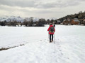
The Crête des Baumes, starting from La Joue du Loup

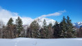
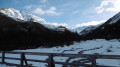
A superb snowshoe hike starting from La Joue du Loup, through magnificent woodland. This route skirts the Crête des Baumes before ascending it. From there, you’ll enjoy an exceptional panoramic view of the entire Champsaur mountain range. This route can also be completed as a regular hike.

Details

n°18685033
Creation:
Last update:
Last review:
  • Snowshoeing
    Activity: Snowshoeing
  • ↔
    Distance: 6.97 mi
  • ◔
    Duration according to the author: 5 hrs 
  • ▲
    Difficulty: Moderate

  • ⚐
    Back to start: Yes
  • ↗
    Ascent: + 1,926 ft
  • ↘
    Descent: - 1,949 ft

  • ▲
    Highest point: 5,636 ft
  • ▼
    Lowest point: 4,249 ft

Photos

Description of the walk

Cross the Col de Rioupes and turn right to reach the Joue du Loup via the D17C. Take the first street on the left, Rue des Chaumattes. Park at the top of the street after the first bend to the right, near some beautiful chalets.

(S/E) Head down into the valley following theGR® de Pays Tour du Devoluy, then climb back up to a junction (shown on the map, but difficult to spot in winter under the snow).

(1) Turn sharply right, staying on theGR®, until you reach another junction.

(2) Ignore the path leading uphill and head left through a wood. You’ll reach the crossroads at the Bergerie du Forest du Puy.

(3) Leave theGRP® here and turn left towards the sheepfold. Walk past it and you’ll come to a wide cross-country ski trail.

(4) Cross it and take the path opposite, which may be completely untouched in winter. Descend into the Bois de Font la Mère and reach the lowest point of this route at the junction marked ‘Les Étroits’.

(5) Turn right, following the balcony-like path towards Les Étroits. At the end of this path, there is another three-way junction.

(6) Take the path on the right to climb between two valleys; follow it through the woods without straying from it, until you emerge onto a wide track and a designated rest area.

(7) Continue to the right and follow the track, which climbs gently, until you reach a clearing and the cross-country ski trails heading towards Super Dévoluy.

(8) Follow the cross-country ski trail to the right for a few metres. Take care to stay on the edges. You’ll reach a Y-shaped junction.

(9) Leave the trail and take the snowshoe path on the left. Climb up, then make a wide left-hand bend. Continue along the Crête des Baumes until you reach the radio masts.

(10) Behind the antennas, take the path that descends steeply and ends at the Collet du Tat. Take care here: the descent along this narrow path can be tricky in snowshoes.

(11) Set off along the snowshoe trail to climb up to a small plateau overlooking La Joue. After this plateau, continue the descent through the woods to reach theGRP® junction you passed on the way out.

(2) Follow the route you took on the way there in the opposite direction to return to the Chaumattes car park (S/E).

Waypoints

  1. S/E : mi 0 - alt. 4,783 ft - Chaumattes car park - Col de Rioupes (1428m)
  2. 1 : mi 0.47 - alt. 4,813 ft - GRP
  3. 2 : mi 0.72 - alt. 4,974 ft - Crossroads of the circular loop
  4. 3 : mi 1.12 - alt. 5,059 ft - Bergerie crossroads
  5. 4 : mi 1.46 - alt. 5,062 ft - Cross-country ski trail
  6. 5 : mi 2.42 - alt. 4,288 ft - Signpost at Les Étroits
  7. 6 : mi 2.88 - alt. 4,491 ft - Three-way junction
  8. 7 : mi 3.28 - alt. 4,895 ft - 1st designated rest area
  9. 8 : mi 3.72 - alt. 5,052 ft - 2nd designated area - Super Devoluy
  10. 9 : mi 3.85 - alt. 5,075 ft - Fork in the road
  11. 10 : mi 4.72 - alt. 5,623 ft - The antennas
  12. 11 : mi 4.93 - alt. 5,295 ft - Small pass of Tat
  13. S/E : mi 6.97 - alt. 4,783 ft - Chaumattes car park

Notes

This snowshoe route can also be completed as a standard hike, although the winter scenery on the Crête des Baumes is exceptional.
Take care when passing close to cross-country ski trails.
Between (2) and (5) Part of this route may be untouched by snowshoes. It is useful to have a GPS or the Visorando app. Snow significantly alters landmarks.

Worth a visit

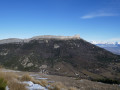
(10) At the top, on the ridges, there is an exceptional panorama of the main massifs of the Champsaur: the Pic de Bure, the Col du Rabou; to the east, the Montagne de Faraut; to the south, the Grand and Petit Ferrand, the Grande Tête de l’Obiou, the Tête de Garnesier, as well as the villages at the bottom of the valleys.

Always be cautious and plan ahead when you're outdoors. Visorando and the author of this route cannot be held responsible for any accidents occurring on this route.

The GR® and PR® markings are the intellectual property of the Fédération Française de Randonnée Pédestre.

Reviews and comments

5 / 5
Based on 1 review

Reliability of the description
5 / 5
Ease of following the route
5 / 5
Route interest
5 / 5
amitié nature
amitié nature

Overall rating : 5 / 5

Date of your route : Jan 06, 2025
Reliability of the description : ★★★★★ Very good
Ease of following the route : ★★★★★ Very good
Route interest : ★★★★★ Very good
Very busy route : No

Route taken in the opposite direction.
Heavy snow, sub-zero temperatures.
After point 5, we joined the road to take the signposted routes via Les Devingas, thereby reducing both the distance and the elevation gain!
The ridge walk between point 6 and point 5, with snow and patches of ice in places, requires a certain level of confidence on snowshoes and careful attention whilst walking.

Machine-translated

lucbultel
lucbultel

Hike undertaken on 1 January 2025; the route was completely covered in snow. A very beautiful route with some elevation gain but no risks. Splendid views at this time of year.
As the route is covered in snow, it is essential to take a GPS with you.

Machine-translated

Other walks in the area

For more walks, use our search engine .

The GPS track and description are the property of this route's author. Please do not copy them without permission.