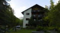
Lodge du Grand Rochebrune – Lodge le Teppio

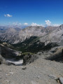
This stage follows part of theGR®® 58, then takes a route offthe GR®® to climb to the Col d’Izoard. Admittedly, this ascent is via the road, but on a day when vehicles are banned, allowing you to enjoy this lunar landscape with its monoliths. The return journey takes you through a deserted ravine. The limestone landscapes of this stage are nothing like those encountered since the start of the Tour du Queyras, which is characterised by slate.

This walk is part of a multi-day hike: Tour complet du Queyras par le GR®58 et ses variantes

Details

3562452
Creation:
Last update:
Last review:
  • Walking
    Activity: Walking
  • ↔
    Distance: 9.80 mi
  • ◔
    Average duration: 6h 50 
  • ▲
    Difficulty: Difficult

  • ⚐
    Back to start: No
  • ↗
    Ascent: + 2,635 ft
  • ↘
    Descent: - 3,176 ft

  • ▲
    Highest point: 7,825 ft
  • ▼
    Lowest point: 5,463 ft

Photos

Description of the walk

(S) From the Grand Rochebrune refuge, cross the top of the hamlet, heading north. Walk past the chapel and the cemetery to reach a wide forest track. Take theGR®® along this path, which climbs gradually through a larch wood, until you reach a junction just before the Souliers sheepfold.

(1) Ignore the path leading to the Souliers sheepfold and continue to the left. After a few hairpin bends, you’ll reach the Col du Tronchet.

(2) Begin the descent and you’ll soon reach the junction of two paths. Leave theGR®®58on your left and take the path, which runs along a ridge, leading to the junction with the Col d’Izoard road. Carry on straight along the path, leaving theGR®® behind, which descends to the left directly towards Brunissard. Pass the path leading up to Lac de Souliers on your right. Continue until you reach the departmental road leading up to the Col d’Izoard at a car park.

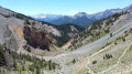
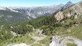
(3) Turn right and walk alongside the road. Admire the scenery on the slopes of the pass, with the monoliths or ‘dames coiffées’, and the ravine to your left. Continue by cutting across the final hairpin bends to reach the Col d’Izoard. From the first hairpin bends, take the footpaths up to the summit.

(4) Continue to the orientation tables.

(5) Return to the Col d’Izoard.

(4) Begin the descent; at thefourth hairpin bend, you’ll come to a crossroads of footpaths.

(6) Turn right here to descend into the ravine along the bed of the Izoard torrent, which is dry at this time of year. The start of the descent takes you through gravel pits. The very rocky and arid landscape is magnificent, completely different from the previous stages. Reach the junction with the path coming from the Lac Souliers car park.

(7) Continue straight on, still descending, until you reach the D902 road above the village of Brunissard.

(8) Follow the road, passing through Brunissard. Reach the end of the village at the junction of theGR®®5andGR®®58paths.

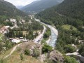
(9) Turn right onto theGR®®58and climb gradually along a ridge above the hamlets. Cross the Ravin de Jalley and continue to a junction at a viewpoint.

(10) Take the path that veers sharply to the left and head down towards the hamlet of La Chalp.
Cross the stream, climb up to a car park, then continue for a few metres along the main road.

(11) Turn right onto the tarmac road to reach the Le Teppio lodge (E).

Waypoints

  1. S : mi 0 - alt. 6,027 ft - Refuge de Rochebrune.
  2. 1 : mi 1.36 - alt. 6,765 ft - GR junction
  3. 2 : mi 2.11 - alt. 7,562 ft - Col du Tronchet
  4. 3 : mi 3.64 - alt. 7,238 ft - Head right, following the road
  5. 4 : mi 4.87 - alt. 7,749 ft - Col d'Izoard
  6. 5 : mi 5.01 - alt. 7,805 ft - Orientation tables
  7. 6 : mi 5.45 - alt. 7,484 ft - Trail junction
  8. 7 : mi 6.14 - alt. 6,808 ft - Trail junction at the Lac Souliers car park
  9. 8 : mi 7.16 - alt. 5,994 ft - D902 road
  10. 9 : mi 7.76 - alt. 5,722 ft - GR5–GR58 junction
  11. 10 : mi 9.04 - alt. 5,735 ft - Viewpoint
  12. 11 : mi 9.72 - alt. 5,515 ft - Crossroads on a tarmac road
  13. E : mi 9.8 - alt. 5,463 ft - Gite le Teppio

Notes

Water sources are scarce on this stage.
Binoculars and a camera are a must. Don’t forget that this 9-day route is a mountain route, which requires good physical fitness and suitable kit, even in summer. The weather changes very quickly, as do temperature fluctuations.

Worth a visit

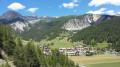
(2) Col Tronchet: enjoy the view of the Pic de Rochebrune, which you will have completely circumnavigated in 24 hours, as well as that of the limestone landscape featuring: the Pic de Beaudouis, the Crête de Combe la Roche, the Pic du Cros and the Pic du Béal Traversier.
Between (3) and (4), the stretch along the road isn’t exactly the most pleasant, but we made the most of the pass being closed to cars. In fact, every summer the pass is closed to cars for one morning in July and August to allow cyclists to enjoy the pass in complete peace. This section of the route allows you to stop for a few moments at the Casse Déserte memorial, erected here in memory of two heroic Tour de France cyclists: Fausto Coppi, the Italian, and Louison Bobet, the Frenchman.
(4) The Col de l’Izoard: a legendary Alpine pass on a par with the Galibier. The pass is marked by a memorial, unveiled in August 1934, paying tribute to the work of General Baron Berge and the Alpine troops responsible for building the Col de l’Izoard road.
(4) The Col de l’Izoard, situated at an altitude of 2,361 metres within the municipality of Arvieux, lies near the Pic de Rochebrune (3,308 metres) and below the Pic Ouest de Cote Belle (2,854 metres). It is one of the gateways to the valley and the Queyras Regional Nature Park, and marks the boundary between the Briançonnais and the Queyras. It gained fame through the Tour de France, amongst other things, and is part of the Route des Grandes Alpes.
(5) Viewpoints: offering views of the northern slope and the Briançonnais region:
- in the distance, the Thabor,
- below, the road to the Napoléon refuge.
(E) Gîte le Teppio: an excellent stopover lodge, with magnificent spots for camping. The food served there is very generous and of high quality.

Always be cautious and plan ahead when you're outdoors. Visorando and the author of this route cannot be held responsible for any accidents occurring on this route.

The GR® and PR® markings are the intellectual property of the Fédération Française de Randonnée Pédestre.

Other walks in the area

For more walks, use our search engine .

The GPS track and description are the property of this route's author. Please do not copy them without permission.