The ‘Trace des Caps’ trail, from Anse des Chevaliers to Grande Anse

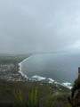
A coastal walk, known as the Trace des Cap, where you’ll pass successively through Baie des Anglais and Savane des Pétrifications, before reaching Pointe des Salines and Grande Anse. Throughout this easy, yellow-marked route, you’ll follow signposts – a sort of marker system – that will help you identify the various sites and track the kilometres covered. You’ll enjoy fabulous panoramic views of one of the most barren areas of Martinique: a striking contrast to the north of the island and its tropical vegetation.

Details

21031755
Creation:
Last update:
Last review:
  • Walking
    Activity: Walking
  • ↔
    Distance: 9.67 mi
  • ◔
    Average duration: 4h 30 
  • ▲
    Difficulty: Moderate

  • ⚐
    Back to start: No
  • ↗
    Ascent: + 98 ft
  • ↘
    Descent: - 102 ft

  • ▲
    Highest point: 72 ft
  • ▼
    Lowest point: 0 ft

Photos

Description of the walk

To go on this walk, you’ll need to leave one car at Grande Anse beforehand.
Park yoursecond vehicle in the car park at Pointe Michel.
To get there from Grande Anse: take the D9 to the roundabout near Poirier. Turn right onto the D33, then leave it to pass through Barrière La Croix, then Cap Chevalier, leading to the Anse Michel/Cap Chevalier car park.

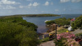
(S) Before starting the route, you can climb to the top of a beautiful observation tower here, offering a magnificent panoramic view, particularly of Îlet Chevalier.
Then head right onto the coastal path known as the Forêt Domaniale du Littoral. Follow the coastline without straying from it, taking the lovely wooden footbridges through the mangroves to reach Pointe Marignan.

(1) Pass this point and Pointe Coton, where you’ll catch sight of Îlet Chevalier or Îlet Lézard. Continue along a long circular loop, first to the right then to the left, to reach the northern end of Baie des Anglais.

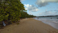
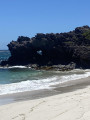
(2) Head due south again, passing the wayside shrines, then the Chapel of Our Lady of the Coolies, followed by the Chapel of Our Lady of the Sailors. These magnificent headlands offer stunning views, including the ruins of a mill near the first chapel. You’ll then emerge at the Anse Trabaud car park and its splendid, unspoilt beach.

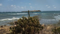
(3) Leave thePR® here and walk along the beautiful, long beach. About a hundred metres further on, rejoin thePR® to reach the Savane des Pétrifications and its jagged coastline where the waves come crashing ashore. You will then reach the Pointe d’Enfer.

(4) Continue along the path to reach, in turn, Anse Braham and then Anse Écluse. Next, make your way through a marshy area, cross a ford over very slippery rocks (which may sometimes be submerged) and cross a small bridge. Offshore, you’ll spot the Table du Diable, a small islet. You’ll then arrive at Anse aux Prunes, with Îlet Cabrits—Martinique’s southernmost point—visible offshore.

(5) Continue through the woodland along the beautiful Grande Terre beach, the Pointe des Salines, to finish at the magnificent Grande Anse des Salines beach. Carry on to the Grande Anse car park to retrieve thesecond vehicle (E).

Waypoints

  1. S : mi 0 - alt. 10 ft - Anse Michel/Cap Chevalier car park
  2. 1 : mi 0.98 - alt. 13 ft - Pointe Marignan
  3. 2 : mi 3.65 - alt. 3 ft - Baie des Anglais
  4. 3 : mi 6.29 - alt. 7 ft - Car park at the - Plage de l'Anse Trabaud
  5. 4 : mi 7.79 - alt. 49 ft - Pointe d’Enfer - Savane des Pétrifications
  6. 5 : mi 8.37 - alt. 10 ft - Anse aux Prunes
  7. E : mi 9.67 - alt. 7 ft - Grande Anse car park - Plage de la Grande Terre des Salines

Notes

There are no water sources (only along Grande Terre), so set off early on your hike; otherwise, make sure you bring plenty of water.
Don’t forget a cap, sun cream, sunglasses and a swimsuit to make the most of the magnificent swimming spots.

Worth a visit

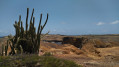
Between (3) and (4), this section resembles a desert, a barren landscape devoid of vegetation – an arid, almost desert-like area, apart from a few cacti. This place is known as ‘Pétrification’ due to the large number of petrified trees. Fossils were once collected here and have since disappeared.
Before (E) at Pointe des Salines: this is the time to enjoy the beach and a swim. All along this beach, you can easily grab a bite to eat at small beachside restaurants.

Always be cautious and plan ahead when you're outdoors. Visorando and the author of this route cannot be held responsible for any accidents occurring on this route.

The GR® and PR® markings are the intellectual property of the Fédération Française de Randonnée Pédestre.

Reviews and comments

4.2 / 5
Based on 3 reviews

Reliability of the description
4.3 / 5
Ease of following the route
4.3 / 5
Route interest
4 / 5
villeret gilbert
villeret gilbert

Overall rating : 4 / 5

Date of your route : Apr 20, 2026
Reliability of the description : ★★★★☆ Good
Ease of following the route : ★★★★☆ Good
Route interest : ★★★★☆ Good
Very busy route : No

A lovely, peaceful walk, almost on my own. On Cap Chevalier beach, where there are lots of kitesurfers, the sargassum isn’t too much of a nuisance—or perhaps not at all. Then, heading north towards Cap Macré, Cap Ferré and the two Macabou beaches, the smell can sometimes be unpleasant; it all depends a bit on the wind.The staff at Le Vauclin council are doing everything they can, with their limited resources, to try and clean up Petit Macabou beach!!! But it’s a never-ending task!!!! You need a lot of stamina to do this sort of work!! I did the Cap Chevalier–Petit Macabou round trip in three stages.

Machine-translated

User 23127146

Overall rating : 4.7 / 5

Date of your route : Mar 11, 2026
Reliability of the description : ★★★★★ Very good
Ease of following the route : ★★★★★ Very good
Route interest : ★★★★☆ Good
Very busy route : No

A superb route along the coast. As you have to get from point A to point B, I decided to leave my car at Salines beach and book a taxi to take me to Cap Chevalier so I could pick up my car at the end. There are no particular difficulties, as it's flat. If you take your time, it takes about 3 hours and 45 minutes...
The route is fairly shaded, but don't forget your sun cream!
For the taxi details, I contacted Taxi Cap in Ste Anne the day before on 0696707444 and then confirmed 30 minutes before arriving (the fare was €40, negotiated down to €30).

Machine-translated

pascal ga
pascal ga

Overall rating : 4 / 5

Date of your route : Mar 02, 2026
Reliability of the description : ★★★★☆ Good
Ease of following the route : ★★★★☆ Good
Route interest : ★★★★☆ Good
Very busy route : No

A very beautiful short hike to do

Machine-translated

Other walks in the area

For more walks, use our search engine .

The GPS track and description are the property of this route's author. Please do not copy them without permission.