The Pic de Chamatte, starting from Vergons

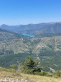
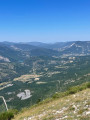
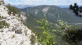
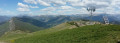
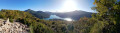
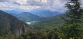
A very lovely walk leading to the Pic de Chamatte at an altitude of 1,879 metres. This walk may prove challenging due to the elevation gain for inexperienced walkers. However, there are no technical sections. Only the descent requires a sense of direction. The path, although marked on the map, is barely visible in places. From the summit, a magnificent 360° view awaits you, taking in the Mercantour, the Verdon massifs and Lac du Castillon.

Details

3251677
Creation:
Last update:
Last review:
  • Walking
    Activity: Walking
  • ↔
    Distance: 8.95 mi
  • ◔
    Average duration: 6h 35 
  • ▲
    Difficulty: Difficult

  • ⚐
    Back to start: Yes
  • ↗
    Ascent: + 2,815 ft
  • ↘
    Descent: - 2,815 ft

  • ▲
    Highest point: 6,135 ft
  • ▼
    Lowest point: 3,389 ft

Photos

Description of the walk

Take the N202 towards Vergons. Park on the second street leading into the village.

(S/E) From there, head towards the centre, then take the first street on the right to leave the village until you reach a ford.

(1) Take the track that climbs to the left before the ford and pass the first junction. Yellow markings.

(2) Carry on straight ahead, ignoring the path coming from the right, which will be the return route. Continue to another junction.

(3) Turn left onto the track and continue to another junction, where several paths branch off. Ahead of you, the track has a Fork in the road.

(4) Continue climbing along the track on the right (ignore all the small paths), which winds upwards in two large hairpin bends to a restored shelter at an altitude of 1280 metres. The view is already stunning, with Lac du Castillon coming into view, along with Pré-chauvin and Castellard. Pass the shelter and continue along the path, which runs along a ledge and then winds in hairpin bends, narrowing as it leads to a junction at an altitude of 1540 metres.

(5) Continue left along this path, which runs along a ledge, straight ahead, towards the summit of the Crêtes de Chamatte. At the summit, the view is very clear, offering a glimpse of the Verdon peaks behind Lac de Castillon.

(6) Continue to the right, through the larch trees, to the cairn at the edge of the ridge.

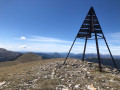
(7) The slope is steep up to the summit masts of Chamatte.

(8) From the top of the peak, there is a 360° panorama. To the north, the first peaks of the Mercantour, the main ones being the Puy de Rent, the Grand Coyer and the Estrop; to the side of Lac du Castillon, in the distance the Grand Marges, the Grand Mourre, the Mourre Charnier and the Chiran; then, in the foreground, the Castellard and the Chauvin; further south, the Teillon, the Crêtes de la Bernarde, the summit of the Gourre and, in the background, the highest point in the Var, Mont Lachen.
For the return journey, turn back as far as the first larch trees, marked by a cairn on the edge of the ridge.

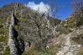
(7) At this point, turn sharply left and begin the descent along a treeless ledge. It would appear that a fire destroyed this former larch forest. The descent follows a series of switchbacks on ground that is sometimes unstable. Take care, as the path is sometimes difficult to follow. The markings are still yellow.
The path descends rapidly.
At an overhang overlooking Lac du Castillon, a junction is marked by a cairn (at around 1530 m).

(9) You have two options:

  • Either continue along the ledge following the yellow markings, straight ahead, which ensures you stay on the right track. You’ll arrive back at point 5; head down to the left to return to the start of the walk.
  • The second option (the one we chose), which is the trickier in terms of finding your way. Leave the yellow markings and take the path that winds down to the left, zigzagging between two ravines.

Please note: as this path is rarely used and is overgrown, the trail is sometimes difficult to make out. After this long descent, you’ll come out onto a wide track.

(10) Head left for a few hundred metres. Before a large bend, you’ll come to a junction with a signpost indicating the return route to Vergons; follow the yellow markings again.

(11) Leave the track and turn sharply right onto the path that rejoins the track you started on.

(2) Turn left and head back to the village and your starting point (S/E)..

Waypoints

  1. S/E : mi 0 - alt. 3,392 ft - N202, towards Vergons (second street)
  2. 1 : mi 0.16 - alt. 3,425 ft - Path leading uphill to the left before the ford
  3. 2 : mi 0.52 - alt. 3,691 ft - Crossroads of the circular loop
  4. 3 : mi 0.72 - alt. 3,825 ft - Take the wide path on the left.
  5. 4 : mi 1.02 - alt. 3,901 ft - Ascent via the track on the right
  6. 5 : mi 2.86 - alt. 5,052 ft - To the left, a balcony path. Or the junction for the circular path. View - Lac de Castillon
  7. 6 : mi 3.56 - alt. 5,335 ft - To the right, through the larch trees
  8. 7 : mi 4.1 - alt. 5,797 ft - Cairn. Fork in the path: access to the summit
  9. 8 : mi 4.38 - alt. 6,099 ft - Antenna - Pic de Chamatte
  10. 9 : mi 6.07 - alt. 5,003 ft - Two options: towards point 5 or to the left
  11. 10 : mi 7.82 - alt. 3,904 ft - Turn left at the fork
  12. 11 : mi 8 - alt. 3,885 ft - Right-hand hairpin bend
  13. S/E : mi 8.95 - alt. 3,389 ft - N202, towards Vergons (second street)

Notes

Admittedly, this hike does not present any major technical difficulties, but the elevation gain is substantial, reaching over 800 m, and requires a good level of fitness.
A good knowledge of navigation and map-reading is essential if you choose the path leading down to point (9) on the left. A possible alternative route is described in the itinerary.
You’ll need good walking boots, binoculars, water, an IGN map, and of course a camera to capture the panoramic views.
This walk is best done in spring, to enjoy the colours and the flora.

Reviews and comments

4.7 / 5
Based on 3 reviews

Reliability of the description
4.3 / 5
Ease of following the route
5 / 5
Route interest
4.7 / 5
FIGEROU
FIGEROU

Overall rating : 5 / 5

Date of your route : Nov 17, 2024
Reliability of the description : ★★★★★ Very good
Ease of following the route : ★★★★★ Very good
Route interest : ★★★★★ Very good
Very busy route : No

A lovely walk with stunning views throughout, particularly at the summit.
Alternative start: I preferred to set off from the village centre and take the Chamatte path, which climbs straight up above and joins the track at a bend (path marked on IGN maps)
On the descent (option 2), the path is blocked by a few trees, but it’s not too much of a hindrance.

Machine-translated

abeauville
abeauville

Overall rating : 4.7 / 5

Date of your route : Sep 27, 2021
Reliability of the description : ★★★★★ Very good
Ease of following the route : ★★★★★ Very good
Route interest : ★★★★☆ Good
Very busy route : No

A lovely walk, with a stunning view from the summit. We had no trouble finding the signposted descent route. However, the descent is quite long, with an impressive number of hairpin bends and sections that are almost level.

Machine-translated

bobine63
bobine63

Overall rating : 4.3 / 5

Date of your route : Aug 04, 2020
Reliability of the description : ★★★☆☆ Average
Ease of following the route : ★★★★★ Very good
Route interest : ★★★★★ Very good
Very busy route : Yes

Set off from the car park signposted in the village and take the “Chemin du Pic de Chamatte”, which joins the track between points 2 and 3; after that, it’s plain sailing to the summit.
On the descent, we tried the path on the left at point 9 and, to be honest, I wouldn’t recommend it: between the scree, the broom and the fallen trees, we found it very difficult to follow the trail to point 10.
We then returned to the start via the forest track and stopped off at the wash house in the village.

Machine-translated

Other walks in the area

For more walks, use our search engine .

The GPS track and description are the property of this route's author. Please do not copy them without permission.