Dormillouse Fort and Pic de Bernardez circular walk from Seyne

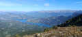
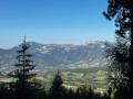
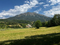
A very beautiful walk with 360° panoramic views, between La Blanche, the Ubaye and Serre Ponçon. An easy initial climb to the Fort de Dormillouse, with its 360° panorama (Serre Ponçon, the Ecrins, Le Champsaur, the Devoluy, the Ubaye, the Mercantour, the Cheval Blanc…), followed by a walk to the Lacs du Milieu and Lac Noir, before ascending the Pic de Bernardez. A challenging route with a few technical sections along the ridge.

Details

n°107657378
Creation:
Last update:
Last review:
–
  • Walking
    Activity: Walking
  • ↔
    Distance: 12.05 mi
  • ◔
    Average duration: 8h 35 
  • ▲
    Difficulty: Very difficult

  • ⚐
    Back to start: Yes
  • ↗
    Ascent: + 3,514 ft
  • ↘
    Descent: - 3,501 ft

  • ▲
    Highest point: 8,209 ft
  • ▼
    Lowest point: 6,204 ft

Photos

Description of the walk

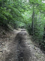
From Seyne-les-Alpes, head towards the village of Saint-Pons, then take the small road leading to the Bellevue forest lodge. This tarmac road turns into a forest track as it approaches the Col Bas car park.

(S) From the Col Bas car park, take the track above the car park and head due south, following the signposts.

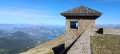
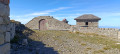
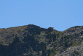
(1) At a junction, take the track on the left and continue straight on, leaving the Col Bas path on your right. The track, running along a ridge above the Monclar resort, narrows with a series of sharp bends flanked by impressive rock faces. You’ll first reach a lovely orientation point offering a 360° panorama over Lake Serre-Ponçon, then the Fort de Dormillouse.

(2) Begin the descent towards a south-facing ski lift.

(3) Turn left and descend, passing under the Dormillouse ski lift three times. At an altitude of 2176, the path descends to the right towards Lac Noir.

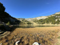
Shortly before reaching the lake, take the path that descends to the left towards Lac du Milieu.

(5) Return to the previous junction. From there, follow the path to the left to Lac Noir and go round it on the left. Continue straight on along the PR® to the bottom of the Vallon du Loup, then head slightly uphill without leaving the PR® (the path furthest to the left). Reach the pastures of the Vallon de Provence, a wetland area, then the Col Bas.

Please note that you are in a pastoral area; there may be sheep accompanied by sheepdogs. On your left is a shepherd’s cottage.

(6) From the Col Bas, head left, towards the south. The slope gradually steepens until you reach the foot of the Pic de Bernardez. Take a moment to admire the view along this stretch. Begin the ascent of the Pic de Bernardez; the slope is steep but not difficult.

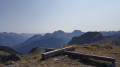
(7) At the summit, there is a beautiful cross and, once again, a 360° panorama. From the peak, begin the descent to the pass. Please note: this very steep and technical descent along the ridge may be daunting for those prone to vertigo.

(8) At the Col de Bernardez, begin the descent along a balcony path, taking the GR®6 – GR®69 on the right.

(9) During the descent, leave the GR® trails and follow a narrow path to the right along the ridge. This narrow, ridge-top path overlooks the GR®, with a few sections of scree, and leads onto the Col Bas forest track.

(10) Follow it to the right until you reach the original junction.

(1) Head down to the left, retracing your steps from the outward journey, and return to the car park (S/E).

Waypoints

  1. S/E : mi 0 - alt. 6,211 ft - Col Bas car park
  2. 1 : mi 0.59 - alt. 6,470 ft - Junction of the circular loop
  3. 2 : mi 3.88 - alt. 8,192 ft - Dormillouse (sommet de)
  4. 3 : mi 4.04 - alt. 8,077 ft - Fork
  5. 4 : mi 5.25 - alt. 6,995 ft - Junction – Access to Lac du Milieu - Lac Noir (vallée de l'Ubaye)
  6. 5 : mi 5.71 - alt. 6,729 ft - Lac du Milieu
  7. 6 : mi 7.63 - alt. 6,926 ft - Col Bas (2112m)
  8. 7 : mi 9.16 - alt. 7,956 ft - Pic de Bernardez (2430m)
  9. 8 : mi 9.58 - alt. 7,539 ft - GR junction - Col de Bernardez (2304m)
  10. 9 : mi 10.3 - alt. 7,031 ft - Leaving the GR – Balcony path
  11. 10 : mi 11.09 - alt. 6,581 ft - Crossroads
  12. S/E : mi 12.05 - alt. 6,211 ft - Col Bas car park

Notes

Please note: After the forest lodge, the forest road is unpaved. The road turns into a track which may have been affected by the weather, so take care if you are driving a low-clearance vehicle. I advise you to ring the Seyne-les-Alpes tourist office, which will provide information on the condition of the forest road: Telephone:04 92 35 11 00

Please note: Between the area marked (5) and (6), you are in a pastoral area. Manyherds are guarded by Patou sheepdogs. Hikers are therefore strongly advised not to stray from the path. If you encounter a guard dog, remain calm and passive to reassure it.

Worth a visit

Dormillouse Fort: https://www.tourisme-alpes-haute-provence.com/visites-et-musees/4490171_site-et-monument-historique-montclar-batterie-de-dormillouse/

Built in 1862, this fortress formed part of the Southern Alps’ defence system against Italy.

The military had named it “Batterie du Col Bas”, even though it stands on a peak whose traditional local name is Dormillouse – meaning “the sleeper”, which is the common name for the marmot.
The Col Bas is several hours’ walk away; until the 19th century, this pass was, in fact, the busiest route for travelling from Seyne to Ubaye.
From its height of 2,505 metres, it overlooked the Ubaye Valley and controlled access to the pass; above all, its elevated position was deliberately chosen to enable warnings to be issued of the arrival of Italian forces, from Grenoble to Toulon. Two posts equipped with telescopes were in use until 1918. The hairpin bends in the road were so steep that everyone had to unhitch their horses, turn the cannons by hand and re-hitch them.
The oldest residents of the valley recount that the soldiers stationed at Dormillouse, who were thoroughly bored, would organise dances to amuse themselves and bring the local girls from the canton there on the backs of mules. In 2002, the battery was restored by the CCVUSP (Community of Communes of the Ubaye-Serre-Ponçon Valley) to serve as a mountain refuge.
Accessible by foot from the chairlift, the resort or the Col Bas, it offers breathtaking views of the Ubaye Valley, the Blanche Valley and Lake Serre-Ponçon. It promises an invigorating historical experience combined with magnificent views.

Always be cautious and plan ahead when you're outdoors. Visorando and the author of this route cannot be held responsible for any accidents occurring on this route.

The GR® and PR® markings are the intellectual property of the Fédération Française de Randonnée Pédestre.

Other walks in the area

For more walks, use our search engine .

The GPS track and description are the property of this route's author. Please do not copy them without permission.