La Monta Mountain Hut – Abriès Campsite

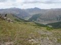
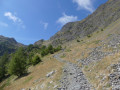
Thisfourth stage is a variant ofthe GR® route, setting off from the Refuge de la Monta and heading to the Abriès winter caravan site. The hike begins with a challenging section through larch forests to reach the Crêtes de Peyra-Plata and then the Crêtes de Gilly. The path follows a beautiful ridge line offering views to the south of the Grand Queyras, Le Viso, the Crêtes de Taillante and the Ristollas Valley, and to the north of the Tête du Pelvas, the Bric Bouchet, the Bric Froid, the Grand Glaiza and the Pic de Roquebrune.

This walk is part of a multi-day hike: Tour complet du Queyras par le GR®58 et ses variantes

Details

n°3562449
Creation:
Last update:
–
Last review:
  • Walking
    Activity: Walking
  • ↔
    Distance: 8.69 mi
  • ◔
    Average duration: 6h 40 
  • ▲
    Difficulty: Difficult

  • ⚐
    Back to start: No
  • ↗
    Ascent: + 3,114 ft
  • ↘
    Descent: - 3,543 ft

  • ▲
    Highest point: 8,497 ft
  • ▼
    Lowest point: 5,066 ft

Photos

Description of the walk

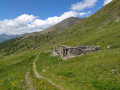
(S) From the campsite at the Refuge de la Monta, behind the Monta cemetery, turn right onto theGR®58alternative route and begin climbing the path that winds through the pastures to reach a larch forest. At the start of the season, the vegetation is dense. Do not stray from the main path.
After the woodland, you’ll reach a more arid landscape at the foot of the Tête du Pelvas, opposite the Bergerie du Pelvas.

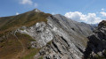
(1) Continue on to reach thefirst ridge, the Peyra Plata ridge. At the summit, the panorama offers a fabulous view over the whole of the Queyras National Park.
Follow the ridge line to the left, from cairn to cairn, to reach the Crête de Gilly.

(2) Begin the descent opposite, down the Colette de Gilly. This is a slightly technical section, with rocky ground consisting mainly of slate. Reach the Colette de Gilly and rejoin theGR®58here, which climbs up from Ristolas.

(3) Turn right and descend towards the Bois Noir and the valley. Enter the woods again to reach a junction offering a new alternative route.

(4) Let theGR®58alternative route branch off to the right. Continue straight on through the woodland on theGR®58. You’ll reach a crossroads at Bois Noir.

(5) Please note: do not follow theGR® route shownon the IGN map, but the route indicated on the attached map. This is because the originalGR® route has been slightly altered compared to the map as it crosses the Bois Noir. The path runs along a ridge whilst gradually descending. You will reach another junction.

(6) Continue along theGR®, ignoring the alternative route on the right which heads down to the village of Le Roux, until you reach a wide track. Follow this for several hundred metres until you come to a path that continues to the right. Further on, you’ll reach the junction with a forest track.

(7) Continue straight on down towards Abries until you reach another junction. Turn sharply left, then right at the next junction, until you reach the village of Abriès.

(8) Walk through the village, turning right along the Bouchet stream until you reach the centre. Then follow the D941 towards Ristolas. The campsite (E) is at the bottom of the village, at the foot of the chairlifts.
Waypoints

  1. S : mi 0 - alt. 5,502 ft - Refuge de la Monta
  2. 1 : mi 1.64 - alt. 7,382 ft - Beneath the Tête de Pelvas
  3. 2 : mi 3.35 - alt. 8,465 ft - La crête de Peyra Plata et de Gilly
  4. 3 : mi 4.01 - alt. 7,769 ft
  5. 4 : mi 4.59 - alt. 7,201 ft - GR junction and its alternative route
  6. 5 : mi 5 - alt. 6,713 ft - New GR58 junction
  7. 6 : mi 5.56 - alt. 6,473 ft - GR junction and its alternative route
  8. 7 : mi 6.7 - alt. 6,175 ft - Forest track junction
  9. 8 : mi 8.26 - alt. 5,092 ft - Abriès
  10. E : mi 8.69 - alt. 5,069 ft - Abries Winter Caravan Campsite - Guil (rivière)

Notes

(E) The welcome at the restaurant and campsite is warm, friendly and welcoming. The owner is a hiking guide, both in summer and winter, and offers valuable advice.
There are plenty of water sources throughout this stage.
Binoculars and a camera are essential. Don’t forget that this 9-day route is a mountain trek, which requires a good level of fitness and suitable equipment, even in summer. The weather can change very quickly, as can temperature fluctuations.

Worth a visit

(E) Abriès
Note: Having opted to camp during this trip, we pitched our tent at the Abriès winter caravan campsite: Chez Pilou.

Always be cautious and plan ahead when you're outdoors. Visorando and the author of this route cannot be held responsible for any accidents occurring on this route.

The GR® and PR® markings are the intellectual property of the Fédération Française de Randonnée Pédestre.

Reviews and comments

5 / 5
Based on 1 review

Reliability of the description
5 / 5
Ease of following the route
5 / 5
Route interest
5 / 5
Nono 88
Nono 88

Overall rating : 5 / 5

Date of your route : Jul 17, 2023
Reliability of the description : ★★★★★ Very good
Ease of following the route : ★★★★★ Very good
Route interest : ★★★★★ Very good
Very busy route : Yes

We set off from the Agnel mountain hut (not a very nice place! They’re only interested in making money! Too commercial! Too forward with the walkers – they even do their washing outside in the old bath!) As for the route itself, no complaints – it was brilliant.

Machine-translated

Other walks in the area

For more walks, use our search engine .

The GPS track and description are the property of this route's author. Please do not copy them without permission.