Saint-Véran – Agnel Mountain Hut

This is the second stage ofthe GR®58, but it takes a variant route via the Col de Saint-Véran or the Col de la Cavale and includes an ascent to an altitude of 3,000 metres, to the Pic de Caramantran. There’s a magnificent view of Mount Viso at the highest point of this route. At the start of the season, there were still plenty of snowfields. A very wild route, which I recommend as an alternative to the Col de Chamoussiére path, which tends to be quite busy.

This walk is part of a multi-day hike: Tour complet du Queyras par le GR®58 et ses variantes

Details

3562446
Creation:
Last update:
Last review:
  • Walking
    Activity: Walking
  • ↔
    Distance: 9.64 mi
  • ◔
    Average duration: 7h 55 
  • ▲
    Difficulty: Difficult

  • ⚐
    Back to start: No
  • ↗
    Ascent: + 3,963 ft
  • ↘
    Descent: - 2,103 ft

  • ▲
    Highest point: 9,882 ft
  • ▼
    Lowest point: 6,398 ft

Photos

Description of the walk

(S) This new stage starts from the Gîte des Gabelous in Saint-Véran. Take the tarmac road, the D5, which you used to climb the day before, and carry on straight ahead, heading south-east. Follow the red and white markings ofthe GR® 58.

(1) At the first junction, take the wide track that descends to the right towards the bed of the Aigue Blanche stream.

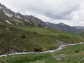
(2) Cross the Pont Vieux and continue to the left, along the left bank of the river. The forest track climbs gradually to the edge of the larch forest and at the foot of the Pointe des Marcelettes, the Pic Marcel, the Pointe des Avers and the Tête de Longuet.
You will then come out onto a footpath. The slope becomes steeper. To the left lies the Pic de Château Renard and its observatory, at nearly 3,000 m. Before beginning the ascent through the larch trees, you will see the remains of the old Saint-Véran copper mines on the left. Continue towards the Clausis Chapel until you reach a wide track.

(3) Continue along the track to the right for about 300 metres, until you reach another junction.

(4) Turn left and climb up to the beautiful Clausis Chapel. Walk past the chapel and take a path back to the previous junction.

(3) Turn right onto the path which climbs steeply to the right towards the Col de Chamoussière and the Col de Saint-Véran on theGR®58. You’ll reach a junction at the Rocher des Marrous.

(5) Leave theGR®58, which climbs directly to the Col de Chamoussière. Continue straight on along the path leading directly to the Col de la Cavale or Saint-Véran and the Pic de Caramantran. At the start of the season, there are still numerous snowfields at this altitude.
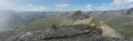
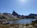
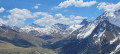
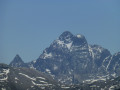
The landscape has become very rocky and the ground is covered in slate. Upon reaching the pass, you can enjoy a unique view of Monte Viso, Italy’s highest peak at 3,800 metres, covered in a thick blanket of snow and ice. From there, you can see the Rocca-Bianca, the Tête des Toillies, the Tête de Longuet and the Péouvou, to name but a few.

(6) Head left, following the slate-covered ridge – there is no real path – to reach the summit of the Pic de Caramantran, which overlooks the valley and the Col Agnel on the northern slope. The drop-off is impressive, offering a unique view of Mont Viso and Italy, and to the north, the Grand Queyras, the Pain de Sucre, and so on.

(7) Then descend due west towards the Col de Chamoussiére. Take care, as the ground is very unstable.

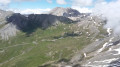
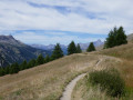
(8) Continue the descent to the right, towards the refuge and the Col Agnel, which you can see below. The path crosses a very rocky landscape, sometimes passing through gravel pits, slate and scree slopes. You’ll reach a first junction leading directly to the refuge, which you should leave on your left. Carry on straight ahead until the next junction.

(9) Take the path on the right to reach Col Agnel. At this point, the peace and quiet comes to an end, but the view is well worth the effort.

(10) Retrace your steps back to the previous junction.

(9) Carry on straight ahead to the magnificent Refuge Agnel. The campsite is on the other side of the road, more than 200 m from the refuge (E).

Waypoints

  1. S : mi 0 - alt. 6,608 ft - Gîte des Gabelous
  2. 1 : mi 0.34 - alt. 6,588 ft - Wide track on the right
  3. 2 : mi 0.94 - alt. 6,401 ft - Pont Vieux on the - Aigue blanche
  4. 3 : mi 3.83 - alt. 7,674 ft - Track on the right - Mine de Cuivre de Saint-Véran
  5. 4 : mi 4.01 - alt. 7,799 ft - Junction at - La chapelle de Clausis
  6. 5 : mi 4.81 - alt. 8,146 ft - Carrefour des Marrous
  7. 6 : mi 6.21 - alt. 9,331 ft - Col de Saint-Véran
  8. 7 : mi 6.92 - alt. 9,882 ft - Pic de Caramantran
  9. 8 : mi 7.27 - alt. 9,472 ft - Col de Chamoussière
  10. 9 : mi 8.58 - alt. 8,661 ft - Junction for a return trip to the Col Agnel
  11. 10 : mi 8.91 - alt. 8,986 ft - Col Agnel
  12. E : mi 9.64 - alt. 8,442 ft - Refuge Agnel

Notes

There are plenty of water sources throughout this stage.
Binoculars and a camera are a must. Don’t forget that this 9-day route is a mountain route, which requires a good level of fitness and suitable kit, even in summer. The weather can change very quickly, as can temperature fluctuations.

Worth a visit

The Pic de Caramantran is an absolute must-do, with no major technical difficulties for a 3,000-metre peak.

(4) The Clausis Chapel is also well worth a visit
Formerly known as the Chapel of Cloussis or the Chapel of Crousis, built in 1846 and renovated in 1988, the chapel is the venue for a celebration held in honour of Our Lady of Mount Carmel every year on 16 July, bringing together the people of Queyrassins from Saint-Véran and the Italians from Chianale. Excerpt
(7) Pic de Caramantran: view of Monte Viso: this peak is situated in the Italian Piedmont but borders the territory of the Queyras Regional Nature Park; it is the highest peak in the Cottian Alps (3,841 m), hence its name, the ‘Giant of the Cottian Alps’.
You may be lucky enough to see the famous fog known as ‘Nebbia’, which rises from the Po Valley and stops at the border.

Always be cautious and plan ahead when you're outdoors. Visorando and the author of this route cannot be held responsible for any accidents occurring on this route.

The GR® and PR® markings are the intellectual property of the Fédération Française de Randonnée Pédestre.

Reviews and comments

5 / 5
Based on 2 reviews

Reliability of the description
5 / 5
Ease of following the route
5 / 5
Route interest
5 / 5
Playmobil voyageur
Playmobil voyageur

Overall rating : 5 / 5

Date of your route : Oct 12, 2025
Reliability of the description : ★★★★★ Very good
Ease of following the route : ★★★★★ Very good
Route interest : ★★★★★ Very good
Very busy route : No

I was lucky enough to have a magnificent day.
A very beautiful hike with a possible variation along the ridges (following the Col de St Véran)
Take the time to climb Pic Caramatran, the view over the whole of Queyras is exceptional.
The climb is not dangerous or exposed at all.
In good weather, you can see Mont Blanc.

Machine-translated

willy.jespers@telenet.be

Overall rating : 5 / 5

Date of your route : Mar 13, 2023
Reliability of the description : ★★★★★ Very good
Ease of following the route : ★★★★★ Very good
Route interest : ★★★★★ Very good
Very busy route : Yes

There are lots of very interesting details:
the duration, difficulty and elevation gain

Machine-translated

Other walks in the area

For more walks, use our search engine .

The GPS track and description are the property of this route's author. Please do not copy them without permission.