


Very few water sources, apart from at the mountain hut.
No water available on Route 2 in summer.
Take your binoculars to spot chamois and ibex.
Please note: you are in the mountains, where the weather can change quickly, so make sure you bring rainwear and warm clothing, even in summer.
High-top hiking boots seem to me to be the best choice for the scree slopes.
The Tête de l’Estrop over two days


A lovely two-day route. Ideal for a weekend trip. Thefirst day is straightforward, taking you to the Refuge de l’Estrop. Thesecond stage is physically very demanding, featuring technical sections that can be daunting when crossing the scree slopes.
Some truly exceptional panoramic views await you at the Baisse de l’Estrop and, above all, at the summit of the Estrop.
Details
Creation:
Last update:
Last review:
-
 Activity: Walking
-
 Distance: 11.91 mi
-
 Average duration: 2 days
-
 Difficulty: Difficult
-
-
 Back to start: Yes
-
 Ascent: + 5,732 ft
-
 Descent: - 5,728 ft
-
-
 Highest point: 9,616 ft
-
 Lowest point: 5,728 ft
-
 Country:
France
-
 Areas: Alps, Trois-Évêchés
-
 City:
Allos (04260)
-
 Start/End: N 44.283751° / E 6.572326°
-


 Hour-by-hour weather
Photos


Stages of the route
This route needs several days, find the details below:
Notes
Reviews and comments
5 / 5
Based on 1 review
Reliability of the description
5 / 5
5 / 5
Ease of following the route
5 / 5
5 / 5
Route interest
5 / 5
5 / 5

Stephorchillers
Overall rating : 5 / 5
Date of your route : Sep 23, 2023
Reliability of the description : ★★★★★ Very good
Ease of following the route : ★★★★★ Very good
Route interest : ★★★★★ Very good
Very busy route : No
A one-day hike, but with the addition of the ascent of the Tête de l’Estrop, and a return via the Baisse de l’Aiguille.
A superb route, though quite difficult in places. The path is damaged or even non-existent in certain sections.
Machine-translated
Other walks in the area
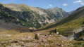
La Foux D’Allos – Refuge de l’Estrop
 Visorando Member
 4.20 mi
+2,215 ft
-1,276 ft
3h 50
 Moderate
 Departure from Allos (Alpes-de-Haute-Provence)
Thefirst stage of this two-day route. An easy day’s walk to get you properly warmed up for the next day’s stage. The ascent of the Baisse de l’Auriac is gentle. At the pass, there’s a magnificent view of the Tête de l’Auriac, the Bléone valley and the Mercantour.
Descent from Valdemars
 Tourist office
 11.35 mi
+3,081 ft
-3,061 ft
7h 55
Difficult
Departure from Allos (Alpes-de-Haute-Provence)
A magnificent route through the forest, taking you to the Baisse de Valdemars, with a superb view of the ridges.
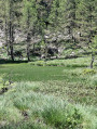
Lac des Grenouilles from Val d'Allos - La Foux
 3.65 mi
+889 ft
-912 ft
2h 25
 Easy
Departure from Allos (Alpes-de-Haute-Provence)
Starting from the Val d'Allos - La Foux resort, you can follow the route that takes you to this pretty little mountain lake, surrounded by larch trees.
Route from Val d'Allos la Foux to Val d'Allos le Seignus
 9.34 mi
+1,611 ft
-2,385 ft
5h 40
Moderate
Departure from Allos (Alpes-de-Haute-Provence)
A forest trail that will take you to the Val d’Allos Le Seignus ski resort.
Large meadow at the start of La Foux d'Allos
2.70 mi
+719 ft
-735 ft
1h 50
Moderate
Departure from Allos (Alpes-de-Haute-Provence)
Starting from the Pont de l'Abrau district at the entrance to the Foux d'Allos resort, this hike will first take you through the undergrowth and then out into open countryside with breathtaking views.
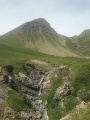
Tête de la Sestrière and the sources of the Verdon
 6.62 mi
+2,592 ft
-2,592 ft
5h 20
Difficult
Departure from Allos (Alpes-de-Haute-Provence)
Near the Sestrière hut, discover the sources of the Verdon. Once at the summit, enjoy magnificent views of the Grande Séolane, the Blanche du Laverq, Allos and Ubaye valleys.
Circular Marmotte starting from La Foux d'Allos
2.68 mi
+469 ft
-479 ft
1h 40
Easy
Departure from Allos (Alpes-de-Haute-Provence)
An easy walk suitable for all ages. Play and sports facilities are located along the route.Bring snowshoes during the winter season.Please respect the regulations of the Val d'Allos protected area.
For more walks, use our search engine .
The GPS track and description are the property of this route's author. Please do not copy them without permission.

