


joorange

 Visorando Member
 Premium user
 - Location: Béthune (62400)
- Gender: man
Sign up:
Published route(s)
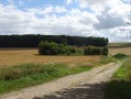
 From Fond de Croisette to Terres de l'Amour
 12.96 mi
 +617 ft
 -617 ft
 6h 30
6h 30
 Difficult
 Departure from Villers-l'Hôpital (Pas-de-Calais)
A route offering beautiful views of the Authie valley.
The paths are very good in the first section (up to Frohen) and the end is a little more challenging, but in the heart of the countryside.
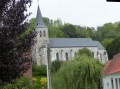
The Surgeon hills
 6.86 mi
+610 ft
-584 ft
3h 40
6.86 mi
+610 ft
-584 ft
3h 40
 Moderate
Departure from Enquin-les-Mines (Pas-de-Calais)
Moderate
Departure from Enquin-les-Mines (Pas-de-Calais)
A short, undulating route offering beautiful views.
From Moringhem to Quelmes
 11.18 mi
+449 ft
-436 ft
5h 30
Moderate
Departure from Moringhem (Pas-de-Calais)
11.18 mi
+449 ft
-436 ft
5h 30
Moderate
Departure from Moringhem (Pas-de-Calais)
A pleasant route, with the chance to enjoy a nice break at the lovely café in Quelmes.
Route amended in August 2026 to take Dominoe’s comments into account. I hope it will be better, but I haven’t been in the area for quite some time.
Le Bois de Mont
 12.15 mi
+709 ft
-732 ft
6h 10
Difficult
Departure from Servins (Pas-de-Calais)
12.15 mi
+709 ft
-732 ft
6h 10
Difficult
Departure from Servins (Pas-de-Calais)
A very green route in the Artois hills, with two beautiful climbs and a minimum of roads.
This route, which is already difficult, becomes very difficult in wet weather. I walked it on 25/02/2026 and some of the paths were barely passable.
Around Bailleul-les-Pernes
7.17 mi
+443 ft
-453 ft
3h 40
Moderate
Departure from Aumerval (Pas-de-Calais)
A short route, on paths and minor roads, following theGR®127.
The hills of Faux
6.78 mi
+486 ft
-476 ft
3h 35
Moderate
Departure from Marest (Pas-de-Calais)
A beautiful, undulating trail on the Ternois hillsides. Donjon de Bours (keep).
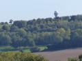
Walk through the Artois Heights
 9.93 mi
+886 ft
-863 ft
5h 20
Moderate
Departure from Nielles-lès-Bléquin (Pas-de-Calais)
9.93 mi
+886 ft
-863 ft
5h 20
Moderate
Departure from Nielles-lès-Bléquin (Pas-de-Calais)
A winding route offering superb views of the Artois heights and the Bléquin valley.
After the Battle of the Somme
7.32 mi
+253 ft
-230 ft
3h 35
Moderate
Departure from Carency (Pas-de-Calais)
An easy route offering fine views of the memorial sites of the Battle of the Somme during the First World War: Lorette, Mont-Saint-Éloi, Vimy and the ruined church at Ablain.
Lucheux and its forest
 9.20 mi
+328 ft
-331 ft
4h 30
Moderate
Departure from Sus-Saint-Léger (Pas-de-Calais)
9.20 mi
+328 ft
-331 ft
4h 30
Moderate
Departure from Sus-Saint-Léger (Pas-de-Calais)
A beautiful route around Lucheux, best done in dry weather, as theGR®124is in very poor condition (and poorly marked!) in the forest.
You may see deer and wild boar.
This route replaces the old one, the western section of which is now impassable.
The valleys of Ourton
 11.17 mi
+656 ft
-630 ft
5h 45
Moderate
Departure from Divion (Pas-de-Calais)
11.17 mi
+656 ft
-630 ft
5h 45
Moderate
Departure from Divion (Pas-de-Calais)
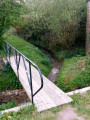
A long route that takes us from the mining landscape to the Artesian countryside.
The Bois de la Justice
 7.18 mi
+446 ft
-446 ft
3h 40
Moderate
Departure from Hestrus (Pas-de-Calais)
7.18 mi
+446 ft
-446 ft
3h 40
Moderate
Departure from Hestrus (Pas-de-Calais)
A lovely route offering beautiful views of the Ternois countryside and its animals, both wild and domestic.
The two woods and the Coqueline
 12.29 mi
+679 ft
-692 ft
6h 15
Difficult
Departure from Aumerval (Pas-de-Calais)
12.29 mi
+679 ft
-692 ft
6h 15
Difficult
Departure from Aumerval (Pas-de-Calais)
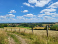
A very pleasant nature trail in dry weather, but becomes more challenging in wet weather: grassy sections (a good test for your shoes, deep ruts, muddy sections).
Warning: October 2024. While it's relatively easy to get through the ruts, the last part of the path out of the wood (before point 9) is in a terrible state. The path has been broken up by machinery and you can only pass along the sides, which are themselves very difficult. It's very slippery and sometimes you have to change sides, which is a real challenge. This used to be a signposted mountain bike trail, is it still?
Le Bois de Mont (short version)
 6.15 mi
+512 ft
-505 ft
3h 15
Moderate
Departure from Bouvigny-Boyeffles (Pas-de-Calais)
6.15 mi
+512 ft
-505 ft
3h 15
Moderate
Departure from Bouvigny-Boyeffles (Pas-de-Calais)
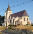
Lots of paths, a beautiful crossing of the Bois (with decent tracks) and a beautiful view as you reach the plateau (but frequent fog in autumn).
2021: I've gone back to the original route, which is more pleasant.
Trail along the little paths of Houdain via Mont de la Comté
 14.82 mi
+961 ft
-935 ft
7h 40
Difficult
Departure from Houdain (Pas-de-Calais)
14.82 mi
+961 ft
-935 ft
7h 40
Difficult
Departure from Houdain (Pas-de-Calais)
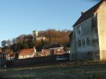
Admittedly, the trail may seem a little monotonous, but what a beautiful path! It takes you gently up to the heights before dropping back down into the valley to climb Mont de la Comté.And at the end of the trail, the church awaits you.
Around Cuvigny
 6.79 mi
+354 ft
-384 ft
3h 25
Moderate
Departure from Rebreuve-Ranchicourt (Pas-de-Calais)
6.79 mi
+354 ft
-384 ft
3h 25
Moderate
Departure from Rebreuve-Ranchicourt (Pas-de-Calais)
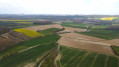
A short walk on good paths in the hills above La Comté. On a clear day, the panorama is superb, and if you're luckier than me, you'll spot a few deer.
Mont de Fleury
7.88 mi
+361 ft
-338 ft
3h 55
Moderate
Departure from Anvin (Pas-de-Calais)
A pleasant short hike on good paths. Beautiful views of the Ternois.
Hike modified in April 2023 because theGRP® route has changed.
From Bergueneuse to La Fosse aux Loups
 7.33 mi
+364 ft
-371 ft
3h 40
Moderate
Departure from Bergueneuse (Pas-de-Calais)
7.33 mi
+364 ft
-371 ft
3h 40
Moderate
Departure from Bergueneuse (Pas-de-Calais)
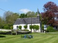
Another short walk to explore the Ternois region: plenty of paths, woods and, if you’re lucky, a few roe deer.
Three-quarters of the route follows theGRP® du Ternois, which is well signposted.
The southern circular route from Bergueneuse
 8.80 mi
+554 ft
-571 ft
4h 30
Moderate
Departure from Bergueneuse (Pas-de-Calais)
8.80 mi
+554 ft
-571 ft
4h 30
Moderate
Departure from Bergueneuse (Pas-de-Calais)
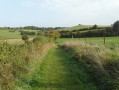
A trail exploring the Ternois region, with paths that are generally in good condition and offering lovely views.
Route amended in April 2023, as the newGRP® route is really rather dull!
Circular North loop of Bergueneuse
 10.64 mi
+584 ft
-571 ft
5h 25
Moderate
Departure from Bergueneuse (Pas-de-Calais)
10.64 mi
+584 ft
-571 ft
5h 25
Moderate
Departure from Bergueneuse (Pas-de-Calais)
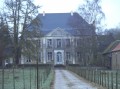
A beautiful circular route north of Bergueneuse with pretty paths and good climbs. Get your calves ready and let's go!
Please note that in wet weather, some paths become difficult (between (1) and (2), between (5) and (6) in particular), which significantly increases the journey time.
On the ridges around Bergueneuse
 15.06 mi
+801 ft
-784 ft
7h 35
Difficult
Departure from Fontaine-lès-Boulans (Pas-de-Calais)
15.06 mi
+801 ft
-784 ft
7h 35
Difficult
Departure from Fontaine-lès-Boulans (Pas-de-Calais)
More than 22 km of trails for a nature trail with some nice climbs and descents. Sharpen your calves!Beautiful views, woods and, if you're lucky, a few wild animals. At least, the ones that the hunters don't slaughter, as we recently freed two roe deer caught in snares (fox traps, but any animal can get caught there, and it's legal!).
Le Puits sans Fond stream
 7.28 mi
+361 ft
-354 ft
3h 40
Moderate
Departure from Fléchin (Pas-de-Calais)
7.28 mi
+361 ft
-354 ft
3h 40
Moderate
Departure from Fléchin (Pas-de-Calais)
A short walk that takes you up to the ridge before descending and going along the Puits sans Fond stream. More pleasant in dry weather, as some paths can be very wet.
De la Canche au Bois de Mortagne
 7.53 mi
+282 ft
-292 ft
3h 45
Moderate
Departure from Canettemont (Pas-de-Calais)
7.53 mi
+282 ft
-292 ft
3h 45
Moderate
Departure from Canettemont (Pas-de-Calais)
An easy start on good paths, then a passage along the Sentier des Culs Trempés (which unfortunately is no longer maintained) before a beautiful climb up to Canettemont.
Eps and Herbeval mountains
 6.36 mi
+548 ft
-545 ft
3h 25
Moderate
Departure from Eps (Pas-de-Calais)
6.36 mi
+548 ft
-545 ft
3h 25
Moderate
Departure from Eps (Pas-de-Calais)
A short but very hilly route (carto-explorer even gives 230m elevation gain) around the village of Eps, unjustly excluded by the marked trails. Beautiful views.Best done on a sunny day - it's magical!
Le Champ de l'Épine
11.83 mi
+732 ft
-725 ft
6h 05
Difficult
Departure from Fillièvres (Pas-de-Calais)
This route was inspired by the "Contour des bois" trail suggested by the 7 Vallées Tourist Office. I removed a few tarmac sections and added a few paths. Get ready for a day in the great outdoors.
An uphill battle
 15.98 mi
+1,371 ft
-1,365 ft
8h 35
Difficult
Departure from Fauquembergues (Pas-de-Calais)
15.98 mi
+1,371 ft
-1,365 ft
8h 35
Difficult
Departure from Fauquembergues (Pas-de-Calais)
It's a route that will delight altitude enthusiasts (Carto exploreur and the Visorando app suggest it's as high as 500m). What's more, the views are stunning.
Route slightly modified in November 2019.
All trails are very good as of May 14, 2020 (even if some are very grassy).
The Two Woods and the Quilienne river
 10.61 mi
+564 ft
-587 ft
5h 20
Moderate
Departure from Pas-en-Artois (Pas-de-Calais)
10.61 mi
+564 ft
-587 ft
5h 20
Moderate
Departure from Pas-en-Artois (Pas-de-Calais)
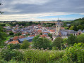
A lovely walk on the borders of Pas-de-Calais and the Somme.You'll discover the pretty Quilienne river (which did a lot of damage in 2016) and the Bois de Saint-Pierre (woods).
It's possible to add one or two extensions, so that the trail can exceed 22km (see practical info).
The upper Lys valley
 13.55 mi
+673 ft
-666 ft
6h 50
Difficult
Departure from Lisbourg (Pas-de-Calais)
13.55 mi
+673 ft
-666 ft
6h 50
Difficult
Departure from Lisbourg (Pas-de-Calais)
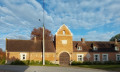
The source of the Lys, the Lugy Mill and a lovely route across the plateau (beautiful views).This walk can be more difficult in wet weather as some paths are regularly churned up.Some tarmac, but on minor roads.
Please note: the path leading up through the Lugy woods after the (5) can be very difficult in wet weather.
From La Planquette to Bois de Fressin
 13.20 mi
+958 ft
-942 ft
6h 55
Difficult
Departure from Fressin (Pas-de-Calais)
13.20 mi
+958 ft
-942 ft
6h 55
Difficult
Departure from Fressin (Pas-de-Calais)
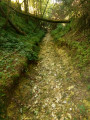
A succession of small roads and paths for a day in the great outdoors.The icing on the cake: a good elevation gain with a superb climb in the Bois de Fressin.
For very experienced hikers, I highly recommend the alternative route described in the practical information section.
From Fruges to the Bois de Radinghem
 9.01 mi
+518 ft
-499 ft
4h 35
Moderate
Departure from Fruges (Pas-de-Calais)
9.01 mi
+518 ft
-499 ft
4h 35
Moderate
Departure from Fruges (Pas-de-Calais)
This varied, not overly difficult route is largely based on the ‘7 Bell Towers’ trail. You’ll therefore come across a few sections marked in yellow.
The slopes of the Ternoise near Auchy
 10.43 mi
+669 ft
-650 ft
5h 25
Moderate
Departure from Rollancourt (Pas-de-Calais)
10.43 mi
+669 ft
-650 ft
5h 25
Moderate
Departure from Rollancourt (Pas-de-Calais)
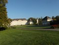
A fairly long but not overly difficult hike offering beautiful views over the Ternoise valley.
May 2025: The Montigny trail (3) has been thoroughly cleared, something that hasn’t happened for ages! It is currently perfectly passable.
The Ternoise hills, from Blangy-sur-Ternoise to Rollancourt
7.64 mi
+548 ft
-551 ft
4h 00
Moderate
Departure from Blangy-sur-Ternoise (Pas-de-Calais)
A circular loop on the good paths surrounding Blangy-sur-Ternoise.
La source de la Lawe
 13.99 mi
+741 ft
-755 ft
7h 05
Difficult
Departure from La Comté (Pas-de-Calais)
13.99 mi
+741 ft
-755 ft
7h 05
Difficult
Departure from La Comté (Pas-de-Calais)
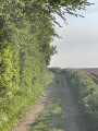
Randonnée au départ de La Comté qui nous mène près de la source de la Lawe.
Paysage très agréable et quelques vallonnements.
5 woods and some steep slopes
 9.42 mi
+1,004 ft
-1,017 ft
5h 10
Difficult
Departure from Saint-Michel-sous-Bois (Pas-de-Calais)
9.42 mi
+1,004 ft
-1,017 ft
5h 10
Difficult
Departure from Saint-Michel-sous-Bois (Pas-de-Calais)
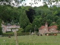
A very hilly route over the Artois heights.
A great sporting outing with beautiful scenery.
From Turkey to Fond Breton (in less than 10 km!)
5.80 mi
+358 ft
-354 ft
3h 00
Moderate
Departure from Renty (Pas-de-Calais)
A short but fairly strenuous route with a steep hill and some very grassy paths.
On 12/08/2025: the start of the trail is once again very overgrown (brambles and nettles). It's passable but it's best to wear trousers or good gaiters and, of course, bring a walking stick or even a pair of secateurs.
The Créquy Woods
 13.09 mi
+745 ft
-732 ft
6h 40
Difficult
Departure from Créquy (Pas-de-Calais)
13.09 mi
+745 ft
-732 ft
6h 40
Difficult
Departure from Créquy (Pas-de-Calais)
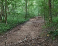
A long route with virtually no roads, making use of three short-distance hiking trails: the Maury, the Têtards and the Fréniaux.It’s best to go during a dry spell, as the paths can be quite poor in wet weather.Three-quarters of the walk takes place on the edge of or within the woods.
The Wismes Loop
13.08 mi
+909 ft
-902 ft
6h 50
Difficult
Departure from Nielles-lès-Bléquin (Pas-de-Calais)
Nothing spectacular, but a good day out in the fresh air. It’s best to go during dry spells, as some paths can become quite (or even very) difficult.
You could also consider starting from Wismes (car park by the church), which allows you to leave your picnic in the car and thus take some of the strain off your back.
The Authie river, the ravine and the moor
 11.18 mi
+827 ft
-801 ft
5h 50
Difficult
Departure from Nœux-lès-Auxi (Pas-de-Calais)
11.18 mi
+827 ft
-801 ft
5h 50
Difficult
Departure from Nœux-lès-Auxi (Pas-de-Calais)
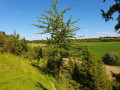
This nearly roadless route takes in the wild Ravin des Cavernes and the astonishing moorland of Nœux-lès-Auxi (le Rietz).
Le Rietz de Nœux is a protected nature reserve. In spring, it's home to the most beautiful orchids. Goes without saying, don't pick them!
This circuit takes up a large part of the "Sentier de l'Étoile" (Path of the Star), of which there are a few routes, but no description. What's more, there are very few markings. The gates are near the fence on the right.
Before tackling this route, I advise you to watch the 2 videos linked in Denis' commentary.
Walk to Kemmel
 8.11 mi
+712 ft
-712 ft
4h 20
Moderate
Departure from Heuvelland (Flandre-Occidentale)
8.11 mi
+712 ft
-712 ft
4h 20
Moderate
Departure from Heuvelland (Flandre-Occidentale)
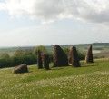
Short route on beautiful, well-maintained Belgian trails with good signage.Simple signposting: there are posts with numbers and an arrow indicating the number you want to go to (not easy to explain but obvious when you're there).
In wet weather, some areas may be soggy or even very muddy.
From Wismes to the Bois d'Esquerdes via the Montagne d'Elnes
15.89 mi
+1,050 ft
-1,030 ft
8h 15
Difficult
Departure from Wismes (Pas-de-Calais)
A long route with very little tarmac and a superb climb.
There are also a few long straight stretches through the fields that will delight many!
Late July 2020:
- the section between points 6 and 7 is in excellent condition.
- at point 13, after the copse, you cross a maize field for about fifty metres (the path is clearly marked) before finding the track.
Around and on Mont Rouge
 10.03 mi
+787 ft
-814 ft
5h 20
Difficult
Departure from Heuvelland (Flandre-Occidentale)
10.03 mi
+787 ft
-814 ft
5h 20
Difficult
Departure from Heuvelland (Flandre-Occidentale)
A long, slightly winding route to enjoy the beautiful Belgian trails, which are well maintained and clearly marked.
Simple signposting: there are posts with numbers and an arrow indicating the number you want to go to (not easy to explain but obvious when you're there).
Difficult route, even very difficult in wet weather.
The Caucourt Ford
 6.75 mi
+240 ft
-226 ft
3h 20
Moderate
Departure from Gauchin-Légal (Pas-de-Calais)
6.75 mi
+240 ft
-226 ft
3h 20
Moderate
Departure from Gauchin-Légal (Pas-de-Calais)
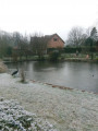
A short route, on paths that are more or less paved, pleasant in all seasons (except during very wet periods) with a passage at the Gué de Caucourt.
1- Hermin Town Hall advises against using the path between points (11) and (12) until the end of 2025. It is now April 2026 and nothing has changed: no works are underway and there are barriers on both sides. I have just walked along it and it is perfectly passable, though still treacherous.
Voyettes and paths of the Béthunois
 6.19 mi
+141 ft
-141 ft
3h 00
6.19 mi
+141 ft
-141 ft
3h 00
 Easy
Departure from Verquin (Pas-de-Calais)
Easy
Departure from Verquin (Pas-de-Calais)
A short country walk in the middle of the Béthune-Nœux-Bruay conurbation.
From La Nave to Puits Sans Fond
14.13 mi
+873 ft
-853 ft
7h 15
Difficult
Departure from Fontaine-lès-Hermans (Pas-de-Calais)
Numerous trails for a walk that stretches between mountains and valleys.This hike is a great way to spend a day outdoors.
At the end of December 2019, after the rains, the paths became very difficult and particularly slippery (even on the flat sections!), both on the normal route and on the alternative route. Under these conditions, the walk can be classified as very difficult.
Where Justice can lead to Hell
 11.27 mi
+686 ft
-692 ft
5h 45
Moderate
Departure from Eps (Pas-de-Calais)
11.27 mi
+686 ft
-692 ft
5h 45
Moderate
Departure from Eps (Pas-de-Calais)
Another lovely route in the Ternois hills. Few roads and, in good weather, beautiful panoramic views.If you're lucky, you may also spot some deer (a herd of six at the end of February 2019).
L'ubac de Rebreuve-sur-Canche
 6.72 mi
+361 ft
-354 ft
3h 25
Easy
Departure from Bouret-sur-Canche (Pas-de-Calais)
6.72 mi
+361 ft
-354 ft
3h 25
Easy
Departure from Bouret-sur-Canche (Pas-de-Calais)
A short, unpretentious and easy route.Very small roads and paths for a relaxing half-day out.
The hedgerows
10.90 mi
+374 ft
-354 ft
5h 20
Moderate
Departure from Teneur (Pas-de-Calais)
The old marked trail around Ambricourt is unfortunately poorly maintained or not maintained at all. We have been walking it for 25 years and have encountered difficulties every time (poor signage, paths buried under nettles or difficult to walk on).The start at Teneur allows you to pass (twice) in front of the superb limestone hillside of Teneur. Deer are often visible in or around the Bois de Crépy
The path is in very poor condition between points (2) and (6).
If possible, avoid the period between mid-June and mid-August. The passage after point (3) will be easier if the field is not too far into the growing season or has already been harvested.
The ponds near Ypres
 15.91 mi
+207 ft
-210 ft
7h 30
Difficult
Departure from Ieper (Flandre-Occidentale)
15.91 mi
+207 ft
-210 ft
7h 30
Difficult
Departure from Ieper (Flandre-Occidentale)
A long walk in Belgium, a little flat, but the length makes up for it. It will allow you to discover beautiful lakes, the Palingbeek estate and part of the ramparts of Ypres.
It may be a little monotonous, but it is sometimes pleasant to hike on well-maintained trails with good signposting. Our Pas-de-Calais has some progress to make in this area. The signposting system is the same as for the Mont Kemmel and Mont Rouge walks.
The Ravin de l’Étoile
12.22 mi
+735 ft
-741 ft
6h 15
Difficult
Departure from Monchy-Cayeux (Pas-de-Calais)
We continue our exploration of the Ternois region, culminating in the superb Ravin de l’Étoile.
From Carency to Mont-Saint-Éloi via the Bois Poret
 13.80 mi
+843 ft
-837 ft
6h 00
Moderate
Departure from Carency (Pas-de-Calais)
13.80 mi
+843 ft
-837 ft
6h 00
Moderate
Departure from Carency (Pas-de-Calais)
A fairly standard route around Mont-Saint-Éloi (the area is very well signposted), but with three less-travelled sections leading to Villers-au-Bois
It’s a bit winding (’not very logical’, as one of my friends always says), but it allows you to take a few less-travelled paths.
From Bras de Bronne to L’Embrienne
15.06 mi
+1,555 ft
-1,532 ft
8h 15
Difficult
Departure from Saint-Michel-sous-Bois (Pas-de-Calais)
Same starting point as for the “5-bois-et-quelques-raidillons” hike, but this route is a bit longer, with a decent climb, and avoids walking along the D129.
I think the app is essential, especially as the GR® markings are very faint (you might even wonder if this legendary GR® still exists?).