Country:
 City:
City:


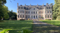
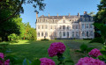
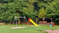
Park at Place de la Mairie de Barly.
(S/E) Leave the square, with the town hall on your left, and at the fork in the road facing the woods, turn left onto the D196. Head uphill until you reach a fork in the road.
(1) Leave the D196, then turn right, then immediately right again, along the edge of the woodland, until you reach a T-junction. Turn right, then take the first path on the left and continue to a further T-junction.
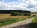
(2) Take the track on the right to cross the Barly plain. This eventually turns right and leads to a small road at a place called Le Tilleul.
(3) Turn left onto the small road. After about 500 m, take the first track on the right (at a place called Le Compte Argent). After 200 m, turn sharply right and follow the correct track, which joins the D59 (with Bois du Roi on the left).
(4) Follow the D59 to the left to reach the D938. Follow it for 200 m to the right and you’ll arrive at the cemetery (on the left).
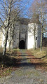
(5) Enter the cemetery and walk round the church to find, behind it, a superb path leading downhill to Outrebois.
(6) Reach the D59 and follow it to the right to enter the village. Cross the Authie.
(7) Turn into the second street on the right (Rue des Fontaines Bleues). Follow the path, which eventually reaches the woods and leads into them. Make sure you stay on the relatively flat path.
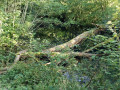
Keep to the level path at all times. You’ll come across a fallen tree trunk which you can easily step over. The next 150 metres are a bit damp, but nothing too bad. Shortly afterwards, you’ll reach a forest lodge (on the left). Les Fontaines Bleues are on the right and, when the sun is shining brightly, they really are very blue (if you walk along the pond on the right, you can reach the stream that flows out of it in a rather wild setting).
(8) The path widens and comes to a junction.
(9) Turn right, then right again to cross the Authie. Stay on the Grande Rue, pass the town hall and, just before reaching the D938, turn left into the Rue à Cailloux. After 200 m, continue along the road on the right until you reach a junction with the D938. Take the small road opposite, which turns immediately left, until you reach a Fork in the road.
(10) Turn right onto the lovely grassy path which joins and crosses the Bois de Courcelles (do not leave this path; the rest is off-limits) and head towards Remaisnil.
(11) Shortly after leaving the woods, you’ll come to a small road; follow it straight ahead to run alongside the castle grounds. Reach the church and, at the Fork in the road, turn right to reach a T-junction.
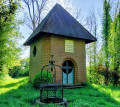
(12) Turn left and, at the chapel, take the small road on the right. About a hundred metres further on, turn left onto a wide path. Follow it straight on for over a kilometre until you reach a T-junction.
(13) Turn right, then reach a junction. Continue straight on, following a lovely dry stone ditch (Fossé Férie). As you approach Barly, turn right, then left to reach Rue du Haut.
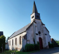
(14) Follow it to the right, then turn left into thesecond street to reach the church and the D59. Then turn left and head for the Place de la Mairie de Barly (S/E).


 Visorando Member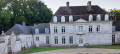

 Difficult
 Easy
Easy